- The Village of Sundridge, Kent, England


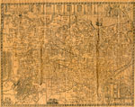
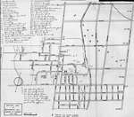
A replica map of Sundridge, Kent England in 1640. The map is accompanied by a two page history of Sundridge, Kent, England. The history goes into the origins of the British Sundridge, what the area is like today, the history of the church in the area, and the impact of …


A replica map of Sundridge, Kent England in 1640. The map is accompanied by a two page history of Sundridge, Kent, England. The history goes into the origins of the …
Sundridge - Strong Union PL
- Georgian Bay Ship Canal Map: Pembroke to Des Joachims

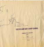
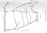
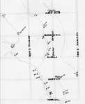
Line map of the canal system drawn in bluish coloured ink, outlines routes along the Ottawa River between Pembroke and the rapids at Des Joachims. The left-hand side of the map has very prominent ink blotches and finger prints made from the same colour of ink as the map itself. …

Line map of the canal system drawn in bluish coloured ink, outlines routes along the Ottawa River between Pembroke and the rapids at Des Joachims. The left-hand side of the …
Petawawa Public Library
- Georgian Bay Ship Canal Map: Des Joachims to Pembroke

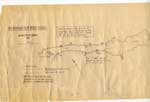
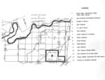
"Traced by members of Deep River Y.C. from photographic copy of original Dept. of Public Works chart. Supplemented from 1" Survey Maps and from personal experience."

"Traced by members of Deep River Y.C. from photographic copy of original Dept. of Public Works chart. Supplemented from 1" Survey Maps and from personal experience."
Petawawa Public Library
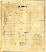
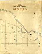
- Maria Township ca. 1886
Head, Clara and Maria Public Library
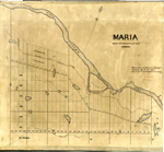
- Maria Township ca. 1866
Head, Clara and Maria Public Library
- Maria Township ca.1869
Head, Clara and Maria Public Library
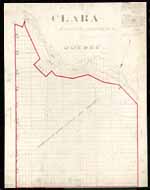
- Clara Township Map ca.1885
Head, Clara and Maria Public Library
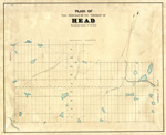
- Head Township ca.1859
Head, Clara and Maria Public Library
- Map of Head Township
Head, Clara and Maria Public Library
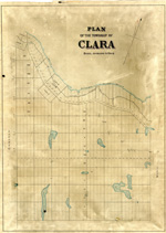
- Map of Clara Township
Head, Clara and Maria Public Library
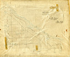
- Plan of the township of Clara, Renfrew County
ca. 1888


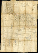
The Map came from Andre Boissonneault, a contractor. The map is hand written on an oil cloth, and covers a total area of 63922 (unit of measure unknown). Early surveyors, like William E. Logan, used Rochon micrometer telescopes and targets (disk on a calibrated pole) to measure distance. Each microscope …


The Map came from Andre Boissonneault, a contractor. The map is hand written on an oil cloth, and covers a total area of 63922 (unit of measure unknown). Early surveyors, …
Head, Clara and Maria Public Library
- Diagram of Laura Secord's Route

Sketched map with text depicting Laura Secord's projected route from Thorold to Queenston.

Sketched map with text depicting Laura Secord's projected route from Thorold to Queenston.
- Map of Richmond Hill

Map of Richmond Hill with handwritten notes and landmarks.

Map of Richmond Hill with handwritten notes and landmarks.
Richmond Hill Public Library
- Map of early mills in Richmond Hill and Vaughan district

Copied from Historical Atlas of York County (Miles and Co., 1878). Owned by Mrs. Walker Hall, Richmond Hill.

Copied from Historical Atlas of York County (Miles and Co., 1878). Owned by Mrs. Walker Hall, Richmond Hill.
Richmond Hill Public Library
- Early mills near Richmond Hill

A list of mills built in Richmond Hill and Markham area in the late eighteenth - early nineteenth century with the description of their functions, locations, and ownership.

A list of mills built in Richmond Hill and Markham area in the late eighteenth - early nineteenth century with the description of their functions, locations, and ownership.
Richmond Hill Public Library
- Map of Six Nations Residents on a Map
Six Nations Public Library
- 114th Battalion at Camp Borden

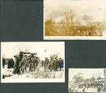
Photographs and documents may be reproduced for research purposes only. Special permission must be obtained for use in publications, websites or for commercial purposes. All photographs and documents used from the Haldimand County Museums records on the Our Ontario website must acknowledge the source in writing on the reproductions as …

Photographs and documents may be reproduced for research purposes only. Special permission must be obtained for use in publications, websites or for commercial purposes. All photographs and documents used from …
Heritage Centre
- E. Sutherland Baxter's Funeral

Photographs and documents may be reproduced for research purposes only. Special permission must be obtained for use in publications, websites or for commercial purposes. All photographs and documents used from the Haldimand County Museums records on the Our Ontario website must acknowledge the source in writing on the reproductions as …

Photographs and documents may be reproduced for research purposes only. Special permission must be obtained for use in publications, websites or for commercial purposes. All photographs and documents used from …
Heritage Centre
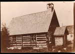
- Anglican Church Deux Rivieres, ON

The man standing in the picture is believed to be Victor R. McQuestion. The church was located in the flood plain and was demolished in 1949.

The man standing in the picture is believed to be Victor R. McQuestion. The church was located in the flood plain and was demolished in 1949.
Head, Clara and Maria Public Library
- Royal Air Force School of Aerial Fighting

Photographs and documents may be reproduced for research purposes only. Special permission must be obtained for use in publications, websites or for commercial purposes. All photographs and documents used from the Haldimand County Museums records on the Our Ontario website must acknowledge the source in writing on the reproductions as …

Photographs and documents may be reproduced for research purposes only. Special permission must be obtained for use in publications, websites or for commercial purposes. All photographs and documents used from …
Heritage Centre


 A replica map of Sundridge, Kent England in 1640. The map is accompanied by a two page history of Sundridge, Kent, England. The history goes into the origins of the British Sundridge, what the area is like today, the history of the church in the area, and the impact of …
 A replica map of Sundridge, Kent England in 1640. The map is accompanied by a two page history of Sundridge, Kent, England. The history goes into the origins of the …Sundridge - Strong Union PL
 Line map of the canal system drawn in bluish coloured ink, outlines routes along the Ottawa River between Pembroke and the rapids at Des Joachims. The left-hand side of the map has very prominent ink blotches and finger prints made from the same colour of ink as the map itself. …
  Line map of the canal system drawn in bluish coloured ink, outlines routes along the Ottawa River between Pembroke and the rapids at Des Joachims. The left-hand side of the …Petawawa Public Library
 "Traced by members of Deep River Y.C. from photographic copy of original Dept. of Public Works chart. Supplemented from 1" Survey Maps and from personal experience."
  "Traced by members of Deep River Y.C. from photographic copy of original Dept. of Public Works chart. Supplemented from 1" Survey Maps and from personal experience."Petawawa Public Library

 Early surveyors, like William E. Logan, used Rochon micrometer telescopes and targets (disk on a calibrated pole) to measure distance. Each microscope had a different calibration and therefore a different range. The instruments were calibrated against a distance measured with a surveyors chain (also known as Gunter’s chain). One chain …

 Early surveyors, like William E. Logan, used Rochon micrometer telescopes and targets (disk on a calibrated pole) to measure distance. Each microscope had a different calibration and therefore a different …Head, Clara and Maria Public Library

 Early surveyors, like William E. Logan, used Rochon micrometer telescopes and targets (disk on a calibrated pole) to measure distance. Each microscope had a different calibration and therefore a different range. The instruments were calibrated against a distance measured with a surveyors chain (also known as Gunter’s chain). One chain …

 Early surveyors, like William E. Logan, used Rochon micrometer telescopes and targets (disk on a calibrated pole) to measure distance. Each microscope had a different calibration and therefore a different …Head, Clara and Maria Public Library

 Early surveyors, like William E. Logan, used Rochon micrometer telescopes and targets (disk on a calibrated pole) to measure distance. Each microscope had a different calibration and therefore a different range. The instruments were calibrated against a distance measured with a surveyors chain (also known as Gunter’s chain). One chain …

 Early surveyors, like William E. Logan, used Rochon micrometer telescopes and targets (disk on a calibrated pole) to measure distance. Each microscope had a different calibration and therefore a different …Head, Clara and Maria Public Library

 Early surveyors, like William E. Logan, used Rochon micrometer telescopes and targets (disk on a calibrated pole) to measure distance. Each microscope had a different calibration and therefore a different range. The instruments were calibrated against a distance measured with a surveyors chain (also known as Gunter’s chain). One chain …

 Early surveyors, like William E. Logan, used Rochon micrometer telescopes and targets (disk on a calibrated pole) to measure distance. Each microscope had a different calibration and therefore a different …Head, Clara and Maria Public Library

 Early surveyors, like William E. Logan, used Rochon micrometer telescopes and targets (disk on a calibrated pole) to measure distance. Each microscope had a different calibration and therefore a different range. The instruments were calibrated against a distance measured with a surveyors chain (also known as Gunter’s chain). One chain …

 Early surveyors, like William E. Logan, used Rochon micrometer telescopes and targets (disk on a calibrated pole) to measure distance. Each microscope had a different calibration and therefore a different …Head, Clara and Maria Public Library

 Early surveyors, like William E. Logan, used Rochon micrometer telescopes and targets (disk on a calibrated pole) to measure distance. Each microscope had a different calibration and therefore a different range. The instruments were calibrated against a distance measured with a surveyors chain (also known as Gunter’s chain). One chain …

 Early surveyors, like William E. Logan, used Rochon micrometer telescopes and targets (disk on a calibrated pole) to measure distance. Each microscope had a different calibration and therefore a different …Head, Clara and Maria Public Library

 Early surveyors, like William E. Logan, used Rochon micrometer telescopes and targets (disk on a calibrated pole) to measure distance. Each microscope had a different calibration and therefore a different range. The instruments were calibrated against a distance measured with a surveyors chain (also known as Gunter’s chain). One chain …

 Early surveyors, like William E. Logan, used Rochon micrometer telescopes and targets (disk on a calibrated pole) to measure distance. Each microscope had a different calibration and therefore a different …Head, Clara and Maria Public Library
 The Map came from Andre Boissonneault, a contractor. The map is hand written on an oil cloth, and covers a total area of 63922 (unit of measure unknown). Early surveyors, like William E. Logan, used Rochon micrometer telescopes and targets (disk on a calibrated pole) to measure distance. Each microscope …
 The Map came from Andre Boissonneault, a contractor. The map is hand written on an oil cloth, and covers a total area of 63922 (unit of measure unknown). Early surveyors, …Head, Clara and Maria Public Library
 Sketched map with text depicting Laura Secord's projected route from Thorold to Queenston.
  Sketched map with text depicting Laura Secord's projected route from Thorold to Queenston.
 Map of Richmond Hill with handwritten notes and landmarks.
  Map of Richmond Hill with handwritten notes and landmarks.Richmond Hill Public Library
 Copied from Historical Atlas of York County (Miles and Co., 1878). Owned by Mrs. Walker Hall, Richmond Hill.
  Copied from Historical Atlas of York County (Miles and Co., 1878). Owned by Mrs. Walker Hall, Richmond Hill.Richmond Hill Public Library
 A list of mills built in Richmond Hill and Markham area in the late eighteenth - early nineteenth century with the description of their functions, locations, and ownership.
  A list of mills built in Richmond Hill and Markham area in the late eighteenth - early nineteenth century with the description of their functions, locations, and ownership.Richmond Hill Public Library

 A Map of Six Nations with residents names on it and the approximate location of where they lived. This map was included with genealogical information from Luella (Anderson) DeGrave

 A Map of Six Nations with residents names on it and the approximate location of where they lived. This map was included with genealogical information from Luella (Anderson) DeGraveSix Nations Public Library
 Photographs and documents may be reproduced for research purposes only. Special permission must be obtained for use in publications, websites or for commercial purposes. All photographs and documents used from the Haldimand County Museums records on the Our Ontario website must acknowledge the source in writing on the reproductions as …
  Photographs and documents may be reproduced for research purposes only. Special permission must be obtained for use in publications, websites or for commercial purposes. All photographs and documents used from …Heritage Centre
 Photographs and documents may be reproduced for research purposes only. Special permission must be obtained for use in publications, websites or for commercial purposes. All photographs and documents used from the Haldimand County Museums records on the Our Ontario website must acknowledge the source in writing on the reproductions as …
  Photographs and documents may be reproduced for research purposes only. Special permission must be obtained for use in publications, websites or for commercial purposes. All photographs and documents used from …Heritage Centre
 The man standing in the picture is believed to be Victor R. McQuestion. The church was located in the flood plain and was demolished in 1949.
  The man standing in the picture is believed to be Victor R. McQuestion. The church was located in the flood plain and was demolished in 1949.Head, Clara and Maria Public Library
 Photographs and documents may be reproduced for research purposes only. Special permission must be obtained for use in publications, websites or for commercial purposes. All photographs and documents used from the Haldimand County Museums records on the Our Ontario website must acknowledge the source in writing on the reproductions as …
  Photographs and documents may be reproduced for research purposes only. Special permission must be obtained for use in publications, websites or for commercial purposes. All photographs and documents used from …Heritage Centre
