Results


Page 1 of 1
- Interior of Brooklin Baptist Church, c.1909

 This church was located at 45 Cassels Road East at the south west corner of Cassels Road and Church Street. It was built as a Bible Christian Church in 1876. From 1884 to 1916 it was a Baptist Church. From 1920 to 1965 it was the Whitby Township hall and …
 This church was located at 45 Cassels Road East at the south west corner of Cassels Road and Church Street. It was built as a Bible Christian Church in 1876. …Whitby Public Library
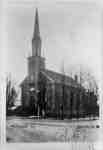
 - Brooklin Baptist Church
 This church was located at 45 Cassels Road East at the south west corner of Cassels Road and Church Street. It was built as a Bible Christian Church in 1876. From 1884 to 1916 it was a Baptist Church. From 1920 to 1965 it was the Whitby Township hall and …
  This church was located at 45 Cassels Road East at the south west corner of Cassels Road and Church Street. It was built as a Bible Christian Church in 1876. …Whitby Public Library
 - Brooklin Presbyterian Church
 This church was located at 15 Church Street on the east side of Church Street south of Mill Street (Cassels Road). It was built in 1862 and demolished in the 1920s after union with the Methodist Church.
  This church was located at 15 Church Street on the east side of Church Street south of Mill Street (Cassels Road). It was built in 1862 and demolished in the …Whitby Public Library
 - Brooklin Methodist Church
 Brooklin Methodist Church was located at 19 Cassels Road East. It was built in 1867 on the south-east corner of Mill Street (Cassels Road) and Princess Street. In 1925 it became the Brooklin United Church. The house that is visible behind the church is the parsonage.
  Brooklin Methodist Church was located at 19 Cassels Road East. It was built in 1867 on the south-east corner of Mill Street (Cassels Road) and Princess Street. In 1925 it …Whitby Public Library
 - Baldwin Street looking north from Roebuck Street
 A.C. Elliott's Grocery Store was located at the south west corner of Baldwin and Campbell Street. The hardware store pictured was located at Baldwin and Roebuck Streets.
  A.C. Elliott's Grocery Store was located at the south west corner of Baldwin and Campbell Street. The hardware store pictured was located at Baldwin and Roebuck Streets.Whitby Public Library
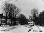
 - Main Street South, Brooklin, Ont.
 A black and white photograph of downtown Brooklin. This picture shows Baldwin Street (Main Street) in winter looking south from a point near the Lynde Creek bridge.
  A black and white photograph of downtown Brooklin. This picture shows Baldwin Street (Main Street) in winter looking south from a point near the Lynde Creek bridge.Whitby Public Library
 - Mill Street (Cassels Road) looking east from Baldwin Street
 A black and white photograph of downtown Brooklin. The church in this picture is the Methodist Church built in 1867 on the south-east corner of Mill Street and Princess Street.
  A black and white photograph of downtown Brooklin. The church in this picture is the Methodist Church built in 1867 on the south-east corner of Mill Street and Princess Street.Whitby Public Library
 - Mill Street (Cassels Road) looking west from Simcoe Street
 A black and white photograph of downtown Brooklin. The brick building at centre is the Baptist Church at the south west corner of Mill and Church Streets. The church with the spire is the Methodist Church at the south east corner of Mill and Princess Streets.
  A black and white photograph of downtown Brooklin. The brick building at centre is the Baptist Church at the south west corner of Mill and Church Streets. The church with …Whitby Public Library
 - Brooklin Public School, ca.1909
 The Brooklin Public School was built before 1872 on the north side of Winchester Rd., opposite the current site of Luther Vipond Memorial Arena. An addition was built on the east side of the school in 1880. In 1923, the building was condemned and demolished. It was replaced by the …
  The Brooklin Public School was built before 1872 on the north side of Winchester Rd., opposite the current site of Luther Vipond Memorial Arena. An addition was built on the …Whitby Public Library
 - Brooklin Train Station, ca.1909
 The Brooklin Station was built in 1895 on the south side of Winchester Rd., opposite Queen St. The railway was the Whitby, Port Perry, and Lindsay Railway which was built in 1871 and removed in 1941. The station was destroyed by fire on 19 April 1937.
  The Brooklin Station was built in 1895 on the south side of Winchester Rd., opposite Queen St. The railway was the Whitby, Port Perry, and Lindsay Railway which was built …Whitby Public Library
Page 1 of 1


