Results
We found 8 matching items.


Page 1 of 1
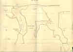
- Second Welland Canal - Book 2, Survey Map 15 - Deep Cut in Thorold

 Survey map of the Second Welland Canal created by the Welland Canal Company showing the canal in the Thorold Township just south of Allanburgh. Identified structures and features associated with the Canal include the Deep Cut and the towing path. The surveyors' measurements and notes can be seen in red …
 Survey map of the Second Welland Canal created by the Welland Canal Company showing the canal in the Thorold Township just south of Allanburgh. Identified structures and features associated with …Brock University Archives
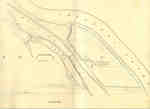
 - Second Welland Canal - Book 3, Survey Map 3 - Vanalstines Creek and Back Water in Thorold

 Survey map of the Second Welland Canal created by the Welland Canal Company showing the canal in Thorold Township near Port Robinson. Identified structures associated with the Canal include towing path. The surveyors' measurements and notes can be seen in red and black ink and pencil. Local area landmarks are …
 Survey map of the Second Welland Canal created by the Welland Canal Company showing the canal in Thorold Township near Port Robinson. Identified structures associated with the Canal include towing …Brock University Archives
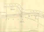
 - Second Welland Canal - Book 3, Survey Map 5 - Old Canal and New Canal along Chippewa Creek in Port Robinson, Thorold Township

 Survey map of the Second Welland Canal created by the Welland Canal Company showing the canal along Chippewa Creek in Thorold Township. Identified structures and features associated with the Canal include the towing path, float bridge, and the waterway itself. The surveyors' measurements and notes can be seen in red …
 Survey map of the Second Welland Canal created by the Welland Canal Company showing the canal along Chippewa Creek in Thorold Township. Identified structures and features associated with the Canal …Brock University Archives
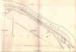
 - Second Welland Canal - Book 3, Survey Map 10 - Canal along Chippewa Creek in Thorold


 Survey map of the Second Welland Canal created by the Welland Canal Company showing the canal in the Thorold Township between Port Robinson and Welland. Identified structures and features associated with the Canal include the towing path, a ditch, foot of the slope of bank, and the waterway itself. The …

 Survey map of the Second Welland Canal created by the Welland Canal Company showing the canal in the Thorold Township between Port Robinson and Welland. Identified structures and features associated …Brock University Archives
 - Second Welland Canal - Book 3, Survey Map 11 - Aqueduct Lock and Canal along Chippewa Creek in Thorold

 Survey map of the Second Welland Canal created by the Welland Canal Company showing the canal as it crosses Chippewa Creek in the Thorold Township near Welland. Identified structures and features associated with the Canal include the towing path, the old canal, the aqueduct lock, the new aqueduct, and the …
 Survey map of the Second Welland Canal created by the Welland Canal Company showing the canal as it crosses Chippewa Creek in the Thorold Township near Welland. Identified structures and …Brock University Archives
 - Second Welland Canal - Book 2, Survey Map 8 - Little Deep Cut in Thorold

 Survey map of the Second Welland Canal created by the Welland Canal Company showing the canal in Thorold South. Identified structures associated with the Canal include the Little Deep Cut and the towing path. The surveyors' measurements and notes can be seen in red and black ink and pencil. Local …
 Survey map of the Second Welland Canal created by the Welland Canal Company showing the canal in Thorold South. Identified structures associated with the Canal include the Little Deep Cut …Brock University Archives
 - Second Welland Canal - Book 2, Survey Map 9 - Back Water Bodies in Thorold

 Survey map of the Second Welland Canal created by the Welland Canal Company showing the Back Water bodies in Thorold Township. The surveyors' measurements and notes can be seen in red and black ink and pencil. A number of trees along the shores presumably used in the measurements are labelled. …
 Survey map of the Second Welland Canal created by the Welland Canal Company showing the Back Water bodies in Thorold Township. The surveyors' measurements and notes can be seen in …Brock University Archives
 - Second Welland Canal - Book 2, Survey Map 11 - Marlatts Bridge in Thorold

 Survey map of the Second Welland Canal created by the Welland Canal Company showing the canal in Thorold Township. Identified structures associated with the Canal include the towing path. The surveyors' measurements and notes can be seen in red and black ink and pencil. Local area landmarks are also identified …
 Survey map of the Second Welland Canal created by the Welland Canal Company showing the canal in Thorold Township. Identified structures associated with the Canal include the towing path. The …Brock University Archives
Page 1 of 1


