Results
We found 278 matching items.


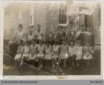
- Glen Morris School Class Photo, 1931


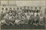
 1st row (left to right): Jinn Forbes, Helen Ryerson, Ruth Sandilands, Gwen Karlberg, Jean Forbes, Win Karlberg, Louise Harkness, Lola Griffen, Janet Payne, Rony Ryerson, Loris Griffen. 2nd row (left to right): teacher Jean Taylor, Art McCrew, George Fletcher, Norman Scott, Harold Griffen, Tony Forbes, Bill Griffen, Willie Wallace, Bert …

 1st row (left to right): Jinn Forbes, Helen Ryerson, Ruth Sandilands, Gwen Karlberg, Jean Forbes, Win Karlberg, Louise Harkness, Lola Griffen, Janet Payne, Rony Ryerson, Loris Griffen. 2nd row (left …
 - The Empire Club of Canada Addresses
 ...
...  ...Empire Club of Canada
 - The Empire Club of Canada Addresses
 ...
...  ...Empire Club of Canada
 - Kowkash-Ogoki Gold Area, District Of Thunder Bay
 Ontario Department of Mines, 1931 Full text available at Brodie Resource Library
  Ontario Department of Mines, 1931 Full text available at Brodie Resource LibraryThunder Bay Public Library
 - Chromite Deposits Of The Obonga Lake area, District Of Thunder Bay
 Ontario Department of Mines, 1931 Full text available at Brodie Resource Library
  Ontario Department of Mines, 1931 Full text available at Brodie Resource LibraryThunder Bay Public Library
 - Mines Of Ontario In 1930
 Ontario Department of Mines, 1931 Full text available at Brodie Resource Library
  Ontario Department of Mines, 1931 Full text available at Brodie Resource LibraryThunder Bay Public Library
 - Geology Of The Heron Bay Area, District Of Thunder Bay
 Ontario Department of Mines, 1931 Full text available at Brodie Resource Library
  Ontario Department of Mines, 1931 Full text available at Brodie Resource LibraryThunder Bay Public Library
 - Niagara Historical Society Pamphlet -No.42 -Historic Niagara Documents -1805-1811

 Pamphlet published by the Niagara Historical Society. No. 42 in a multi-part series collects documents relating to Niagara history from the period leading up to the War of 1812.
 Pamphlet published by the Niagara Historical Society. No. 42 in a multi-part series collects documents relating to Niagara history from the period leading up to the War of 1812.
 - Reach Township Assessment Rolls 1925-1926, 1928-1931


 Scugog Shores Museum Village and Archives
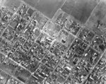
 - Whitby Aerial View, 1931
 Black and white negative of an aerial photograph of the south-west portion of Whitby. The street at the bottom left corner is Henry street and at the top right corner is Green Street and the Joseph King Estate. All Saints' Anglican Church is at the top left corner. The Theodore …
  Black and white negative of an aerial photograph of the south-west portion of Whitby. The street at the bottom left corner is Henry street and at the top right corner …Whitby Public Library
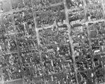
 - Downtown Aerial View, 1931
 Black and white negative of a an aerial photograph of the downtown/central business district of Whitby. The intersection of John and Perry Streets is visible in the upper left corner. At the upper right corner is the intersection of Dunlop and Green Streets. Henry and Colborne Streets are visible in …
  Black and white negative of a an aerial photograph of the downtown/central business district of Whitby. The intersection of John and Perry Streets is visible in the upper left corner. …Whitby Public Library
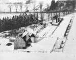
 - Coldstream and Jeffery Farms Aerial View, 1931
 Black and white negative of an aerial photograph of the Coldstream and Jeffery Farms located on lot 30 of Concession 1. View looking north toward Highway 2, east of Lynde Creek. The Albert A. Walker residence, located at the corner of Highway 2 and Raglan Street, is visible at the …
  Black and white negative of an aerial photograph of the Coldstream and Jeffery Farms located on lot 30 of Concession 1. View looking north toward Highway 2, east of Lynde …Whitby Public Library
 - Red Wing Orchards Pontoon Plane at Whitby Harbour, 1931
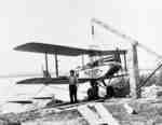
 This plane was owned by G. Norman Irwin of Red Wing Orchards.
  This plane was owned by G. Norman Irwin of Red Wing Orchards.Whitby Public Library
 - Airplane Hanger at Whitby Harbour, 1931
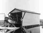
 G. Norman Irwin of Red Wing Orchards built this hanger at the north end of the Whitby harbour in 1931.
  G. Norman Irwin of Red Wing Orchards built this hanger at the north end of the Whitby harbour in 1931.Whitby Public Library
 - Doug Thompson's Farm, 1931
 Black and white negative of an aerial photograph showing Doug Thompson's farm near Brooklin.
  Black and white negative of an aerial photograph showing Doug Thompson's farm near Brooklin.Whitby Public Library
 - Whitby Collegiate Institute Literary Society
 The Whitby Collegiate Institute was built in 1873 and was located on the south side of Colborne Street between King and Centre Streets. The school was demolished in 1975-1976.
  The Whitby Collegiate Institute was built in 1873 and was located on the south side of Colborne Street between King and Centre Streets. The school was demolished in 1975-1976.Whitby Public Library
 - Descendants of Early Settlers of Mount Pleasant by Pioneer Cemetery Monument, 1931
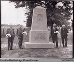
 This 1931 photograph shows a group of descendants of Mount Pleasant pioneers by the monument erected that year to the town's founders and early settlers. The monument is located in the Mount Pleasant Pioneer Cemetery. The men in this photograph are, left to right: W.W. Ellis; Judge A.D. Hardy; Jas. …
  This 1931 photograph shows a group of descendants of Mount Pleasant pioneers by the monument erected that year to the town's founders and early settlers. The monument is located in …County of Brant Public Library
 - Seeley's Bay Public School 1931

 (Condition: Good)
 (Condition: Good)Leeds & Thousand Islands Public Library
 - Women's Institute Meeting at home of Mrs. Peter Maclean, 1931

 This photo can be found in the Tweedsmuir History created by the Sunnyside Women's Institute.
 This photo can be found in the Tweedsmuir History created by the Sunnyside Women's Institute.Thessalon Union Public Library
 - Sinclair School Class, 1931
 Sinclair School was built on the north side of Concession 4 (Taunton Road) east of Garden Street in 1874. It was used as a school until it closed in 1979. Sinclair School was demolished in 1992.
  Sinclair School was built on the north side of Concession 4 (Taunton Road) east of Garden Street in 1874. It was used as a school until it closed in 1979. …Whitby Public Library

