Results


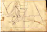
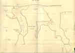
- Second Welland Canal - Book 2, Survey Map 5 - Locks 16, 17 and 18 in Grantham


 Survey map of the Second Welland Canal created by the Welland Canal Company showing the Grantham Township at Merritton. Identified structures associated with the Canal include Locks 15, 16, 17, and 18, and the towing path. The surveyors' measurements and notes can be seen in red and black ink and …

 Survey map of the Second Welland Canal created by the Welland Canal Company showing the Grantham Township at Merritton. Identified structures associated with the Canal include Locks 15, 16, 17, …Brock University Archives
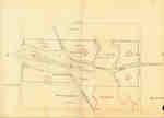
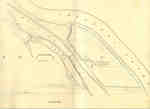
 - Second Welland Canal - Book 2, Survey Map 8 - Little Deep Cut in Thorold

 Survey map of the Second Welland Canal created by the Welland Canal Company showing the canal in Thorold South. Identified structures associated with the Canal include the Little Deep Cut and the towing path. The surveyors' measurements and notes can be seen in red and black ink and pencil. Local …
 Survey map of the Second Welland Canal created by the Welland Canal Company showing the canal in Thorold South. Identified structures associated with the Canal include the Little Deep Cut …Brock University Archives
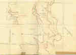
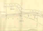
 - Second Welland Canal - Book 2, Survey Map 9 - Back Water Bodies in Thorold

 Survey map of the Second Welland Canal created by the Welland Canal Company showing the Back Water bodies in Thorold Township. The surveyors' measurements and notes can be seen in red and black ink and pencil. A number of trees along the shores presumably used in the measurements are labelled. …
 Survey map of the Second Welland Canal created by the Welland Canal Company showing the Back Water bodies in Thorold Township. The surveyors' measurements and notes can be seen in …Brock University Archives
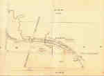
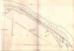
 - Second Welland Canal - Book 2, Survey Map 11 - Marlatts Bridge in Thorold

 Survey map of the Second Welland Canal created by the Welland Canal Company showing the canal in Thorold Township. Identified structures associated with the Canal include the towing path. The surveyors' measurements and notes can be seen in red and black ink and pencil. Local area landmarks are also identified …
 Survey map of the Second Welland Canal created by the Welland Canal Company showing the canal in Thorold Township. Identified structures associated with the Canal include the towing path. The …Brock University Archives
 - Second Welland Canal - Book 2, Survey Map 14 - Lock 26 and Allanburgh

 Survey map of the Second Welland Canal created by the Welland Canal Company showing the canal as it passes through the Village of Allanburgh. Identified structures and features associated with the Canal include Lock 26, a Guard Lock, Lock Tender's House, the New Cut, waste wear, and the towing path. …
 Survey map of the Second Welland Canal created by the Welland Canal Company showing the canal as it passes through the Village of Allanburgh. Identified structures and features associated with …Brock University Archives
 - Second Welland Canal - Book 3, Survey Map 3 - Vanalstines Creek and Back Water in Thorold

 Survey map of the Second Welland Canal created by the Welland Canal Company showing the canal in Thorold Township near Port Robinson. Identified structures associated with the Canal include towing path. The surveyors' measurements and notes can be seen in red and black ink and pencil. Local area landmarks are …
 Survey map of the Second Welland Canal created by the Welland Canal Company showing the canal in Thorold Township near Port Robinson. Identified structures associated with the Canal include towing …Brock University Archives
 - Second Welland Canal - Book 3, Survey Map 5 - Old Canal and New Canal along Chippewa Creek in Port Robinson, Thorold Township

 Survey map of the Second Welland Canal created by the Welland Canal Company showing the canal along Chippewa Creek in Thorold Township. Identified structures and features associated with the Canal include the towing path, float bridge, and the waterway itself. The surveyors' measurements and notes can be seen in red …
 Survey map of the Second Welland Canal created by the Welland Canal Company showing the canal along Chippewa Creek in Thorold Township. Identified structures and features associated with the Canal …Brock University Archives
 - Second Welland Canal - Book 3, Survey Map 10 - Canal along Chippewa Creek in Thorold


 Survey map of the Second Welland Canal created by the Welland Canal Company showing the canal in the Thorold Township between Port Robinson and Welland. Identified structures and features associated with the Canal include the towing path, a ditch, foot of the slope of bank, and the waterway itself. The …

 Survey map of the Second Welland Canal created by the Welland Canal Company showing the canal in the Thorold Township between Port Robinson and Welland. Identified structures and features associated …Brock University Archives
 - Second Welland Canal - Book 3, Survey Map 11 - Aqueduct Lock and Canal along Chippewa Creek in Thorold

 Survey map of the Second Welland Canal created by the Welland Canal Company showing the canal as it crosses Chippewa Creek in the Thorold Township near Welland. Identified structures and features associated with the Canal include the towing path, the old canal, the aqueduct lock, the new aqueduct, and the …
 Survey map of the Second Welland Canal created by the Welland Canal Company showing the canal as it crosses Chippewa Creek in the Thorold Township near Welland. Identified structures and …Brock University Archives
 - Halton Volunteers 1866
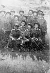
 Canadian Champion (Milton, ON), 21 Jul 1868, p. 3 Portrait of Halton Volunteers with studio backdrop of Niagara Falls. Captain James Young (Back, centre, holding sword) of Georgetown is the commanding officer. They were patrolling the Welland Canal against Fenian Raids.
  Canadian Champion (Milton, ON), 21 Jul 1868, p. 3 Portrait of Halton Volunteers with studio backdrop of Niagara Falls. Captain James Young (Back, centre, holding sword) of Georgetown is the commanding officer. They were patrolling the Welland Canal against …Esquesing Historical Society
 - Bandel Family
 Joseph Bandel (1826-1896) and Mary Stelzle (1833-1914) both came to Canada from Wurtemburg, Germany. They were married at Toronto in 1854. In 1858 they settled at Whitby. Joseph and Mary Bandel had nine surviving children: Mary Josephine (1858-1927), Joseph George (1860-1883), Joseph Anton (1862-1900), Emeline (1864-1953), Anthony (1867-1946), Louis Stephen …
  Joseph Bandel (1826-1896) and Mary Stelzle (1833-1914) both came to Canada from Wurtemburg, Germany. They were married at Toronto in 1854. In 1858 they settled at Whitby. Joseph and Mary …Whitby Public Library
 - Elizabeth (Wilkinson) Norton & Francis John Norton
 Elizabeth (Wilkinson) Norton 1840-1918 & Francis John Norton 1868-1880
  Elizabeth (Wilkinson) Norton 1840-1918 & Francis John Norton 1868-1880Trafalgar Township Historical Society
 - A Codicil to my Will, Hiram Capron

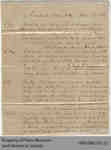
 This is a handwritten manuscript of the codicil Hiram Capron added to his will, adding new provisions and changing some which existed in the original document. He revises his gift to his sons Banfield and William and makes more explicit arrangements for his wife and daughters. He also sets out …
 This is a handwritten manuscript of the codicil Hiram Capron added to his will, adding new provisions and changing some which existed in the original document. He revises his gift …
 - Deed between Neville Smith and James Hitchcox

 This land deed between Neville Smith, his wife Martha Smith, and James Hitchcox, all of the town of Paris, transfers a portion of land in exchange for $875. The land is approximately 3/4 of an acre in lots 1, 2, and 3 on the south side of William Street.
 This land deed between Neville Smith, his wife Martha Smith, and James Hitchcox, all of the town of Paris, transfers a portion of land in exchange for $875. The land …County of Brant Public Library
 - Hiram Capron or Norman Hamilton Miniature Account Book, 1866-68

 This diminutive account book contains lists of transactions running approximately from 1866 to 1868. The inside of the back cover contains some unrelated miscellaneous information, such as George Washington's dates of birth and death. The creator is not definitively known. The label on the front proposes that Norman Hamilton may …
 This diminutive account book contains lists of transactions running approximately from 1866 to 1868. The inside of the back cover contains some unrelated miscellaneous information, such as George Washington's dates …
 - New Dominion 1868
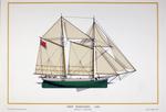
 NEW DOMINION. 1868 Schooner - Great Lakes Ian L. Morgan c1972 Ships and Small Craft of Canada
  NEW DOMINION. 1868 Schooner - Great Lakes Ian L. Morgan c1972 Ships and Small Craft of CanadaMaritime History of the Great Lakes
 - Steamer Lawrence
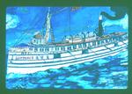
 Passenger & freight steamer; built 1868, Cleveland, Ohio; 135' x 25'; 447 gross tons. Rebuilt 1902, and name changed to Frontenac. Berthed foot Wabash Ave.,Chicago. Listed Beers, History of the Great Lakes, Vol 1., p. 847; Inland Lloyds Vessel Register, 1893; Ship Masters' Assoc. Directory, 1903. In Register of 1905, …
  Passenger & freight steamer; built 1868, Cleveland, Ohio; 135' x 25'; 447 gross tons. Rebuilt 1902, and name changed to Frontenac. Berthed foot Wabash Ave.,Chicago. Listed Beers, History of the …Maritime History of the Great Lakes
 - Tug Winneconne and Steamer Scutanabacon
 Scene at the dam, Appleton, Wis., 1868. Capt. Sam Neff in the tug, Winneconne is about to rescue the Str. Schtenanbequon [Scutanabacon] from being carried over the dam. Capt. Neff also righted the vessel when it was bottom up in Lake Winnebago; it also sank in the Menasha lock. After …
  Scene at the dam, Appleton, Wis., 1868. Capt. Sam Neff in the tug, Winneconne is about to rescue the Str. Schtenanbequon [Scutanabacon] from being carried over the dam. Capt. Neff …Maritime History of the Great Lakes
 - Preliminary Chart of Part of Lake Superior, 1868 [Ontonagon to Grand Island]
 SURVEY OF THE NORTHERN AND NORTH WESTERN LAKES. Made in obedience to acts of Congress and orders from THE BUREAU OF ENGINEERS OF THE WAR DEPARTMENT, and under the direction of Brvt. Brig. Genl. W.F. RAYNOLDS, Lt. Col. Corps of Engrs Supt. PRELIMINARY CHART OF PART OF LAKE
  SURVEY OF THE NORTHERN AND NORTH WESTERN LAKES. Made in obedience to acts of Congress and orders from THE BUREAU OF ENGINEERS OF THE WAR DEPARTMENT, and under the direction …Maritime History of the Great Lakes
 - Preliminary Chart of Part of Lake Superior, 1868 [Grand Island to Sault Ste. Marie]
 SURVEY OF THE NORTHERN AND NORTH WESTERN LAKES. Made in obedience to acts of Congress and orders from THE BUREAU OF ENGINEERS OF THE WAR DEPARTMENT, and under the direction of Brvt. Brig. Genl. W.F. RAYNOLDS, Lt. Col. Corps of Engrs Supt. PRELIMINARY CHART OF PART OF LAKE
  SURVEY OF THE NORTHERN AND NORTH WESTERN LAKES. Made in obedience to acts of Congress and orders from THE BUREAU OF ENGINEERS OF THE WAR DEPARTMENT, and under the direction …Maritime History of the Great Lakes






![Preliminary Chart of Part of Lake Superior, 1868 [Ontonagon to Grand Island] Preliminary Chart of Part of Lake Superior, 1868 [Ontonagon to Grand Island]](https://images.MaritimeHistoryoftheGreatLakes.ca/images/MHGL000066599t.jpg)
![Preliminary Chart of Part of Lake Superior, 1868 [Grand Island to Sault Ste. Marie] Preliminary Chart of Part of Lake Superior, 1868 [Grand Island to Sault Ste. Marie]](https://images.MaritimeHistoryoftheGreatLakes.ca/images/MHGL000066601t.jpg)
