Results
We found 14 matching items.


Page 1 of 1
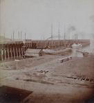
- Marquette, from Ridge Street
 Stereoview of the long wharves at Marquette, MI
  Stereoview of the long wharves at Marquette, MIMaritime History of the Great Lakes
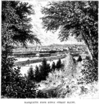
 - Marquette from Ridge Street Bluff
 Illustration from the article by F. Johnson, Jun, "The Upper Peninsula of Michigan," Harper's Monthly, May 1882, p. 893
  Illustration from the article by F. Johnson, Jun, "The Upper Peninsula of Michigan," Harper's Monthly, May 1882, p. 893Maritime History of the Great Lakes
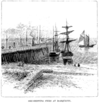
 - Ore-shipping piers at Marquette
 Illustration from the article by F. Johnson, Jun, "The Upper Peninsula of Michigan," Harper's Monthly, May 1882, p. 893
  Illustration from the article by F. Johnson, Jun, "The Upper Peninsula of Michigan," Harper's Monthly, May 1882, p. 893Maritime History of the Great Lakes
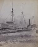
 - Marquette Waterfront
 IRON AGE was launched in 1880 with 3 masts, and rebuilt in 1887 with 4 masts
  IRON AGE was launched in 1880 with 3 masts, and rebuilt in 1887 with 4 mastsMaritime History of the Great Lakes
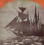
 - Ice Blockade in Marquette Harbor, June 3d 1873
 Stereoview of several vessels trapped by ice in Marquette in June 1873. In the center is a barkentine with its sails raised.
  Stereoview of several vessels trapped by ice in Marquette in June 1873. In the center is a barkentine with its sails raised.Maritime History of the Great Lakes
 - Ore Dock, Marquette
 Stereoview of a 3-masted schooner and a steam barge loading iron ore at the ore dock in Marquette. The bow of another sailing vessel is in the right foreground. The name on the stern of the 3-masted schooner is "[obscured] OF CLEVELAND". A number of masts can be seen of …
  Stereoview of a 3-masted schooner and a steam barge loading iron ore at the ore dock in Marquette. The bow of another sailing vessel is in the right foreground. The …Maritime History of the Great Lakes
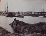
 - Marquette

 Maritime History of the Great Lakes
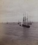
 - Marquette Waterfront
 Stereoview of a tug towing a schooner out past vessels anchored off shore at Marquette.
  Stereoview of a tug towing a schooner out past vessels anchored off shore at Marquette.Maritime History of the Great Lakes
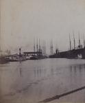
 - Marquette waterfront
 Stereoview of the Marquette waterfront. A tug and other boats are at the ore dock. A small two masted schoner lies on the shore. A number of ore cars on on the top of the dock. Other the dock can be seen the masts of some other vessels.
  Stereoview of the Marquette waterfront. A tug and other boats are at the ore dock. A small two masted schoner lies on the shore. A number of ore cars on …Maritime History of the Great Lakes
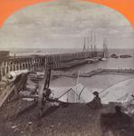
 - Ore Piers, Marquette
 Stereoview showing two schooners at the Marquette ore dock. A cannon looks down from the heights over the harbour. The name on the schooner is ____ OF ERIE
  Stereoview showing two schooners at the Marquette ore dock. A cannon looks down from the heights over the harbour. The name on the schooner is ____ OF ERIEMaritime History of the Great Lakes
 - Marquette
 134. Marquette Gems of Lake Superior Scenery. Childs' Art Gallery, Marquette, Mich.
  134. Marquette Gems of Lake Superior Scenery. Childs' Art Gallery, Marquette, Mich.Maritime History of the Great Lakes
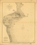
 - Preliminary Chart of Marquette Harbor, Lake Superior, 1859
 PRELIMINARY CHART OF MARQUETTE HARBOR LAKE SUPERIOR From surveys under the direction of the TOPOGRAPHICAL BUREAU OF THE WAR DEPARTMENT in obedience to Acts of Congress requiring the SURVEY OF THE NORTH AND NORTH WESTERN LAKES Surveyed and drawn under the orders of Captain Geo. G. MEADE ...
  PRELIMINARY CHART OF MARQUETTE HARBOR LAKE SUPERIOR From surveys under the direction of the TOPOGRAPHICAL BUREAU OF THE WAR DEPARTMENT in obedience to Acts of Congress requiring the SURVEY OF …Maritime History of the Great Lakes
 - Lake Superior. Sheet 2 [1823-24, 1863]
 This edition adds a significant number of place names, including lights, fishing stations and Hudson Bay Company posts along with additional notes about local magnetic variations. From the American charts have been added insets for Ontonagon, Agate Harbour and Marquette.
  This edition adds a significant number of place names, including lights, fishing stations and Hudson Bay Company posts along with additional notes about local magnetic variations. From the American charts …Maritime History of the Great Lakes
 - Lake Superior [1878]
 North American Lakes Lake Superior The Canadian Shore from the Admiralty Survey by Lieut't H. W. Bayfield, r. N., 1823-5 The Coast and Plans of the United States from the United States Government Surveys of 1855-72. ... Magnetic Variation in 1883; Westerly increasing, Easterly decreasing ...
  North American Lakes Lake Superior The Canadian Shore from the Admiralty Survey by Lieut't H. W. Bayfield, r. N., 1823-5 The Coast and Plans of the United States from the …Maritime History of the Great Lakes
Page 1 of 1


![Lake Superior. Sheet 2 [1823-24, 1863] Lake Superior. Sheet 2 [1823-24, 1863]](https://images.MaritimeHistoryoftheGreatLakes.ca/images/MHGL000122608t.jpg)
![Lake Superior [1878] Lake Superior [1878]](https://images.MaritimeHistoryoftheGreatLakes.ca/images/MHGL000122621t.jpg)
