Results
We found 4 matching items.


Page 1 of 1
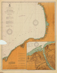
- Lake Ontario Coast Chart No. 2. Stony Point to Little Sodus Bay. 1912
 Survey of the south eastern shores of Lake Ontario from Little Sodus Bay, Fair Haven, Oswego, Texas, Port Ontario to Stony Point Lighthouse. Major inset with Oswego Harbor.
  Survey of the south eastern shores of Lake Ontario from Little Sodus Bay, Fair Haven, Oswego, Texas, Port Ontario to Stony Point Lighthouse. Major inset with Oswego Harbor.Maritime History of the Great Lakes
 - Lake Ontario, 1912
 US Hydrographic chart of Lake Ontario
  US Hydrographic chart of Lake OntarioMaritime History of the Great Lakes
 - Steamer "Rochester" on Lake Ontario
 Divided back postcard.
  Divided back postcard.Maritime History of the Great Lakes
 - Steamer "Rochester" at Night
 Divided back postcard. Postmarked Syracuse & Rome, Aug. 1912.
  Divided back postcard. Postmarked Syracuse & Rome, Aug. 1912.Maritime History of the Great Lakes
Page 1 of 1


