Results
We found 4005 matching items.


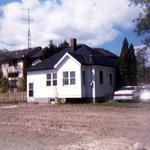
- House on Anderson Street, north of Highway 2
 Pictured is a house located on the west side of Anderson Street, and north of Highway 2.
  Pictured is a house located on the west side of Anderson Street, and north of Highway 2.Whitby Public Library
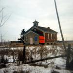
 - School on Base Line Road at Railway Station
 Pictured is a school located on Base Line Road at Railway Station in Whitby. The school was torn down in 1987.
  Pictured is a school located on Base Line Road at Railway Station in Whitby. The school was torn down in 1987.Whitby Public Library
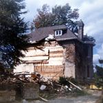
 - House on Highway 2, west of Highland Towers
 Pictured is the house located on the south side of Highway 2, west of the Highland Towers Apartments. The house was moved in 1986.
  Pictured is the house located on the south side of Highway 2, west of the Highland Towers Apartments. The house was moved in 1986.Whitby Public Library
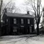
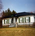
 - House on Colborne Street
 Pictured is a house located on Colborne Street in Whitby.
  Pictured is a house located on Colborne Street in Whitby.Whitby Public Library
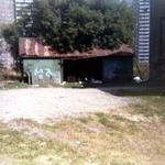
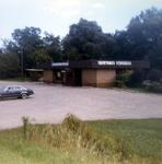
 - Garage on Highway 2, west of Highland Towers
 Pictured is the garage located on Highway 2, west of the Highland Towers apartments. The garage was torn down in 1986.
  Pictured is the garage located on Highway 2, west of the Highland Towers apartments. The garage was torn down in 1986.Whitby Public Library
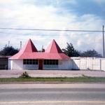
 - Fruit Market at Highway 12, north of Rossland Rd.
 Pictured is a fruit market located on the west side of Highway 12, north of Rossland Road in Whitby.
  Pictured is a fruit market located on the west side of Highway 12, north of Rossland Road in Whitby.Whitby Public Library
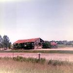
 - Barn on Highway 2 near Pickering
 Pictured is a barn located on the south side of Highway 2 near Pickering. The barn was to be torn down to make room for a housing subdivision.
  Pictured is a barn located on the south side of Highway 2 near Pickering. The barn was to be torn down to make room for a housing subdivision.Whitby Public Library
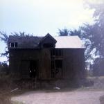
 - House on Dundas Street
 Pictured is a house located on Dundas Street, across from the Spruce Hotel. The house was due to be torn down to make way for a Plaza.
  Pictured is a house located on Dundas Street, across from the Spruce Hotel. The house was due to be torn down to make way for a Plaza.Whitby Public Library
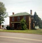
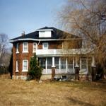
 - House at Corner of Highway 2 and 23
 Pictured is a house located at the corner of Highways 2 and 23 in Whitby. It is the home of the Red Wing Orchard.
  Pictured is a house located at the corner of Highways 2 and 23 in Whitby. It is the home of the Red Wing Orchard.Whitby Public Library
 - Coach House Restaurant on Highway 2
 Pictured it the Coach House restaurant, located on the south side of Highway 2, just east of D'Hillier Street in Whitby.
  Pictured it the Coach House restaurant, located on the south side of Highway 2, just east of D'Hillier Street in Whitby.Whitby Public Library
 - House on North side of Highway 2
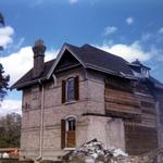
 Pictured is the house located on the North side of Highway 2 in Whitby.
  Pictured is the house located on the North side of Highway 2 in Whitby.Whitby Public Library
 - Barn on south side of Highway 2
 Pictured is a barn located behind a house on the south side of Highway 2, west of Highland Towers in Whitby. The barn was torn down in 1986.
  Pictured is a barn located behind a house on the south side of Highway 2, west of Highland Towers in Whitby. The barn was torn down in 1986.Whitby Public Library
 - House on Highway 2, west of Highland Towers
 Pictured is a house located on Highway 2, west of Highland Towers Apartments in Whitby. The house was moved in 1986.
  Pictured is a house located on Highway 2, west of Highland Towers Apartments in Whitby. The house was moved in 1986.Whitby Public Library
 - Mystery Photo: Unidentified Couple


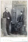
 ...
... 


 ...The Ontario Genealogical Society
 - Byron Street, c.1918
 Black and white negative of a photograph of a postcard showing Byron Street looking south from John Street. The Patterson home, on the south-west corner of Byron and John Streets, is visible at right. Byron Street is at left.
  Black and white negative of a photograph of a postcard showing Byron Street looking south from John Street. The Patterson home, on the south-west corner of Byron and John Streets, …Whitby Public Library
 - Centre Street, 1906
 Black and white negative of a photograph of a postcard showing Centre Street looking north from Dunlop Street. In the background is the steeple of All Saints' Anglican Church. The steeple of the Methodist Tabernacle is visible at right. The postcard has been framed with a fancy border.
  Black and white negative of a photograph of a postcard showing Centre Street looking north from Dunlop Street. In the background is the steeple of All Saints' Anglican Church. The …Whitby Public Library
 - Byron Street, c.1918
 Black and white negative of a photograph of a postcard showing Byron Street looking north from Mary Street. The house on the left was owned by Sheriff John F. Paxton.
  Black and white negative of a photograph of a postcard showing Byron Street looking north from Mary Street. The house on the left was owned by Sheriff John F. Paxton.Whitby Public Library
 - Centre Street Looking South, 1907
 Black and white negatives of a photograph showing Centre Street looking south from Dundas Street. The photograph was taken in spring after a late snowfall in 1907. The Methodist Tabernacle (St. Mark's United Church) is visible at left on the corner of Centre and Colborne Streets. The residence of W.J. …
  Black and white negatives of a photograph showing Centre Street looking south from Dundas Street. The photograph was taken in spring after a late snowfall in 1907. The Methodist Tabernacle …Whitby Public Library
 - Colborne Street Looking West, c.1913
 Black and white negative of a photograph of a postcard showing Colborne Street looking west from Byron Street. The Methodist Tabernacle (St. Mark's United Church) is at left and the residence of George Cormack is at right.
  Black and white negative of a photograph of a postcard showing Colborne Street looking west from Byron Street. The Methodist Tabernacle (St. Mark's United Church) is at left and the …Whitby Public Library
 - Byron Street Looking North, 1914
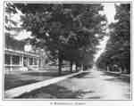
 Rous & Mann, Whitby, The Best Residential Town near Toronto (1914), 1914 Black and white negative of a photograph of an image of Byron Street that was printed in Whitby, the Best Residential Town near Toronto in 1914. View looking north toward John Street shows a tree-lined Byron Street with a house visible at left.
  Rous & Mann, Whitby, The Best Residential Town near Toronto (1914), 1914 Black and white negative of a photograph of an image of Byron Street that was printed in Whitby, the Best Residential Town near Toronto in 1914. View looking north toward …Whitby Public Library

