Results
We found 2 matching items.


Page 1 of 1
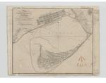
- Plan of Toronto Harbour, Lake Ontario
 Plan of Toronto Harbour, Lake Ontario. Surveyed under the Direction of Capt'n W. F. W. Owen, R. N. By Lieu't now Commander H.W.Bayfield, R. N. Drawn by Geo. D. Cranfield, Lieu't 90th L't. Inf'y The Town is copied from a Plan in the Surveyor General's Office. --- London Published ...
  Plan of Toronto Harbour, Lake Ontario. Surveyed under the Direction of Capt'n W. F. W. Owen, R. N. By Lieu't now Commander H.W.Bayfield, R. N. Drawn by Geo. D. Cranfield, …Maritime History of the Great Lakes
 - Plan of Toronto Harbour, Lake Ontario [1863]
 Although based on the 1817 chart, this edition is substantially revised. The streets and wharves of the city of Toronto have been completely redrawn to reflect the new wharves and the infilling of the waterfront. The shoal around Gibraltar Point has been reconfigured, and shows the buoys at the Western …
  Although based on the 1817 chart, this edition is substantially revised. The streets and wharves of the city of Toronto have been completely redrawn to reflect the new wharves and …Maritime History of the Great Lakes
Page 1 of 1


![Plan of Toronto Harbour, Lake Ontario [1863] Plan of Toronto Harbour, Lake Ontario [1863]](https://images.MaritimeHistoryoftheGreatLakes.ca/images/MHGL000122607t.jpg)
