Results
We found 27 matching items.


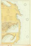
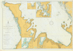
- Southern Georgian Bay, 1902
 Nottawasaga Bay; inset of Penetaguishene
  Nottawasaga Bay; inset of PenetaguisheneMaritime History of the Great Lakes
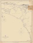
 - Lake Huron. Sheet III [Georgian Bay, 1822]
 Lake Huron. Sheet III The Soundings are in feet Surveyed by Capt'n H. W. Bayfield, R. N. 1822 London Published according to Act of Parliament at the Hydrographical Office of the Admiralty, 29th Sept. 1828. J. & C. Walker Sculpt
  Lake Huron. Sheet III The Soundings are in feet Surveyed by Capt'n H. W. Bayfield, R. N. 1822 London Published according to Act of Parliament at the Hydrographical Office of …Maritime History of the Great Lakes
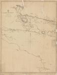
 - Lake Huron. Georgian Bay [1822, 1864]
 Modifications to the original chart include lights and some place names.
  Modifications to the original chart include lights and some place names.Maritime History of the Great Lakes
 - Lake Huron, 1914
 Insets of Rogers and Calcite, Alpena and Tawas Harbor
  Insets of Rogers and Calcite, Alpena and Tawas HarborMaritime History of the Great Lakes
 - Lake Huron, 1822
 by H. W. Bayfield; North East corner with Manitoulin Island
  by H. W. Bayfield; North East corner with Manitoulin IslandMaritime History of the Great Lakes
 - Lake Huron, 1822
 Northwest corner; Aids to Navigation corrected 1848
  Northwest corner; Aids to Navigation corrected 1848Maritime History of the Great Lakes
 - Lake Huron, 1822
 Northwest corner; Aids to Navigation corrected 1848
  Northwest corner; Aids to Navigation corrected 1848Maritime History of the Great Lakes
 - Lake Huron, 1822
 by Henry W. Bayfield, RN; Thunder Bay to Saginaw Bay, published 1828
  by Henry W. Bayfield, RN; Thunder Bay to Saginaw Bay, published 1828Maritime History of the Great Lakes
 - Lake Huron, 1822
 by Henry W. Bayfield, RN; Saginaw Bay to Chiefs Point, published 1828
  by Henry W. Bayfield, RN; Saginaw Bay to Chiefs Point, published 1828Maritime History of the Great Lakes
 - Lake Huron, 1860
 Aids to Navigation corrected to 2 March 1888
  Aids to Navigation corrected to 2 March 1888Maritime History of the Great Lakes
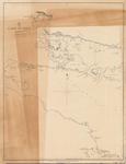
 - Lake Huron: Sheet II [1822]
 Coverage on the chart ranges from the Ducks in the northwest to Collins Inlet in the northeast to Chiefs Point on the Lake Huron side of the Bruce Peninsula and Lions Head on the Georgian Bay side
  Coverage on the chart ranges from the Ducks in the northwest to Collins Inlet in the northeast to Chiefs Point on the Lake Huron side of the Bruce Peninsula and …Maritime History of the Great Lakes
 - Lake Huron. Sheet IV [1822]
 Western shore of Lake Huron from roughly White Rock Point to Middle Island, including Saginaw Bay and Thunder Bay
  Western shore of Lake Huron from roughly White Rock Point to Middle Island, including Saginaw Bay and Thunder BayMaritime History of the Great Lakes
 - Lake Huron. Sheet V [1822]
 Chart of southern Lake Huron, from Point aux Barques in the center west, to Fort Gratiate [Gratiot] and Point Edward in the south to Chiefs Point in the northeast.
  Chart of southern Lake Huron, from Point aux Barques in the center west, to Fort Gratiate [Gratiot] and Point Edward in the south to Chiefs Point in the northeast.Maritime History of the Great Lakes
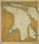
 - Lake Huron [1865, 1900]
 North America Lake Huron The Canadian Shores form Admiralty Surveys by Lieut. H. W. Bayfield, R. N. , 1822 and Staff Comm'r J. G. Boulton R. N., and Mr. W. J. Stewart 1884-99. under the Orders of the Government of the Dominion of Canada. The United States Shores from the …
  North America Lake Huron The Canadian Shores form Admiralty Surveys by Lieut. H. W. Bayfield, R. N. , 1822 and Staff Comm'r J. G. Boulton R. N., and Mr. W. …Maritime History of the Great Lakes
 - General Chart of Lake Huron including Georgian Bay and North Channel. 1908
 Survey of Lake Michigan
  Survey of Lake MichiganMaritime History of the Great Lakes
 - East Coast of Lake Huron including Southern portion of Georgian Bay. 1903
 Chart of Lake Huron from Port Elgin to Cape Hurd, along with the southern half of Georgian Bay. Inset charts include Southampton, Lions Head, Owen Sound, Midland and Penetanguishene harbours
  Chart of Lake Huron from Port Elgin to Cape Hurd, along with the southern half of Georgian Bay. Inset charts include Southampton, Lions Head, Owen Sound, Midland and Penetanguishene harboursMaritime History of the Great Lakes
 - General Chart of Lake Huron, 1860
 SURVEY OF THE NORTHERN AND NORTH WESTERN LAKES Made in obedience to Acts of Congress and under the direction of THE BUREAU OF TOPOGRAPHICAL ENGINEERS OF THE WAR DEPARTMENT GENERAL CHART OF LAKE HURON Projected from trigonometrical Surveys under the orders of Captain G. G. MEADE Topl ...
  SURVEY OF THE NORTHERN AND NORTH WESTERN LAKES Made in obedience to Acts of Congress and under the direction of THE BUREAU OF TOPOGRAPHICAL ENGINEERS OF THE WAR DEPARTMENT GENERAL …Maritime History of the Great Lakes
 - South End of Lake Huron and Head of the St. Clair River, 1859
 SURVEY OF THE NORTHERN AND NORTH WESTERN LAKES Made in obedience to acts of Congress and under the direction of THE BUREAU OF TOPOGRAPHICAL ENGINEERS OF THE WAR DEPARTMENT SOUTH END OF LAKE HURON AND HEAD OF THE ST. CLAIR RIVER Projected from a trigonometrical Survey, executed under the ...
  SURVEY OF THE NORTHERN AND NORTH WESTERN LAKES Made in obedience to acts of Congress and under the direction of THE BUREAU OF TOPOGRAPHICAL ENGINEERS OF THE WAR DEPARTMENT SOUTH …Maritime History of the Great Lakes
 - Collingwood and its Approaches [1890]
 Canada Georgian Bay - Lake Huron Collingwood and its Approaches Surveyed by Staff Commander J. G. Boulton, R. N. Assisted by Messrs. J. W. Stewart and D. C. Campbell, 1888 under the orders of the Government of the Dominion of Canada. ... Magnetic Variation in 1913, increasing about 3' ...
  Canada Georgian Bay - Lake Huron Collingwood and its Approaches Surveyed by Staff Commander J. G. Boulton, R. N. Assisted by Messrs. J. W. Stewart and D. C. Campbell, 1888 …Maritime History of the Great Lakes
 - Lake Huron: Cove Island to Great Duck Island and Entrance to Georgian Bay
 Canada Lake Huron Cove Island to Great Duck Island and Entrance to Georgian Bay Surveyed by Mr. W. J. Stewart, assisted by Messrs. F. Anderson, J. F. Fraser and R. E. Tyrwhitt, 1898-9, East of Michael Bay surveyed by Staff Commander J. G. Boulton, R. N., and Mr. W. J. …
  Canada Lake Huron Cove Island to Great Duck Island and Entrance to Georgian Bay Surveyed by Mr. W. J. Stewart, assisted by Messrs. F. Anderson, J. F. Fraser and R. …Maritime History of the Great Lakes


![Lake Huron. Sheet III [Georgian Bay, 1822] Lake Huron. Sheet III [Georgian Bay, 1822]](https://images.MaritimeHistoryoftheGreatLakes.ca/images/MHGL000122592t.jpg)
![Lake Huron. Georgian Bay [1822, 1864] Lake Huron. Georgian Bay [1822, 1864]](https://images.MaritimeHistoryoftheGreatLakes.ca/images/MHGL000122609t.jpg)
![Lake Huron: Sheet II [1822] Lake Huron: Sheet II [1822]](https://images.MaritimeHistoryoftheGreatLakes.ca/images/MHGL000122581t.jpg)
![Lake Huron. Sheet IV [1822] Lake Huron. Sheet IV [1822]](https://images.MaritimeHistoryoftheGreatLakes.ca/images/MHGL000122582t.jpg)
![Lake Huron. Sheet V [1822] Lake Huron. Sheet V [1822]](https://images.MaritimeHistoryoftheGreatLakes.ca/images/MHGL000122591t.jpg)
![Lake Huron [1865, 1900] Lake Huron [1865, 1900]](https://images.MaritimeHistoryoftheGreatLakes.ca/images/MHGL000122619t.jpg)
![Collingwood and its Approaches [1890] Collingwood and its Approaches [1890]](https://images.MaritimeHistoryoftheGreatLakes.ca/images/MHGL000122627t.jpg)

