Results
We found 15 matching items.


Page 1 of 1
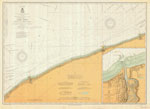
- Lake Erie: Dunkirk to vicinity of Erie, 1878

 Maritime History of the Great Lakes
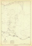
 - West End of Lake Erie and Detroit River, 1849

 Maritime History of the Great Lakes
 - Lake Erie Coast Chart No. 1. Buffalo to Dunkirk, 1908
 Survey of the southern shore of Lake Erie from Buffalo to Dunkirk, including Lackawanna, Silver Creek. Includes the Niagara River north to Niagara Falls and the Welland Canal from Allanburg to Port Colborne. The north shore of Lake Erie is shown as far west as Morgans Point.
  Survey of the southern shore of Lake Erie from Buffalo to Dunkirk, including Lackawanna, Silver Creek. Includes the Niagara River north to Niagara Falls and the Welland Canal from Allanburg …Maritime History of the Great Lakes
 - Lake Erie Coast Chart No. 2. Dunkirk to Erie and Long Point, 1906
 Survey of the southern shore of Lake Erie from Dunkirk, NY to Eire, PA including Westfield, NY (Barcelona). The tip of Long Point, ON appears in the North west corner of the chart.
  Survey of the southern shore of Lake Erie from Dunkirk, NY to Eire, PA including Westfield, NY (Barcelona). The tip of Long Point, ON appears in the North west corner …Maritime History of the Great Lakes
 - Lake Erie Coast Chart No. 3. Erie to Conneaut, and Long Point, 1902
 Survey of the southern shore of Lake Erie from Eire, PA to Conneaut, OH. The end of Long Point, ON appears in the North east corner of the chart.
  Survey of the southern shore of Lake Erie from Eire, PA to Conneaut, OH. The end of Long Point, ON appears in the North east corner of the chart.Maritime History of the Great Lakes
 - Lake Erie Coast Chart No. 4. Conneaut to Chagrin River, 1913
 Survey of the southern shore of Lake Erie from Conneaut, OH to the Chagrin River, including Ashtabula and Fairport, OH. The chart features an insert with Conneaut Harbor, OH.
  Survey of the southern shore of Lake Erie from Conneaut, OH to the Chagrin River, including Ashtabula and Fairport, OH. The chart features an insert with Conneaut Harbor, OH.Maritime History of the Great Lakes
 - Lake Erie Coast Chart No. 5. Chagrin River to Vermilion, 1920
 Survey of the southern shore of Lake Erie from the Chagrin River to Vermilion, OH, including Cleveland and Lorain, OH
  Survey of the southern shore of Lake Erie from the Chagrin River to Vermilion, OH, including Cleveland and Lorain, OHMaritime History of the Great Lakes
 - Lake Erie Coast Chart No. 6. Vermilion to Port Clinton, Ohio, Point Pelee to Colchester, Ont. 1934
 Survey of Lake Erie from the Vermilion to Port Clinton, OH, and Point Pelee to Colchester, Ont. including Huron and Sandusky, OH, Kelleys Island, the Bass Islands, Pelee Island, Kingsville and Leamington, ON
  Survey of Lake Erie from the Vermilion to Port Clinton, OH, and Point Pelee to Colchester, Ont. including Huron and Sandusky, OH, Kelleys Island, the Bass Islands, Pelee Island, Kingsville …Maritime History of the Great Lakes
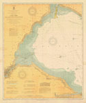
 - Lake Erie Coast Chart No. 7. Port Clinton to Toledo and Detroit River. 1910
 Survey of the western end of Lake Erie Port Clinton, OH to Toledo, OH and north to the mouth of the Detroit River. The north shore from Bar Point to Colchester, ON is also charted.
  Survey of the western end of Lake Erie Port Clinton, OH to Toledo, OH and north to the mouth of the Detroit River. The north shore from Bar Point to …Maritime History of the Great Lakes
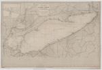
 - Lake Erie, 1849
 LAKE ERIE, Compiled from Surveys made under the direction of the BUREAU OF TOPOGRAPHICAL ENGINEERS, WAR DEPARTMENT, in obedience to Acts of Congress requiring the SURVEY OF THE NORTHERN AND NORTH WESTERN LAKES, and from other reliable information. 1849 Reduction for Engraving by John ...
  LAKE ERIE, Compiled from Surveys made under the direction of the BUREAU OF TOPOGRAPHICAL ENGINEERS, WAR DEPARTMENT, in obedience to Acts of Congress requiring the SURVEY OF THE NORTHERN AND …Maritime History of the Great Lakes
 - A Survey of Lake Erie [1817-18]
 A Survey of Lake Erie; in the Years 1817 & 1818 By Lieu't Henry W. Bayfield, R. N. All Soundings are in feet N.B. The depth of water varies, according as the seasons are wet or dry; the maximum being from two to three feet. ---insets--- Survey of Put In …
  A Survey of Lake Erie; in the Years 1817 & 1818 By Lieu't Henry W. Bayfield, R. N. All Soundings are in feet N.B. The depth of water varies, according …Maritime History of the Great Lakes
 - A Survey of Lake Erie [1817-18, 1861]
 The principal edits to the chart published in 1828 are the addition of place names and information on lights.
  The principal edits to the chart published in 1828 are the addition of place names and information on lights.Maritime History of the Great Lakes
 - Lake Erie
 Chart of Lake Erie includes references to a number of wrecks, including the approximate position of the CITY OF VENICE and LOCKWOOD.
  Chart of Lake Erie includes references to a number of wrecks, including the approximate position of the CITY OF VENICE and LOCKWOOD.Maritime History of the Great Lakes
 - Lake Erie: West End [1864, 1898]
 North America Lake Erie West End From the United States Coast Survey 1849 Soundings in feet ... Note. The depth of water varies, according as the Seasons are wet or dry, the maximum being from 2 to 3 ft. --inset-- Kingsville Harbour From a Canadian Government Survey 1895 Soundings in …
  North America Lake Erie West End From the United States Coast Survey 1849 Soundings in feet ... Note. The depth of water varies, according as the Seasons are wet or …Maritime History of the Great Lakes
 - Survey of Lake Erie [1817-18][manuscript]
 Copy of the original manuscript chart of Lake Erie surveyed by Henry W. Bayfield in 1817-18. There are different insets than in the published chart.
  Copy of the original manuscript chart of Lake Erie surveyed by Henry W. Bayfield in 1817-18. There are different insets than in the published chart.Maritime History of the Great Lakes
Page 1 of 1




![A Survey of Lake Erie [1817-18] A Survey of Lake Erie [1817-18]](https://images.MaritimeHistoryoftheGreatLakes.ca/images/MHGL000122588t.jpg)
![A Survey of Lake Erie [1817-18, 1861] A Survey of Lake Erie [1817-18, 1861]](https://images.MaritimeHistoryoftheGreatLakes.ca/images/MHGL000122606t.jpg)
![Lake Erie: West End [1864, 1898] Lake Erie: West End [1864, 1898]](https://images.MaritimeHistoryoftheGreatLakes.ca/images/MHGL000122618t.jpg)
![Survey of Lake Erie [1817-18][manuscript] Survey of Lake Erie [1817-18][manuscript]](https://images.MaritimeHistoryoftheGreatLakes.ca/images/MHGL000122605t.jpg)
