Results


Page 1 of 1
- Plan of Fort's George, Mississauga, and Niagara, The Military Reserves and the Town of Newark- 1908 Copy of an 1817 Original
 A plan by H.H. Willson[s] of Fort's George, Mississauga and Niagara, the Military Reserves and the Town of Newark. It is dated 2 May 1817 and has "Royal Regiment Office, Quebec". A memo above the title states the plan "shows a new proposed military reserve in red lines." This is …
  A plan by H.H. Willson[s] of Fort's George, Mississauga and Niagara, the Military Reserves and the Town of Newark. It is dated 2 May 1817 and has "Royal Regiment Office, …
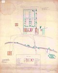
 - Mr. President Russel's Estate- 1915 copy
 A 1915 copy of Mr. President Russel's (president and acting administrator of Upper Canada from 1796-1799) estate plan in 1797. It illustrates the house and garden plans of his estate including site descriptions and dimensions.
  A 1915 copy of Mr. President Russel's (president and acting administrator of Upper Canada from 1796-1799) estate plan in 1797. It illustrates the house and garden plans of his estate …
 - Map: Laura Secord’s Route from Queenston to Beaverdams
 A handwritten map of Laura Secord’s route from Queenston to Beaverdams during the War of 1812. There is also a short history of the map itself included. It is black ink on three pieces of cream paper. It is believed that this map was made for Mrs. Curzon when writing …
  A handwritten map of Laura Secord’s route from Queenston to Beaverdams during the War of 1812. There is also a short history of the map itself included. It is black …
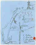
 - Ink Sketch of the Site of Sir Isaac Brock's death
 This is a sketch, done in pen, of the site of Brock's death. It includes a sketch of the monument, details of Queenston Heights and the site of where it was believed Brock fell. The creator also mentions Wynn's Tavern and writes "where Body was taken" just beside it.
  This is a sketch, done in pen, of the site of Brock's death. It includes a sketch of the monument, details of Queenston Heights and the site of where it …
 - Map of the Town of Newark in 1813
 A print of a plan of Niagara in 1813 which provides a basic outline of the town of Newark, the North end of the Niagara River, Fort George, Fort Niagara and other points of interest.
  A print of a plan of Niagara in 1813 which provides a basic outline of the town of Newark, the North end of the Niagara River, Fort George, Fort Niagara …
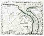
 - Map of the Niagara Frontier showing 1812-1814 Battle Sites
 A map of the Niagara Frontier which shows 1812-1814 battle sites. Possibly from "Lossing's Field Book of the War of 1812" dated 1869.
  A map of the Niagara Frontier which shows 1812-1814 battle sites. Possibly from "Lossing's Field Book of the War of 1812" dated 1869.
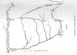
 - Diagram of Laura Secord's Route
 Sketched map with text depicting Laura Secord's projected route from Thorold to Queenston.
  Sketched map with text depicting Laura Secord's projected route from Thorold to Queenston.
 - Plan of the river from Niagara to Fort Schlosser
 Historical map showing Fort Niagara, Fort Schlosser, the line of the escarpment and hydrological features. Relief shown by shading. Oriented with north to the right. "Quebec 6th Decr. 1788."
  Historical map showing Fort Niagara, Fort Schlosser, the line of the escarpment and hydrological features. Relief shown by shading. Oriented with north to the right. "Quebec 6th Decr. 1788."
 - Map of Historic Niagara, Showing the Principal Points of Interest in Connection with the History of the Niagara River
 Made for Peter A. Porter. It outlines all the major historical sites for the War of 1812 in Niagara.
  Made for Peter A. Porter. It outlines all the major historical sites for the War of 1812 in Niagara.
Page 1 of 1

