Results
We found 8467 matching items.


- Remembrance Day Ceremony at the Brooklin Cenotaph, November 11, 2019

 The Brooklin Cenotaph was relocated from the Luther Vipond Memorial Arena at 67 Winchester Road to the Brooklin Community Centre and Library at 8 Vipond Road in Brooklin. The dedication ceremony was held on September 29, 2019. The new cenotaph was built through federal and municipal grants as well as …
 The Brooklin Cenotaph was relocated from the Luther Vipond Memorial Arena at 67 Winchester Road to the Brooklin Community Centre and Library at 8 Vipond Road in Brooklin. The dedication …Whitby Public Library
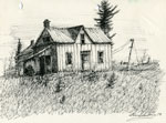
 - Pencil Sketch of an Abandoned House, 1978

 Signed by the artist. Part of a group of ten sketches which were donated to the Perry Township Public Library in 1978.
 Signed by the artist. Part of a group of ten sketches which were donated to the Perry Township Public Library in 1978.Perry Township Public Library
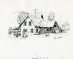
 - Pencil Sketch of a Snow-Covered Home, 1978

 Signed by the artist. Part of a group of ten sketches which were donated to the Perry Township Public Library in 1978.
 Signed by the artist. Part of a group of ten sketches which were donated to the Perry Township Public Library in 1978.Perry Township Public Library
 - Pencil Sketch of a Large Wooden Barn, 1977

 Signed by the artist. Part of a group of ten sketches which were donated to the Perry Township Public Library in 1978.
 Signed by the artist. Part of a group of ten sketches which were donated to the Perry Township Public Library in 1978.Perry Township Public Library
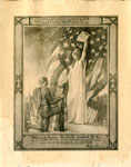
 - Columbia Gives to her son the accolade of the new chivalry of Humanity


 Photographs and documents may be reproduced for research purposes only. Special permission must be obtained for use in publications, websites or for commercial purposes. All photographs and documents used from the Haldimand County Museums records on the Our Ontario website must acknowledge the source in writing on the reproductions as …

 Photographs and documents may be reproduced for research purposes only. Special permission must be obtained for use in publications, websites or for commercial purposes. All photographs and documents used from …Heritage Centre
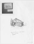
 - Sand Bay School S.S. #18 & 15

 (Condition: Good.)
 (Condition: Good.)Leeds & Thousand Islands Public Library
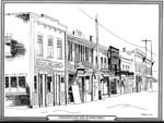
 - East Side Main Street, Thessalon, circa 1920


 This is a black and white ink sketch of the east side of Thessalon's Main Street in the early 1920s. It shows a series of two-story buildings including the Imperial Bank of Canada and the People's Meat Market. the illustrator is Barbara Halyk.

 This is a black and white ink sketch of the east side of Thessalon's Main Street in the early 1920s. It shows a series of two-story buildings including the Imperial …Thessalon Union Public Library
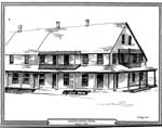
 - Drawing of the Queen's Royal Hotel, Thessalon, 1989

 This is a black and white ink sketch of the Queen's Royal Hotel, Thessalon, built in 1887. The sketch depicts the long two-story hotel with a covered porch around the building, There are also two small second floor balconies.
 This is a black and white ink sketch of the Queen's Royal Hotel, Thessalon, built in 1887. The sketch depicts the long two-story hotel with a covered porch around the …Thessalon Union Public Library
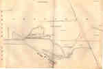
 - Second Welland Canal - Book 1, Survey Map 1 - Entrance, Lock 1 and Port Dalhousie


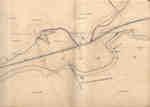
 Survey map of the Second Welland Canal created by the Welland Canal Company showing the areas in and around Port Dalhousie and Grantham Township. Identified structures associated with the Canal include Lock 1, Lighthouse, Lighthouse Keeper's House, East and West Piers, Harbour, Waste Weir, Store House, Collector's Office, Collector Assistant …

 Survey map of the Second Welland Canal created by the Welland Canal Company showing the areas in and around Port Dalhousie and Grantham Township. Identified structures associated with the Canal …Brock University Archives
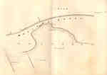
 - Second Welland Canal - Book 1, Survey Map 2 - Lock 1 and Port Dalhousie

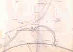
 Survey map of the Second Welland Canal created by the Welland Canal Company showing the areas in and around Port Dalhousie and Grantham Township. Identified structures associated with the Canal include Lock 1, East and West Piers, Collector's Office, Lock Tender's House and the new towing path. The surveyors' measurements …
 Survey map of the Second Welland Canal created by the Welland Canal Company showing the areas in and around Port Dalhousie and Grantham Township. Identified structures associated with the Canal …Brock University Archives
 - Second Welland Canal - Book 1, Survey Map 3 - Old Lock 2 in Grantham Township

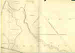
 Survey map of the Second Welland Canal created by the Welland Canal Company showing a portion of the Grantham Township near Port Dalhousie. Identified structures associated with the Canal include the new towing path. The surveyors' measurements and notes can be seen in red and black ink and pencil. Features …
 Survey map of the Second Welland Canal created by the Welland Canal Company showing a portion of the Grantham Township near Port Dalhousie. Identified structures associated with the Canal include …Brock University Archives
 - Second Welland Canal - Book 1, Survey Map 4 - Through Grantham Township

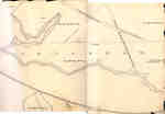
 Survey map of the Second Welland Canal created by the Welland Canal Company showing a portion of the Grantham Township. Identified structures associated with the Canal include the floating tow path and the canal itself. The surveyors' measurements and notes can be seen in red and black ink and pencil. …
 Survey map of the Second Welland Canal created by the Welland Canal Company showing a portion of the Grantham Township. Identified structures associated with the Canal include the floating tow …Brock University Archives
 - Second Welland Canal - Book 1, Survey Map 5 - Through Grantham Township


 Survey map of the Second Welland Canal created by the Welland Canal Company showing a portion of the Grantham Township near Port Dalhousie. Identified structures associated with the Canal include the tow path and floating tow path. The surveyors' measurements and notes can be seen in red and black ink …

 Survey map of the Second Welland Canal created by the Welland Canal Company showing a portion of the Grantham Township near Port Dalhousie. Identified structures associated with the Canal include …Brock University Archives
 - Second Welland Canal - Book 1, Survey Map 6 - Through Grantham and Louth Townships

 Survey map of the Second Welland Canal created by the Welland Canal Company showing the area between the Townships of Grantham and Louth. Identified structures associated with the Canal include the floating tow path. The surveyors' measurements and notes can be seen in red and black ink and pencil. Features …
 Survey map of the Second Welland Canal created by the Welland Canal Company showing the area between the Townships of Grantham and Louth. Identified structures associated with the Canal include …Brock University Archives
 - Second Welland Canal - Book 1, Survey Map 8 - Through Grantham and Louth Townships

 Survey map of the Second Welland Canal created by the Welland Canal Company showing the area between the Townships of Louth and Grantham. Identified structures associated with the Canal include the floating tow path. It is not labelled, but runs along the bottom of the map. The surveyors' measurements and …
 Survey map of the Second Welland Canal created by the Welland Canal Company showing the area between the Townships of Louth and Grantham. Identified structures associated with the Canal include …Brock University Archives
 - Second Welland Canal - Book 1, Survey Map 7 - Through Grantham Township

 Survey map of the Second Welland Canal created by the Welland Canal Company showing a portion of the Grantham Township. Identified structures associated with the Canal include the floating tow path. The surveyors' measurements and notes can be seen in red and black ink and pencil. Local area landmarks are …
 Survey map of the Second Welland Canal created by the Welland Canal Company showing a portion of the Grantham Township. Identified structures associated with the Canal include the floating tow …Brock University Archives
 - Second Welland Canal - Book 1, Survey Map 10 - St. Catharines


 Survey map of the Second Welland Canal created by the Welland Canal Company along the western edge of the Town of St. Catharines. Although not labelled, the Second Welland Canal can be seen running through the map along with its tow path, which is located on the southwestern edge of …

 Survey map of the Second Welland Canal created by the Welland Canal Company along the western edge of the Town of St. Catharines. Although not labelled, the Second Welland Canal …Brock University Archives
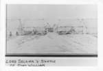
 - Lord Selkirk's Sketch of Fort William.

 Also P3438
 Also P3438Thunder Bay Public Library
 - Second Welland Canal - Book 2, Survey Map 15 - Deep Cut in Thorold

 Survey map of the Second Welland Canal created by the Welland Canal Company showing the canal in the Thorold Township just south of Allanburgh. Identified structures and features associated with the Canal include the Deep Cut and the towing path. The surveyors' measurements and notes can be seen in red …
 Survey map of the Second Welland Canal created by the Welland Canal Company showing the canal in the Thorold Township just south of Allanburgh. Identified structures and features associated with …Brock University Archives
 - Second Welland Canal - Book 2, Survey Map 16 - Deep Cut in Thorold

 Survey map of the Second Welland Canal created by the Welland Canal Company showing the canal in the Thorold Township between Allanburg and Port Robinson. Identified structures and features associated with the Canal include the Deep Cut and the towing path. The surveyors' measurements and notes can be seen in …
 Survey map of the Second Welland Canal created by the Welland Canal Company showing the canal in the Thorold Township between Allanburg and Port Robinson. Identified structures and features associated …Brock University Archives


