Results


Page 1 of 1
- Southern Georgian Bay, 1902
 Nottawasaga Bay; inset of Penetaguishene
  Nottawasaga Bay; inset of PenetaguisheneMaritime History of the Great Lakes
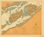
 - St. Lawrence River, 1902
 Wolfe Island to Wellesley Island; Clayton and Gananoque
  Wolfe Island to Wellesley Island; Clayton and GananoqueMaritime History of the Great Lakes
 - St. Marys River from Head of Hay Lake to Whitefish Bay, 1902

 Maritime History of the Great Lakes
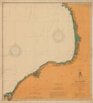
 - Lake Ontario Coast Chart No. 2. Stony Point to Little Sodus Bay. 1902
 Survey of the south eastern shores of Lake Ontario from Little Sodus Bay, Oswego, Texas, Port Ontario to Stony Point Lighthouse
  Survey of the south eastern shores of Lake Ontario from Little Sodus Bay, Oswego, Texas, Port Ontario to Stony Point LighthouseMaritime History of the Great Lakes
 - Lake Erie Coast Chart No. 3. Erie to Conneaut, and Long Point, 1902
 Survey of the southern shore of Lake Erie from Eire, PA to Conneaut, OH. The end of Long Point, ON appears in the North east corner of the chart.
  Survey of the southern shore of Lake Erie from Eire, PA to Conneaut, OH. The end of Long Point, ON appears in the North east corner of the chart.Maritime History of the Great Lakes
 - Lake Huron: Chantry Island to Cove Island
 Canada Lake Huron Chantry Island to Cove Island Surveyed by Mr. W. J. Stewart, assisted by Messrs F. Anderson, and R. E. Tyrwhitt, 1899-1900. North of Cape Hurd surveyed by Staff Commander J. G. Boulton, R.N., and Mr. W. J. Stewart, 1884 under the orders of the Government of the …
  Canada Lake Huron Chantry Island to Cove Island Surveyed by Mr. W. J. Stewart, assisted by Messrs F. Anderson, and R. E. Tyrwhitt, 1899-1900. North of Cape Hurd surveyed by …Maritime History of the Great Lakes
 - St. Marys River From Twin Island to Sault Ste. Marie. 1898
 Survey of the St. Marys River from Twin Islands (in Mud Lake) to Sault Sainte Marie
  Survey of the St. Marys River from Twin Islands (in Mud Lake) to Sault Sainte MarieMaritime History of the Great Lakes
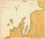
 - North east end of Lake Michigan including Grand and Little Traverse Bays and the Fox and Manitou Islands, 1902
 includes Traverse City, Charlevoix and Petoskey
  includes Traverse City, Charlevoix and PetoskeyMaritime History of the Great Lakes
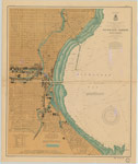
 - Milwaukee Harbor, Wisconsin, 1902
 WAR DEPARTMENT, CORPS OF ENGINEERS. SURVEY OF THE NORTHERN AND NORTH WESTERN LAKES Made in obedience to acts of Congress and orders from HEADQUARTERS CORPS OF ENGINEERS, U. S. ARMY, CHART OF MILWAUKEE HARBOR, WISCONSIN. Prepared under the direction of Major W. L. FISK, Corps of ...
  WAR DEPARTMENT, CORPS OF ENGINEERS. SURVEY OF THE NORTHERN AND NORTH WESTERN LAKES Made in obedience to acts of Congress and orders from HEADQUARTERS CORPS OF ENGINEERS, U. S. ARMY, …Maritime History of the Great Lakes
Page 1 of 1


