Results
We found 3 matching items.


Page 1 of 1
- Lake Erie
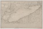
 Chart of Lake Erie includes references to a number of wrecks, including the approximate position of the CITY OF VENICE and LOCKWOOD.
  Chart of Lake Erie includes references to a number of wrecks, including the approximate position of the CITY OF VENICE and LOCKWOOD.Maritime History of the Great Lakes
 - Lake Erie: West End [1864, 1898]
 North America Lake Erie West End From the United States Coast Survey 1849 Soundings in feet ... Note. The depth of water varies, according as the Seasons are wet or dry, the maximum being from 2 to 3 ft. --inset-- Kingsville Harbour From a Canadian Government Survey 1895 Soundings in …
  North America Lake Erie West End From the United States Coast Survey 1849 Soundings in feet ... Note. The depth of water varies, according as the Seasons are wet or …Maritime History of the Great Lakes
 - Bay of Quinte: Kingston to Deseronto
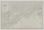
 The chart includes some handwritten annotations.
  The chart includes some handwritten annotations.Maritime History of the Great Lakes
Page 1 of 1


![Lake Erie: West End [1864, 1898] Lake Erie: West End [1864, 1898]](https://images.MaritimeHistoryoftheGreatLakes.ca/images/MHGL000122618t.jpg)

