Results
We found 7 matching items.


Page 1 of 1
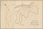
- Survey of a portion of the Galoppe Rapids
 Map 1 from "Maps, Reports, Estimates, &c., Relative to Improvements of the Navigation of the River St. Lawrence; and a Proposed Canal Connecting the River St. Lawrence and Lake Champlain"
  Map 1 from "Maps, Reports, Estimates, &c., Relative to Improvements of the Navigation of the River St. Lawrence; and a Proposed Canal Connecting the River St. Lawrence and Lake Champlain"Maritime History of the Great Lakes
 - Survey of a portion of the North Channel of the Long Sault.
 Map 2 from "Maps, Reports, Estimates, &c., Relative to Improvements of the Navigation of the River St. Lawrence; and a Proposed Canal Connecting the River St. Lawrence and Lake Champlain"
  Map 2 from "Maps, Reports, Estimates, &c., Relative to Improvements of the Navigation of the River St. Lawrence; and a Proposed Canal Connecting the River St. Lawrence and Lake Champlain"Maritime History of the Great Lakes
 - Lower Reach of Saginaw River and Bar in Front, 1856
 Preliminary Chart
  Preliminary ChartMaritime History of the Great Lakes
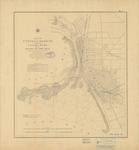
 - Buffalo Harbor and Head of Niagara River, 1856

 Maritime History of the Great Lakes
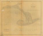
 - Tawas Harbor, 1856
 Preliminary Chart, Harbor of Refuge, Lake Michigan
  Preliminary Chart, Harbor of Refuge, Lake MichiganMaritime History of the Great Lakes
 - Diagram Map exhibiting the Various Routes Proposed for the St. Lawrence & Lake Champlain Ship Canal.
 From "Maps, Reports, Estimates, &c., Relative to Improvements of the Navigation of the River St. Lawrence; and a Proposed Canal Connecting the River St. Lawrence and Lake Champlain"
  From "Maps, Reports, Estimates, &c., Relative to Improvements of the Navigation of the River St. Lawrence; and a Proposed Canal Connecting the River St. Lawrence and Lake Champlain"Maritime History of the Great Lakes
 - Maps, Reports, Estimates, &c., Relative to Improvements of the Navigation of the River St. Lawrence; and a Proposed Canal Connecting the River St. Lawrence and Lake Champlain


 Report on studies of possible canals between the Saint Lawrence and Richelieu Rivers and of the rapids of the Saint Lawrence River between Prescott and Montreal produced for the Department of Public Works in 1856, from fieldwork done between 1853 and 1856.

 Report on studies of possible canals between the Saint Lawrence and Richelieu Rivers and of the rapids of the Saint Lawrence River between Prescott and Montreal produced for the Department …Maritime History of the Great Lakes
Page 1 of 1


