Results
We found 16 matching items.


Page 1 of 1
- Plan of Fort's George, Mississauga, and Niagara, The Military Reserves and the Town of Newark- 1908 Copy of an 1817 Original
 A plan by H.H. Willson[s] of Fort's George, Mississauga and Niagara, the Military Reserves and the Town of Newark. It is dated 2 May 1817 and has "Royal Regiment Office, Quebec". A memo above the title states the plan "shows a new proposed military reserve in red lines." This is …
  A plan by H.H. Willson[s] of Fort's George, Mississauga and Niagara, the Military Reserves and the Town of Newark. It is dated 2 May 1817 and has "Royal Regiment Office, …
 - Map of the Town of Newark in 1813
 A print of a plan of Niagara in 1813 which provides a basic outline of the town of Newark, the North end of the Niagara River, Fort George, Fort Niagara and other points of interest.
  A print of a plan of Niagara in 1813 which provides a basic outline of the town of Newark, the North end of the Niagara River, Fort George, Fort Niagara …
 - Niagara Escarpment Plan: County of Grey, 1994 (Map 6)
 Map of a section of the Niagara Escarpment, encompassing the County of Grey. This includes the Townships of Artemeisa, Collingwood, Euphrasia, Osprey, and St. Vincent. Compiled as a part of a full proposed revision to the Niagara Escarpment Plan in 1994. Map information was supplied by the Department of Energy, …
  Map of a section of the Niagara Escarpment, encompassing the County of Grey. This includes the Townships of Artemeisa, Collingwood, Euphrasia, Osprey, and St. Vincent. Compiled as a part of …Niagara-on-the-Lake Public Library
 - Niagara Escarpment Plan: County of Grey, 1994 (Map 7)
 Map of a section of the Niagara Escarpment, encompassing the County of Grey. This includes the Townships of Derby, Holland, Keppel, Sarawak, Sydenham, and the city of Owen Sound. Compiled as a part of a full proposed revision to the Niagara Escarpment Plan in 1994. Map information was supplied by …
  Map of a section of the Niagara Escarpment, encompassing the County of Grey. This includes the Townships of Derby, Holland, Keppel, Sarawak, Sydenham, and the city of Owen Sound. Compiled …Niagara-on-the-Lake Public Library
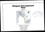
 - Niagara Escarpment Plan: County of Bruce, 1994 (Map 8)
 Map of a section of the Niagara Escarpment, encompassing the County of Bruce. This includes the Townships Albermarle, Amabel, and Eastnor, the town of Wiarton, and the Village of Lion's Head. Compiled as a part of a full proposed revision to the Niagara Escarpment Plan in 1994. Map information was …
  Map of a section of the Niagara Escarpment, encompassing the County of Bruce. This includes the Townships Albermarle, Amabel, and Eastnor, the town of Wiarton, and the Village of Lion's …Niagara-on-the-Lake Public Library
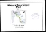
 - Niagara Escarpment Plan: County of Bruce, 1994 (Map 9)
 Map of a section of the Niagara Escarpment, encompassing the Bruce. This includes the Townships of Lindsay and St. Edmunds. Compiled as a part of a full proposed revision to the Niagara Escarpment Plan in 1994. Map information was supplied by the Department of Energy, Mines, and Resources c. 1989-1992. …
  Map of a section of the Niagara Escarpment, encompassing the Bruce. This includes the Townships of Lindsay and St. Edmunds. Compiled as a part of a full proposed revision to …Niagara-on-the-Lake Public Library
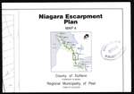
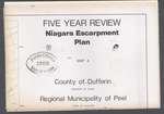
 - Niagara Escarpment Plan: County of Dufferin and Municipality of Peel, 1994 (Map 4)
 Map of a section of the Niagara Escarpment, encompassing the Regional Municipality of Peel and the County of Dufferin. This includes the town of Caledon and Township of Mono. Compiled as a part of a full proposed revision to the Niagara Escarpment Plan in 1994. Map information was supplied by …
  Map of a section of the Niagara Escarpment, encompassing the Regional Municipality of Peel and the County of Dufferin. This includes the town of Caledon and Township of Mono. Compiled …Niagara-on-the-Lake Public Library
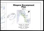
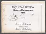
 - Niagara Escarpment Plan: County of Simcoe and County of Dufferin, 1994 (Map 5)
 Map of a section of the Niagara Escarpment, encompassing the Counties of Simcoe and Dufferin. This includes the Townships of Clearview and Mulmur. Compiled as a part of a full proposed revision to the Niagara Escarpment Plan in 1994. Map information was supplied by the Department of Energy, Mines, and …
  Map of a section of the Niagara Escarpment, encompassing the Counties of Simcoe and Dufferin. This includes the Townships of Clearview and Mulmur. Compiled as a part of a full …Niagara-on-the-Lake Public Library
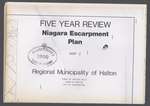
 - Niagara Escarpment Plan: Regional Municipality of Halton, 1991 (Map 3)
 Map of a section of the Niagara Escarpment, encompassing the Municipality of Halton. This includes Halton Hills, Milton, and Burlington. Compiled as a part of a full proposed revision to the Niagara Escarpment Plan in 1991. Map information was supplied by the Department of Energy, Mines, and Resources c. 1980. …
  Map of a section of the Niagara Escarpment, encompassing the Municipality of Halton. This includes Halton Hills, Milton, and Burlington. Compiled as a part of a full proposed revision to …Niagara-on-the-Lake Public Library
 - Niagara Escarpment Plan: County of Dufferin and Regional Municipality of Peel, 1991 (Map 4)
 Map of a section of the Niagara Escarpment, encompassing the County of Dufferin and Municipality of Peel. This includes the township of Mono and town of Caledon. Compiled as a part of a full proposed revision to the Niagara Escarpment Plan in 1991. Map information was supplied by the Department …
  Map of a section of the Niagara Escarpment, encompassing the County of Dufferin and Municipality of Peel. This includes the township of Mono and town of Caledon. Compiled as a …Niagara-on-the-Lake Public Library
 - Niagara Escarpment Plan: County of Dufferin and County of Simcoe, 1991 (Map 5)
 Map of a section of the Niagara Escarpment, encompassing the County of Dufferin and County of Simcoe. This includes Nottawasaga, Mulmur, and Melancthon. Compiled as a part of a full proposed revision to the Niagara Escarpment Plan in 1991. Map information was supplied by the Department of Energy, Mines, and …
  Map of a section of the Niagara Escarpment, encompassing the County of Dufferin and County of Simcoe. This includes Nottawasaga, Mulmur, and Melancthon. Compiled as a part of a full …Niagara-on-the-Lake Public Library
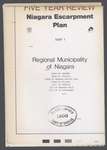
 - Niagara Escarpment Plan: Regional Municipality of Niagara, 1991 (Map 1)
 Map of a section of the Niagara Escarpment, encompassing the Municipality of Niagara. This includes Grimsby, Lincoln, Niagara-on-the-Lake, Pelham, Thorold, Niagara Falls, and St. Catharines. Compiled as a part of a full proposed revision to the Niagara Escarpment Plan in 1991. Map information was supplied by the Department of Energy, …
  Map of a section of the Niagara Escarpment, encompassing the Municipality of Niagara. This includes Grimsby, Lincoln, Niagara-on-the-Lake, Pelham, Thorold, Niagara Falls, and St. Catharines. Compiled as a part of …Niagara-on-the-Lake Public Library
 - Niagara Escarpment Plan: County of Grey, 1991 (Map 7)
 Map of a section of the Niagara Escarpment, encompassing part of the County of Grey. This includes Derby, Holland, Keppel, Sarawak, Sydenham, and Owen Sound. Compiled as a part of a full proposed revision to the Niagara Escarpment Plan in 1991. Map information was supplied by the Department of Energy, …
  Map of a section of the Niagara Escarpment, encompassing part of the County of Grey. This includes Derby, Holland, Keppel, Sarawak, Sydenham, and Owen Sound. Compiled as a part of …Niagara-on-the-Lake Public Library
 - Niagara Escarpment Plan: Regional Municipality of Niagara, 1994 (Map 1)
 Map of a section of the Niagara Escarpment, encompassing the Regional Municipality of Niagara. This includes Grimsby, Lincoln, Niagara Falls, Niagara-on-the-Lake, Pelham, St. Catharines, and Thorold. Compiled as a part of a full proposed revision to the Niagara Escarpment Plan in 1994. Map information was supplied by the Department of …
  Map of a section of the Niagara Escarpment, encompassing the Regional Municipality of Niagara. This includes Grimsby, Lincoln, Niagara Falls, Niagara-on-the-Lake, Pelham, St. Catharines, and Thorold. Compiled as a part …Niagara-on-the-Lake Public Library
 - Niagara Escarpment Plan: Regional Municipality of Hamilton-Wentworth, 1994 (Map 2)
 Map of a section of the Niagara Escarpment, encompassing the Regional Municipality of Hamilton-Wentworth. This includes Ancaster, Dundas, Flamborough, Hamilton, and Stoney Creek. Compiled as a part of a full proposed revision to the Niagara Escarpment Plan in 1994. Map information was supplied by the Department of Energy, Mines, and …
  Map of a section of the Niagara Escarpment, encompassing the Regional Municipality of Hamilton-Wentworth. This includes Ancaster, Dundas, Flamborough, Hamilton, and Stoney Creek. Compiled as a part of a full …Niagara-on-the-Lake Public Library
 - Niagara Escarpment Plan: Regional Municipality of Halton, 1994 (Map 3)
 Map of a section of the Niagara Escarpment, encompassing the Regional Municipality of Halton. This includes Burlington, Halton Hills, and Milton. Compiled as a part of a full proposed revision to the Niagara Escarpment Plan in 1994. Map information was supplied by the Department of Energy, Mines, and Resources c. …
  Map of a section of the Niagara Escarpment, encompassing the Regional Municipality of Halton. This includes Burlington, Halton Hills, and Milton. Compiled as a part of a full proposed revision …Niagara-on-the-Lake Public Library
Page 1 of 1

