Results
We found 26 matching items.


- Geraldton Gold Camp Historical Plaque
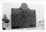
 Photo of the historic Gold Camp Plaque erected in Geraldton on the southwest corner of Main Street and Fourth Avenue South by the Archaeological and Historic Sites Board of Ontario.
  Photo of the historic Gold Camp Plaque erected in Geraldton on the southwest corner of Main Street and Fourth Avenue South by the Archaeological and Historic Sites Board of Ontario.Greenstone Public Library
 - Geraldton - Hardrock Mine
 View looking east down Mine Road to No.2 headframe and mill. Inscription reads 'Hard Rock Gold Mine Ltd'. At the extreme left of photo is the office and residence.
  View looking east down Mine Road to No.2 headframe and mill. Inscription reads 'Hard Rock Gold Mine Ltd'. At the extreme left of photo is the office and residence.Greenstone Public Library
 - Hardrock Mine - Porphyry Hill
 View looking west up Mine Rd. at No.2 headframe and mill. Inscription reads 'Hard Rock Gold Mine'. In 1936, the company began sinking No.2 shaft on the porphyry outcrop, and erected a mill in 1937. Hard Rock Mine became the gold camp's 3rd producer in 1938.
  View looking west up Mine Rd. at No.2 headframe and mill. Inscription reads 'Hard Rock Gold Mine'. In 1936, the company began sinking No.2 shaft on the porphyry outcrop, and …Greenstone Public Library
 - Geraldton - Gold Camp
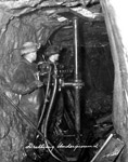
 Photo showing an underground drilling operation of a gold mine.
  Photo showing an underground drilling operation of a gold mine.Greenstone Public Library
 - Bankfield Mine
 A winter view of Bankfield Mine looking west. Note the water line running to the water tower serving both Bankfield and Tombill Mines. The Bankfield Gold Mines began shaft-sinking in 1934, and three years later poured its first gold bricks.
  A winter view of Bankfield Mine looking west. Note the water line running to the water tower serving both Bankfield and Tombill Mines. The Bankfield Gold Mines began shaft-sinking in …Greenstone Public Library
 - Man Holding a Gold Brick at the Mine
 ...
...  ...Greenstone Public Library
 - Magnet Mine
 View looking southeast from the old Bankfield Highway at Magnet Mine. Today, Highway 11 is beyond the buildings shown here. Inscription reads 'Magnet Consolidated Gold Mine.' Magnet Consolidated Gold Mines Ltd.(1936), began sinking a shaft that year,and in 1938, became the gold camp's 5th producer.
  View looking southeast from the old Bankfield Highway at Magnet Mine. Today, Highway 11 is beyond the buildings shown here. Inscription reads 'Magnet Consolidated Gold Mine.' Magnet Consolidated Gold Mines …Greenstone Public Library
 - Masonic Opening and Mines - Geraldton
 Black and white photo of mining operation near Geraldton, Ontario.
  Black and white photo of mining operation near Geraldton, Ontario.Greenstone Public Library
 - Group of Prospectors, One Man Holding Gold Brick


 Group of unidentified prospectors, one of them holding a gold brick.

 Group of unidentified prospectors, one of them holding a gold brick.Greenstone Public Library
 - Geraldton - Little Long Lac Mine
 View of Little Long Lac mining office. From left to right, T.H. Rea, George Rayner, Tony Oklend, Joseph Errington, J.H.C Waite, and two pilots, Boual and George. Rayner Construction had the contracts with Ontario Department of Northern Development to link local mines with roads. Tony Okeland was co-discoverer of Little …
  View of Little Long Lac mining office. From left to right, T.H. Rea, George Rayner, Tony Oklend, Joseph Errington, J.H.C Waite, and two pilots, Boual and George. Rayner Construction had …Greenstone Public Library
 - MacLeod Mine's First Brick (1938)
 Inscription reads 'Pouring of first Gold Brick at MacLeod Cockshutt Gold Mine, May 20th, 1938'.
  Inscription reads 'Pouring of first Gold Brick at MacLeod Cockshutt Gold Mine, May 20th, 1938'.Greenstone Public Library
 - Bankfield Mine - First Gold Brick (1937)
 Inscription reads 'First Gold Brick - Bankfield Consolidated Mine June 12, 1937'. The first brick weighed in at 601.19 ounces. The Bankfield Mine was one of the most modern mills in the gold mining industry for the time. The whole mill was entirely powered by electricity.
  Inscription reads 'First Gold Brick - Bankfield Consolidated Mine June 12, 1937'. The first brick weighed in at 601.19 ounces. The Bankfield Mine was one of the most modern mills …Greenstone Public Library
 - Hutchison Lake Mine Site (1936)
 Hutchinson Lake Gold Mines Ltd., incorporated in 1935, dug a series of trenches and test pits, but not until 1936 did the company begin it's shaft-sinking operation. The photo shows the site after the Geraldton fire in July, 1936.
  Hutchinson Lake Gold Mines Ltd., incorporated in 1935, dug a series of trenches and test pits, but not until 1936 did the company begin it's shaft-sinking operation. The photo shows …Greenstone Public Library
 - Tombill Mine (~1937)
 View looking west at Tombill mine. Note the water line to a short water tower in the foreground of the photo. Tombill Gold Mines was incorporated in 1935 and shaft-sinking began the following year. By 1938, Tombill mine became a producer, the sixth in the Geraldton district.
  View looking west at Tombill mine. Note the water line to a short water tower in the foreground of the photo. Tombill Gold Mines was incorporated in 1935 and shaft-sinking …Greenstone Public Library
 - Bankfield, Tombill and Jellicoe Mines (~1934)
 Aerial View looking west towards Wildgoose Lake. The inscription reads 'Air view of Bankfield Consolidated Mine, Tombill Mine, and Jellicoe Mine'. Highway 11 and Bankfield Mine are in the foreground. Beyond,on an elevation, is Tombill Mine, and in the distance is Jellicoe Mine. Jellicoe Consolidated Gold Mines Limited was incorporated …
  Aerial View looking west towards Wildgoose Lake. The inscription reads 'Air view of Bankfield Consolidated Mine, Tombill Mine, and Jellicoe Mine'. Highway 11 and Bankfield Mine are in the foreground. …Greenstone Public Library
 - Hardrock Mine - Discovery Point (1938)
 Aerial view looking north, along the shoreline of Kenogamisis Lake. Hard Rock Gold Mine was incorporated in 1934 and in 1935 the No.1 shaft was sunk on Discovery Point. Work ceased in 1937 in order to concentrate on the No.2 shaft on Porphyry Hill, farther west(not shown). Hardrock Townsite, seen …
  Aerial view looking north, along the shoreline of Kenogamisis Lake. Hard Rock Gold Mine was incorporated in 1934 and in 1935 the No.1 shaft was sunk on Discovery Point. Work …Greenstone Public Library
 - Elmos Mine - Barton Bay (~1938)
 Aerial view looking northeast. Inscription reads 'Elmos Mine'. The name of Elmos is a composite for Ellis and Mosher. In the centre is the headframe site on a tiny island, and to the left is a cluster of buildings. The two sites and the mainland are linked by a trestle. …
  Aerial view looking northeast. Inscription reads 'Elmos Mine'. The name of Elmos is a composite for Ellis and Mosher. In the centre is the headframe site on a tiny island, …Greenstone Public Library
 - Discovery Point - Geraldton Gold Camp (~1936)
 Aerial view looking west from Kenogamisis Lake. In the foreground is the No.1 headframe of Hardrock Mine. To the extreme right is Hardrock Townsite. In the centre is No.2 headframe of the Hardrock Mine on Porphyry Hill. Beyond this cluster is MacLeod Cockshutt Mine, and to the extreme upper right …
  Aerial view looking west from Kenogamisis Lake. In the foreground is the No.1 headframe of Hardrock Mine. To the extreme right is Hardrock Townsite. In the centre is No.2 headframe …Greenstone Public Library
 - MacLeod-Cockshutt Mine (1937)
 Aerial view looking northwest. Inscription reads 'MacLeod Cockshutt Gold Mine showing Hard Rock Gold mine in the foreground, December, 1937.' Upper portion shows the hills on which MacLeod Townsite is rising, and beyond it, the clearing for the Kenogamisis Golf Course. There is no sign of the future Highway 11 …
  Aerial view looking northwest. Inscription reads 'MacLeod Cockshutt Gold Mine showing Hard Rock Gold mine in the foreground, December, 1937.' Upper portion shows the hills on which MacLeod Townsite is …Greenstone Public Library
 - Little Long Lac Mine and Townsite (~1937)

 Aerial view looking northeast across Barton Bay. Inscription reads 'Little Long Lac Gold mine'. In the foreground is the clearing for Errington Avenue. It would later be called Arena Road and in 1939, it would become part of Highway 11. At the extreme left is the townsite of Little Long …
 Aerial view looking northeast across Barton Bay. Inscription reads 'Little Long Lac Gold mine'. In the foreground is the clearing for Errington Avenue. It would later be called Arena Road …Greenstone Public Library


