Results


Page 1 of 1
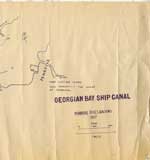
- Georgian Bay Ship Canal Map: Pembroke to Des Joachims
 Line map of the canal system drawn in bluish coloured ink, outlines routes along the Ottawa River between Pembroke and the rapids at Des Joachims. The left-hand side of the map has very prominent ink blotches and finger prints made from the same colour of ink as the map itself. …
  Line map of the canal system drawn in bluish coloured ink, outlines routes along the Ottawa River between Pembroke and the rapids at Des Joachims. The left-hand side of the …Petawawa Public Library
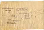
 - Georgian Bay Ship Canal Map: Des Joachims to Pembroke
 "Traced by members of Deep River Y.C. from photographic copy of original Dept. of Public Works chart. Supplemented from 1" Survey Maps and from personal experience."
  "Traced by members of Deep River Y.C. from photographic copy of original Dept. of Public Works chart. Supplemented from 1" Survey Maps and from personal experience."Petawawa Public Library
Page 1 of 1


