Results
We found 413 matching items.


- Maps, Reports, Estimates, &c., Relative to Improvements of the Navigation of the River St. Lawrence; and a Proposed Canal Connecting the River St. Lawrence and Lake Champlain


 Report on studies of possible canals between the Saint Lawrence and Richelieu Rivers and of the rapids of the Saint Lawrence River between Prescott and Montreal produced for the Department of Public Works in 1856, from fieldwork done between 1853 and 1856.

 Report on studies of possible canals between the Saint Lawrence and Richelieu Rivers and of the rapids of the Saint Lawrence River between Prescott and Montreal produced for the Department …Maritime History of the Great Lakes
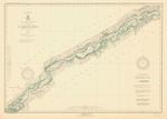
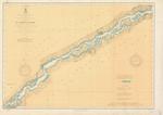
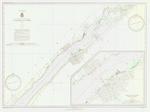
 - St. Lawrence River, 1937
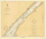
 Bradford Point to St. Regis; includes Massena, Cornwall and the Cornwall Canal
  Bradford Point to St. Regis; includes Massena, Cornwall and the Cornwall CanalMaritime History of the Great Lakes
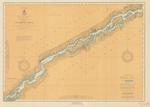
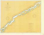
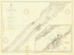
 - St. Lawrence River, 1921
 Bradford Point to St. Regis; includes Massena, Cornwall and the Cornwall Canal
  Bradford Point to St. Regis; includes Massena, Cornwall and the Cornwall CanalMaritime History of the Great Lakes
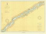
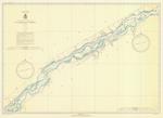
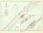
 - St. Lawrence River, 1911
 Bradford Point to St. Regis; includes Massena, Cornwall and the Cornwall Canal
  Bradford Point to St. Regis; includes Massena, Cornwall and the Cornwall CanalMaritime History of the Great Lakes
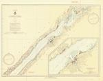
 - St. Lawrence River, 1935
 Bradford Point to St. Regis; includes Massena, Cornwall and the Cornwall Canal
  Bradford Point to St. Regis; includes Massena, Cornwall and the Cornwall CanalMaritime History of the Great Lakes
 - St. Lawrence River, 1926
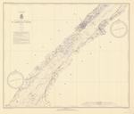
 Cardinal to Goose Neck island to Bradford Point; including Cardinal, Iroquois, Waddington and Morrisburg
  Cardinal to Goose Neck island to Bradford Point; including Cardinal, Iroquois, Waddington and MorrisburgMaritime History of the Great Lakes
 - St. Lawrence River, 1915
 Cardinal to Goose Neck island to Bradford Point; including Cardinal, Iroquois, Waddington and Morrisburg
  Cardinal to Goose Neck island to Bradford Point; including Cardinal, Iroquois, Waddington and MorrisburgMaritime History of the Great Lakes
 - St. Lawrence River, 1921
 Cardinal to Goose Neck island to Bradford Point; including Cardinal, Iroquois, Waddington and Morrisburg
  Cardinal to Goose Neck island to Bradford Point; including Cardinal, Iroquois, Waddington and MorrisburgMaritime History of the Great Lakes
 - St. Lawrence River, 1910
 Cardinal to Goose Neck island to Bradford Point; including Cardinal, Iroquois, Waddington and Morrisburg
  Cardinal to Goose Neck island to Bradford Point; including Cardinal, Iroquois, Waddington and MorrisburgMaritime History of the Great Lakes
 - St. Lawrence River, 1905
 Cardinal to Goose Neck island to Bradford Point; including Cardinal, Iroquois, Waddington and Morrisburg
  Cardinal to Goose Neck island to Bradford Point; including Cardinal, Iroquois, Waddington and MorrisburgMaritime History of the Great Lakes
 - St. Lawrence River, 1937
 Cardinal to Goose Neck island to Bradford Point; including Cardinal, Iroquois, Waddington and Morrisburg
  Cardinal to Goose Neck island to Bradford Point; including Cardinal, Iroquois, Waddington and MorrisburgMaritime History of the Great Lakes
 - St. Lawrence River, 1916
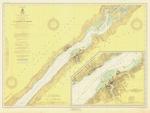
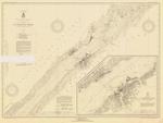
 Maitland to Galops; inset of Ogsendburg and Prescott
  Maitland to Galops; inset of Ogsendburg and PrescottMaritime History of the Great Lakes
 - St. Lawrence River, 1937
 Maitland to Galops; inset of Ogsendburg and Prescott
  Maitland to Galops; inset of Ogsendburg and PrescottMaritime History of the Great Lakes
 - St. Lawrence River, 1913
 Maitland to Galops; inset of Ogsendburg and Prescott
  Maitland to Galops; inset of Ogsendburg and PrescottMaritime History of the Great Lakes
 - St. Lawrence River, 1933
 Maitland to Galops; inset of Ogsendburg and Prescott
  Maitland to Galops; inset of Ogsendburg and PrescottMaritime History of the Great Lakes
 - St. Lawrence River, 1935
 Maitland to Galops; inset of Ogsendburg and Prescott
  Maitland to Galops; inset of Ogsendburg and PrescottMaritime History of the Great Lakes
 - St. Lawrence River, 1930
 Maitland to Galops; inset of Ogsendburg and Prescott
  Maitland to Galops; inset of Ogsendburg and PrescottMaritime History of the Great Lakes
 - St. Lawrence River, 1917
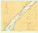
 Chippewa Point to Brooks Point; Includes Brockville and Morristown
  Chippewa Point to Brooks Point; Includes Brockville and MorristownMaritime History of the Great Lakes
 - St. Lawrence River, 1935
 Chippewa Point to Brooks Point; Includes Brockville and Morristown
  Chippewa Point to Brooks Point; Includes Brockville and MorristownMaritime History of the Great Lakes
 - St. Lawrence River, 1912
 Chippewa Point to Brooks Point; Includes Brockville and Morristown
  Chippewa Point to Brooks Point; Includes Brockville and MorristownMaritime History of the Great Lakes

