Results
We found 52 matching items.


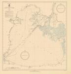
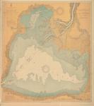
- Lake St. Clair, 1936

 Maritime History of the Great Lakes
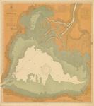
 - Lake St. Clair, 1903

 Maritime History of the Great Lakes
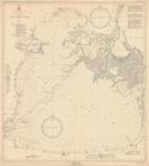
 - Lake St. Clair, 1933

 Maritime History of the Great Lakes
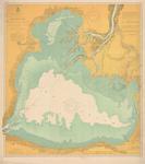
 - Lake St. Clair, 1906

 Maritime History of the Great Lakes
 - Lake St. Clair, 1908

 Maritime History of the Great Lakes
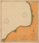
 - Lake Ontario, 1920

 Maritime History of the Great Lakes
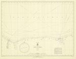
 - Lake Ontario, 1935
 Charlotte to Sodus Bay
  Charlotte to Sodus BayMaritime History of the Great Lakes
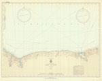
 - Lake Ontario, 1935
 Charlotte to Sodus Bay
  Charlotte to Sodus BayMaritime History of the Great Lakes
 - Lake Ontario Coast Chart No. 2. Stony Point to Little Sodus Bay. 1902
 Survey of the south eastern shores of Lake Ontario from Little Sodus Bay, Oswego, Texas, Port Ontario to Stony Point Lighthouse
  Survey of the south eastern shores of Lake Ontario from Little Sodus Bay, Oswego, Texas, Port Ontario to Stony Point LighthouseMaritime History of the Great Lakes
 - Lake Ontario Coast Chart No. 2. Stony Point to Little Sodus Bay. 1908
 Survey of the south eastern shores of Lake Ontario from Little Sodus Bay, Fair Haven, Oswego, Texas, Port Ontario to Stony Point Lighthouse. Major inset with Oswego Harbor.
  Survey of the south eastern shores of Lake Ontario from Little Sodus Bay, Fair Haven, Oswego, Texas, Port Ontario to Stony Point Lighthouse. Major inset with Oswego Harbor.Maritime History of the Great Lakes
 - Lake Ontario Coast Chart No. 2. Stony Point to Little Sodus Bay. 1912
 Survey of the south eastern shores of Lake Ontario from Little Sodus Bay, Fair Haven, Oswego, Texas, Port Ontario to Stony Point Lighthouse. Major inset with Oswego Harbor.
  Survey of the south eastern shores of Lake Ontario from Little Sodus Bay, Fair Haven, Oswego, Texas, Port Ontario to Stony Point Lighthouse. Major inset with Oswego Harbor.Maritime History of the Great Lakes
 - Lake Ontario Coast Chart No. 2. Stony Point to Little Sodus Bay. 1917
 Survey of the south eastern shores of Lake Ontario from Little Sodus Bay, Fair Haven, Oswego, Texas, Port Ontario to Stony Point Lighthouse. Major inset with Oswego Harbor.
  Survey of the south eastern shores of Lake Ontario from Little Sodus Bay, Fair Haven, Oswego, Texas, Port Ontario to Stony Point Lighthouse. Major inset with Oswego Harbor.Maritime History of the Great Lakes
 - Lake Ontario Coast Chart No. 2. Stony Point to Little Sodus Bay. 1922
 Survey of the south eastern shores of Lake Ontario from Little Sodus Bay, Fair Haven, Oswego, Texas, Port Ontario to Stony Point Lighthouse. Major inset with Oswego Harbor.
  Survey of the south eastern shores of Lake Ontario from Little Sodus Bay, Fair Haven, Oswego, Texas, Port Ontario to Stony Point Lighthouse. Major inset with Oswego Harbor.Maritime History of the Great Lakes
 - Lake Ontario Coast Chart No. 2. Stony Point to Little Sodus Bay. 1926
 Survey of the south eastern shores of Lake Ontario from Little Sodus Bay, Fair Haven, Oswego, Texas, Port Ontario to Stony Point Lighthouse. Major inset with Oswego Harbor.
  Survey of the south eastern shores of Lake Ontario from Little Sodus Bay, Fair Haven, Oswego, Texas, Port Ontario to Stony Point Lighthouse. Major inset with Oswego Harbor.Maritime History of the Great Lakes
 - Lake Ontario Coast Chart No. 2. 1935
 Survey of the south eastern shores of Lake Ontario from Port Bay, to Little Sodus Bay, Fair Haven, Oswego, Texas, Port Ontario to North Big Sandy Pond.
  Survey of the south eastern shores of Lake Ontario from Port Bay, to Little Sodus Bay, Fair Haven, Oswego, Texas, Port Ontario to North Big Sandy Pond.Maritime History of the Great Lakes
 - Lake Ontario Coast Chart No. 2. 1937
 Survey of the south eastern shores of Lake Ontario from Port Bay, to Little Sodus Bay, Fair Haven, Oswego, Texas, Port Ontario to North Big Sandy Pond.
  Survey of the south eastern shores of Lake Ontario from Port Bay, to Little Sodus Bay, Fair Haven, Oswego, Texas, Port Ontario to North Big Sandy Pond.Maritime History of the Great Lakes
 - Lake Ontario, South of Stony Point to Little Sodus Bay, N.Y., Coast Chart No. 22. 1940
 Survey of the south eastern shores of Lake Ontario from Port Bay, to Little Sodus Bay, Fair Haven, Oswego, Texas, Port Ontario to North Big Sandy Pond.
  Survey of the south eastern shores of Lake Ontario from Port Bay, to Little Sodus Bay, Fair Haven, Oswego, Texas, Port Ontario to North Big Sandy Pond.Maritime History of the Great Lakes
 - Lake Ontario, 1904
 US Hydrographic chart of Lake Ontario
  US Hydrographic chart of Lake OntarioMaritime History of the Great Lakes
 - Lake Ontario, 1901
 US Hydrographic chart of Lake Ontario
  US Hydrographic chart of Lake OntarioMaritime History of the Great Lakes
 - Lake Ontario, 1907
 US Hydrographic chart of Lake Ontario
  US Hydrographic chart of Lake OntarioMaritime History of the Great Lakes

