Results
We found 4 matching items.


Page 1 of 1
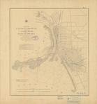
- Buffalo Harbor and Head of Niagara River, 1856

 Maritime History of the Great Lakes
 - Buffalo Harbour and Head of Niagara River [1897]
 North America Lake Erie Buffalo Harbour and Head of Niagara River From the latest United States Government Chart. London. Published at the Admiralty, 28th Feb. 1897, under the Superintendence of Rear Admiral W. J. L. Wharton C. B. F. R. S. Hydrographer. Sold by J. D. Potter, Agent for ...
  North America Lake Erie Buffalo Harbour and Head of Niagara River From the latest United States Government Chart. London. Published at the Admiralty, 28th Feb. 1897, under the Superintendence of …Maritime History of the Great Lakes
 - Survey of the River Niagara [1817, 1863]
 Survey of the River Niagara. Made under the direction of Capt'n W'm Fitz W'm. Owen, in the Year 1817 The enlarged Plan of the Entrance, & that on the smaller Scale distinguished by upright Soundings, is from the United States Survey corrected to 1856. The Soundings are laid down in …
  Survey of the River Niagara. Made under the direction of Capt'n W'm Fitz W'm. Owen, in the Year 1817 The enlarged Plan of the Entrance, & that on the smaller …Maritime History of the Great Lakes
 - River Niagara and Welland Canal [1897]
 North America Lakes Ontario and Erie River Niagara and Welland Canal From the latest United States Government Charts Welland Canal from the latest Canadian Government Surveys All heights are expressed in feet above High Water. Magnetic Variation in 1900; increasing about 4' ...
  North America Lakes Ontario and Erie River Niagara and Welland Canal From the latest United States Government Charts Welland Canal from the latest Canadian Government Surveys All heights are expressed …Maritime History of the Great Lakes
Page 1 of 1


![Buffalo Harbour and Head of Niagara River [1897] Buffalo Harbour and Head of Niagara River [1897]](https://images.MaritimeHistoryoftheGreatLakes.ca/images/MHGL000122632t.jpg)
![Survey of the River Niagara [1817, 1863] Survey of the River Niagara [1817, 1863]](https://images.MaritimeHistoryoftheGreatLakes.ca/images/MHGL000122603t.jpg)
![River Niagara and Welland Canal [1897] River Niagara and Welland Canal [1897]](https://images.MaritimeHistoryoftheGreatLakes.ca/images/MHGL000122633t.jpg)
