Results
We found 5225 matching items.


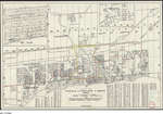
- 1958 Map Oakville Trafalgar Bronte Area

 We were trying to ascertain where R.R. 1 Bronte was, what roads/streets it covered in the 1950's. Unfortunately this map doesn't have that information but it is as close as the Canada Post Archives can provide. In April 2020, we have added a 1918 Post Office "mail contract" asking for …
 We were trying to ascertain where R.R. 1 Bronte was, what roads/streets it covered in the 1950's. Unfortunately this map doesn't have that information but it is as close as …Trafalgar Township Historical Society
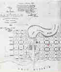
 - Map of Oakville 1837
 The Drawing has been prepared from information gathered from a copy of the first registered plan of Oakville, by Deputy Provincial Surveyor, Robert W. Kerr in 1836, under the direction of Col. William Chisholm, the founder of Oakville. The Plan was registered January 12th 1850. James Madill, Oakville, 1973
  The Drawing has been prepared from information gathered from a copy of the first registered plan of Oakville, by Deputy Provincial Surveyor, Robert W. Kerr in 1836, under the direction …Oakville Public Library
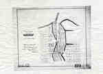
 - Plan of Oakville 1876
 This map shows the division of land in Oakville surrounding the Sixteen Mile Creek. It was verified by the Department of Crown Lands the same year it was created.
  This map shows the division of land in Oakville surrounding the Sixteen Mile Creek. It was verified by the Department of Crown Lands the same year it was created.Oakville Public Library
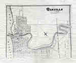
 - Map of Oakville 1877

 This map was compiled using original registered surveys from J.H. Pope.
 This map was compiled using original registered surveys from J.H. Pope.Oakville Public Library
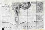
 - Plan of Oakville, Township of Trafalgar, Upper Canada, 1835
 A map from 1835 showing the town of Oakville from Brock Street to Allan Street, including the Sixteen Mile Creek. This map features the church, market square, wharf and an intended damn site north of the Colborne Street bridge.
  A map from 1835 showing the town of Oakville from Brock Street to Allan Street, including the Sixteen Mile Creek. This map features the church, market square, wharf and an …Oakville Public Library
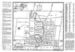
 - Oakville Town Map, 1948

 This map was sent to Mr. Stuart Wark and has been kept in the original envelope. To see the envelope, either click on the map image or open up "Page 2".
 This map was sent to Mr. Stuart Wark and has been kept in the original envelope. To see the envelope, either click on the map image or open up "Page …Trafalgar Township Historical Society
 - A map of the land purchased from the Mississaugas in 1806
 A map of the land purchased from the Mississaugas in 1806
  A map of the land purchased from the Mississaugas in 1806Oakville Public Library
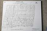
 - 1806 Trafalgar Township Map


 This copy of the Wilmot survey map of Trafalgar Township was photographed from a wonderful display copy. It looks like Mr. Wilmot signed his name, "Sam L. Wilmot", but it is actually "Sam S. Wilmot".

 This copy of the Wilmot survey map of Trafalgar Township was photographed from a wonderful display copy. It looks like Mr. Wilmot signed his name, "Sam L. Wilmot", but it …Trafalgar Township Historical Society
 - View From Radial Bridge Postcard
 Postcard showing the view eastward from the Radial Bridge (Now the Rebecca Street Bridge). Similar to today's view, many boats can be seen.
  Postcard showing the view eastward from the Radial Bridge (Now the Rebecca Street Bridge). Similar to today's view, many boats can be seen.Oakville Public Library
 - Water Sports, West Pier, Oakville
 Postcard featuring a black and white photograph of some people on a pier and out on the lake.
  Postcard featuring a black and white photograph of some people on a pier and out on the lake.Oakville Public Library
 - Rosebank, Oakville

 For further information about the house, click on the link to the undated Town of Oakville Heritage Assessment Report for the property. This is underneath the photograph, under "Other Web Sites". The ownership and history of the house starts on page 48 of the report internet/pdf version, or 119 of …
 For further information about the house, click on the link to the undated Town of Oakville Heritage Assessment Report for the property. This is underneath the photograph, under "Other Web …Trafalgar Township Historical Society
 - The Old Mill ruins
 Mill ruins on the Sixteen Mile Creek near Cross Avenue in Oakville.
  Mill ruins on the Sixteen Mile Creek near Cross Avenue in Oakville.Trafalgar Township Historical Society
 - Public Skating Rink and Dance Hall (Victoria Hall) Oakville

 Further information about Victoria Park, the Hall and rink can be found in the books: Oakville and the Sixteen, and, Oakville; A Small Town 1900-1930 by Frances Robin Ahern.
 Further information about Victoria Park, the Hall and rink can be found in the books: Oakville and the Sixteen, and, Oakville; A Small Town 1900-1930 by Frances Robin Ahern.Trafalgar Township Historical Society
 - Dominion Day Regatta
 Canoeing and games on sixteen Mile Creek in Oakville for Dominion Day.
  Canoeing and games on sixteen Mile Creek in Oakville for Dominion Day.Trafalgar Township Historical Society
 - Harbour Scene, Oakville Ontario
 This image of the Oakville Harbour likely shows the old bridge across Lakeshore Rd. (Originally Colborne St.), however this is not confirmed.
  This image of the Oakville Harbour likely shows the old bridge across Lakeshore Rd. (Originally Colborne St.), however this is not confirmed.Trafalgar Township Historical Society
 - Grand Trunk Railway Bridge

 Because this clearly shows the bridge having 4 supports, it is likely the bridge over the Sixteen between Cornwall Road to the south and Cross Avenue on the north, just west of Trafalgar Road.
 Because this clearly shows the bridge having 4 supports, it is likely the bridge over the Sixteen between Cornwall Road to the south and Cross Avenue on the north, just …Trafalgar Township Historical Society
 - Grank Trunk Depot
 A postcard depicting the Grank Trunk Depot in Oakville.
  A postcard depicting the Grank Trunk Depot in Oakville.Trafalgar Township Historical Society
 - Hog's Back
 Hog's Back, Oakville, Ont....
  Hog's Back, Oakville, Ont....Trafalgar Township Historical Society
 - Postcard: Radial Bridge and Public School, Oakville, Ont., Canada
 The postcard spelling of "Radical" was corrected and a later printing of the postcard with the correct spelling, "Radial" is also uploaded to this database.
  The postcard spelling of "Radical" was corrected and a later printing of the postcard with the correct spelling, "Radial" is also uploaded to this database.Trafalgar Township Historical Society
 - The Radial Bridge, Oakville, Ontario
 A postcard illustrating the Radial Bridge in Oakville. The Hamilton Radial Railway operated between Hamilton and Oakville and the tracks ran along what is now Rebecca Street. The Anderson Bridge replaced the Radial bridge in the early 1960s. The headquarters building on Randall Street still stands today.
  A postcard illustrating the Radial Bridge in Oakville. The Hamilton Radial Railway operated between Hamilton and Oakville and the tracks ran along what is now Rebecca Street. The Anderson Bridge …Trafalgar Township Historical Society

