Results
We found 736 matching items.


- Mother and child, Castleton, ca.1890
 Placed in decorative cardboard mount. Hand tinting added to the faces in the portrait. The archives does not hold this photograph in its collections, but has a high quality image.
  Placed in decorative cardboard mount. Hand tinting added to the faces in the portrait. The archives does not hold this photograph in its collections, but has a high quality image.Cramahe Township Public Library
 - Sarah Ella Scott
 Cramahe Archives does not hold the original item in its archives, but has a high quality digital image. The tintype has some damage to its surface. See the publication - How Firm a Foundation: A History of the Township of Cramahe and the Village of Colborne in Cramahe's Digital Archives …
  Cramahe Archives does not hold the original item in its archives, but has a high quality digital image. The tintype has some damage to its surface. See the publication - …Cramahe Township Public Library
 - Young woman
 Cramahe Archives does not hold the original item in its archives, but has a digital image. Tintype originally from the collection of Enid Rogers. See the publication - How Firm a Foundation: A History of the Township of Cramahe and the Village of Colborne in Cramahe's Digital Archives (3bk), pp.48-49 …
  Cramahe Archives does not hold the original item in its archives, but has a digital image. Tintype originally from the collection of Enid Rogers. See the publication - How Firm …Cramahe Township Public Library
 - Studio portrait of a man
 Hand tinted red applied to portrait. Damaged.
  Hand tinted red applied to portrait. Damaged.Cramahe Township Public Library
 - Studio portrait of a couple
 Hand tinted red applied to portrait. Badly damaged.
  Hand tinted red applied to portrait. Badly damaged.Cramahe Township Public Library
 - Studio portrait of a young woman
 Cramahe Archives does not hold the original item in its archives, but has a digital image. Tintype originally from the collection of Enid Rogers. See the publication - How Firm a Foundation: A History of the Township of Cramahe and the Village of Colborne in Cramahe's Digital Archives (3bk), pp.48-49 …
  Cramahe Archives does not hold the original item in its archives, but has a digital image. Tintype originally from the collection of Enid Rogers. See the publication - How Firm …Cramahe Township Public Library
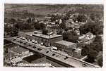
 - Photo postcard aerial view of King Street East, Colborne Women's Institute Scrapbook

 Written on WI scrapbook page 47 (which features four images): "Colborne Then and Now" "Pictures contributed by Mrs. Maude Kirk and Charles Brown." Click on the Select arrow for Pages to see a downloaded digital image of postcard image which has a larger file size. The Pages box is located …
 Written on WI scrapbook page 47 (which features four images): "Colborne Then and Now" "Pictures contributed by Mrs. Maude Kirk and Charles Brown." Click on the Select arrow for Pages …Cramahe Township Public Library
 - Hand drawn map of acreage and boundary line between Haldimand and Cramahe, 1903

 Hand drawn map outlining acreage owned by several families.
 Hand drawn map outlining acreage owned by several families.Cramahe Township Public Library
 - Township of Cramahe in the County of Northumberland, Province of Ontario, Office of Public Roads and Highways, 1915.
 Downloaded from Library and Archives Canada. MIKAN no. 4135090 1 map : Blueline Print ; 83.0 x 51.4. See 11mp – 1957 pipeline map - which used the 1915 map as a source.
  Downloaded from Library and Archives Canada. MIKAN no. 4135090 1 map : Blueline Print ; 83.0 x 51.4. See 11mp – 1957 pipeline map - which used the 1915 map …Cramahe Township Public Library
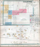
 - Insurance Plan (Goad Map) of the Town of Colborne, 1934 by Underwriters' Survey Bureau
 Highly detailed street level map with building / owner identified information. Use the drop down box at the top left of the screen to access the desired page. Click on the image to use the zoomify feature and see the details of the map. Keep clicking on the map to …
  Highly detailed street level map with building / owner identified information. Use the drop down box at the top left of the screen to access the desired page. Click on …Cramahe Township Public Library
 - Transfer Plan of part of a Highway (Route No.2) in the Village of Colborne, 4 September 1959

 Village of Colborne, Concessions 1 & 2; Lot 31 & Lots 26-31 - Registered plan of village of Colborne - 1 inch=200 feet. Also includes an identification plan of the Township of Cramahe - Scale: 1 inch=i mile
 Village of Colborne, Concessions 1 & 2; Lot 31 & Lots 26-31 - Registered plan of village of Colborne - 1 inch=200 feet. Also includes an identification plan of the …Cramahe Township Public Library
 - Transfer Plan of part of a Highway (Route No.2) in the Village of Colborne, 26 August 1959

 Village of Colborne, Concession 2 Lot 31 & Lot 32 - Registered plan of village of Colborne - 1 inch=200 feet. Also includes an identification plan of the Township of Cramahe - Scale: 1 inch=1 mile
 Village of Colborne, Concession 2 Lot 31 & Lot 32 - Registered plan of village of Colborne - 1 inch=200 feet. Also includes an identification plan of the Township of …Cramahe Township Public Library
 - Land Plan of part of Lot 27, Conc.1 & 2 and part of Lots 210 and 211, 2 February 1955

 Land Plan of part of Lot 27, Conc.1 & 2 and part of Lots 210 and 211, Plan of village of Colborne
 Land Plan of part of Lot 27, Conc.1 & 2 and part of Lots 210 and 211, Plan of village of ColborneCramahe Township Public Library
 - Plan to illustrate description of part of Lot 180 Registered Plan of the Village of Colborne, March 1952

 Land Plan of part of Lot 30, Conc. 2, Plan of village of Colborne, the Director, the Veterans' Land Act
 Land Plan of part of Lot 30, Conc. 2, Plan of village of Colborne, the Director, the Veterans' Land ActCramahe Township Public Library
 - Lakeport, ON. 1:25,000. Map sheet 030N13E,F, [ed. 1], 1969
 Cramahe Archives does not hold the original item in its archives, but has a digital image.
  Cramahe Archives does not hold the original item in its archives, but has a digital image.Cramahe Township Public Library
 - Castleton, ON. 1:25,000. Map sheet 031C04D, [ed. 1], 1970
 Cramahe Archives does not hold the original item in its archives, but has a digital image.
  Cramahe Archives does not hold the original item in its archives, but has a digital image.Cramahe Township Public Library
 - Cramahe Township map detail, A Map of Upper and Lower Canada, or, British North America with the Adjacent States, 1842
 Cramahe Archives does not hold the original item in its archives, but has a digital image.
  Cramahe Archives does not hold the original item in its archives, but has a digital image.Cramahe Township Public Library
 - Cramahe Township map detail, Smith's Canadian gazetteer: comprising statistical and general information respecting all parts of the Upper Province, or Canada West, 1846

 (There appears to be little difference in content between the 1846 edition and 1849 edition of this publication - except the available online 1849 copy did not have a map). Cramahe Archives does not hold the original item in its archives, but has a digital image.
 (There appears to be little difference in content between the 1846 edition and 1849 edition of this publication - except the available online 1849 copy did not have a map). …Cramahe Township Public Library
 - Map of the North Shore of Lake Ontario, the Trent River, and Rice Lake, 1792

 Catalogued by Toronto Public Library Digital Archive and downloaded from their site. See external link to the right of this record to access the original source of this map. Map of the North Shore of Lake Ontario, the Trent River, and Rice Lake Collins, John, d.1795 Map, 1792, English Notes …
 Catalogued by Toronto Public Library Digital Archive and downloaded from their site. See external link to the right of this record to access the original source of this map. Map …Cramahe Township Public Library
 - Cramahe Township map detail, A map of the province of Upper Canada describing all the settlements and townships &c. with the countries adjacent from Quebec to Lake Huron, 1818

 A screenshot of this map was taken to illustrate Cramahe Township.
 A screenshot of this map was taken to illustrate Cramahe Township.Cramahe Township Public Library






![Lakeport, ON. 1:25,000. Map sheet 030N13E,F, [ed. 1], 1969 Lakeport, ON. 1:25,000. Map sheet 030N13E,F, [ed. 1], 1969](https://images.ourontario.ca/Partners/CTPL/CTPL003699385t.jpg)
![Castleton, ON. 1:25,000. Map sheet 031C04D, [ed. 1], 1970 Castleton, ON. 1:25,000. Map sheet 031C04D, [ed. 1], 1970](https://images.ourontario.ca/Partners/CTPL/CTPL003699404t.jpg)


