Results
We found 8379 matching items.


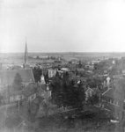
- Panoramic Photograph of Whitby Part II, 1906
 This is the centre image of a three-part panoramic photograph.
  This is the centre image of a three-part panoramic photograph.Whitby Public Library
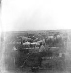
 - Panoramic Photograph of Whitby Part I, 1906
 This is the first of a three-part panoramic photograph of Whitby.
  This is the first of a three-part panoramic photograph of Whitby.Whitby Public Library
 - Brooklin Public School Panorama, 1928
 Brooklin Public School was built in 1923. The school was closed in the 1970s and the building was demolished in 1982.
  Brooklin Public School was built in 1923. The school was closed in the 1970s and the building was demolished in 1982.Whitby Public Library
 - Whitby Collegiate Institute Student Photograph, 1922
 The Whitby Collegiate Institute was built in 1873 and was located on the south side of Colborne Street between King and Centre Streets. The school was demolished in 1975-1976.
  The Whitby Collegiate Institute was built in 1873 and was located on the south side of Colborne Street between King and Centre Streets. The school was demolished in 1975-1976.Whitby Public Library
 - Whitby Collegiate Institute Student Photograph, 1922
 The Whitby Collegiate Institute was built in 1873 and was located on the south side of Colborne Street between King and Centre Streets. The school was demolished in 1975-1976.
  The Whitby Collegiate Institute was built in 1873 and was located on the south side of Colborne Street between King and Centre Streets. The school was demolished in 1975-1976.Whitby Public Library
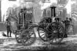
 - Merryweather Steam Fire Engine at Montreal, 1873
 William Notman, Canadian Illustrated News, 1872 The Merryweather Steam Fire Engine, manufactured in England, served the Town of Whitby from November 1872 to 1926 when it was replaced by two motorized fire trucks. The engine saved downtown Oshawa from destruction by fire on the night of December 8, 1872. In 1934 the Town of Whitby gave …
  William Notman, Canadian Illustrated News, 1872 The Merryweather Steam Fire Engine, manufactured in England, served the Town of Whitby from November 1872 to 1926 when it was replaced by two motorized fire trucks. The engine saved …Whitby Public Library
 - Spruce Villa Hotel Aerial View, c.1955

 This farmhouse was originally constructed in 1872 at 734 Dundas Street West. It was owned by a farmer called William Clendenan (1826-1906). Around 1918, this property was purchased by Mrs. W.H. Weddell and she turned the house into one of the first bread and breakfasts in Whitby. She renamed the …
 This farmhouse was originally constructed in 1872 at 734 Dundas Street West. It was owned by a farmer called William Clendenan (1826-1906). Around 1918, this property was purchased by Mrs. …Whitby Public Library
 - Looking North from Ontario Street, 1963
 Black and white negative of an aerial view of Whitby looking north from Ontario Street. The Whitby Community Arena is visible at centre. This image was used for a postcard.
  Black and white negative of an aerial view of Whitby looking north from Ontario Street. The Whitby Community Arena is visible at centre. This image was used for a postcard.Whitby Public Library
 - Whitby Yacht Club Aerial View, 1970
 Black and white negative showing an aerial view of the Whitby Yacht Club. View looking south-west from Whitby Harbour. The Whitby Psychiatric Hospital is visible in the background. This image was used for a postcard.
  Black and white negative showing an aerial view of the Whitby Yacht Club. View looking south-west from Whitby Harbour. The Whitby Psychiatric Hospital is visible in the background. This image …Whitby Public Library
 - Picnic at Corbett's Point 1913

 Corbett's Point is located on the shore of Lake Ontario east of Thickson Road. This view is looking east.In 1948 Corbett's Point was renamed Thickson Point.
 Corbett's Point is located on the shore of Lake Ontario east of Thickson Road. This view is looking east.In 1948 Corbett's Point was renamed Thickson Point.Whitby Public Library
 - Mildmay Camp

 Mildmay Camp was located on the shore of Lake Ontario, east of the Cranberry Marsh in Whitby Township. It was an Anglican Church camp which was operated from around 1927 to 1953 by the Mildmay Institute of Toronto.
 Mildmay Camp was located on the shore of Lake Ontario, east of the Cranberry Marsh in Whitby Township. It was an Anglican Church camp which was operated from around 1927 …Whitby Public Library
 - Employee Picnic at Corbett's Point 1919

 Corbett's Point is located on the shore of Lake Ontario, east of Thickson Road.
 Corbett's Point is located on the shore of Lake Ontario, east of Thickson Road.Whitby Public Library
 - Rest Hour at Mildmay Camp

 Mildmay Camp was located on the shore of Lake Ontario, east of the Cranberry Marsh in Whitby Township. It was an Anglican Church camp which was operated from around 1927 to 1953 by the Mildmay Institute of Toronto.
 Mildmay Camp was located on the shore of Lake Ontario, east of the Cranberry Marsh in Whitby Township. It was an Anglican Church camp which was operated from around 1927 …Whitby Public Library
 - Mildmay Camp c.1943

 Mildmay Camp was located on the shore of Lake Ontario, east of the Cranberry Marsh in Whitby Township. It was an Anglican Church camp which was operated from around 1927 to 1953 by the Mildmay Institute of Toronto.
 Mildmay Camp was located on the shore of Lake Ontario, east of the Cranberry Marsh in Whitby Township. It was an Anglican Church camp which was operated from around 1927 …Whitby Public Library
 - Byron Street, c.1918
 Black and white negative of a photograph of a postcard showing Byron Street looking south from John Street. The Patterson home, on the south-west corner of Byron and John Streets, is visible at right. Byron Street is at left.
  Black and white negative of a photograph of a postcard showing Byron Street looking south from John Street. The Patterson home, on the south-west corner of Byron and John Streets, …Whitby Public Library
 - Centre Street, 1906
 Black and white negative of a photograph of a postcard showing Centre Street looking north from Dunlop Street. In the background is the steeple of All Saints' Anglican Church. The steeple of the Methodist Tabernacle is visible at right. The postcard has been framed with a fancy border.
  Black and white negative of a photograph of a postcard showing Centre Street looking north from Dunlop Street. In the background is the steeple of All Saints' Anglican Church. The …Whitby Public Library
 - Byron Street, c.1918
 Black and white negative of a photograph of a postcard showing Byron Street looking north from Mary Street. The house on the left was owned by Sheriff John F. Paxton.
  Black and white negative of a photograph of a postcard showing Byron Street looking north from Mary Street. The house on the left was owned by Sheriff John F. Paxton.Whitby Public Library
 - Centre Street Looking South, 1907
 Black and white negatives of a photograph showing Centre Street looking south from Dundas Street. The photograph was taken in spring after a late snowfall in 1907. The Methodist Tabernacle (St. Mark's United Church) is visible at left on the corner of Centre and Colborne Streets. The residence of W.J. …
  Black and white negatives of a photograph showing Centre Street looking south from Dundas Street. The photograph was taken in spring after a late snowfall in 1907. The Methodist Tabernacle …Whitby Public Library
 - Colborne Street Looking West, c.1913
 Black and white negative of a photograph of a postcard showing Colborne Street looking west from Byron Street. The Methodist Tabernacle (St. Mark's United Church) is at left and the residence of George Cormack is at right.
  Black and white negative of a photograph of a postcard showing Colborne Street looking west from Byron Street. The Methodist Tabernacle (St. Mark's United Church) is at left and the …Whitby Public Library
 - Byron Street Looking North, 1919
 In the 1980s, Bill Little moved the two houses at right across the street to the south-east corner of Mary and Byron and they became part of the shopping area known as Pearsons Lanes.
  In the 1980s, Bill Little moved the two houses at right across the street to the south-east corner of Mary and Byron and they became part of the shopping area …Whitby Public Library


