Results
We found 4624 matching items.


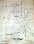
- Town Plot of Windsor, 1979
 Photographic image of the Town Plot of Windsor site plan. The plan was created to improve the design of Whitby Harbour. This plan is a 1979 copy of the 1838 original by F.P. Rubige. The 1838 version is based on a 1837 survey by J.J. Dennehy. Plan shows early settlements …
  Photographic image of the Town Plot of Windsor site plan. The plan was created to improve the design of Whitby Harbour. This plan is a 1979 copy of the 1838 …Whitby Public Library
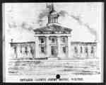
 - Ontario County Court House
 The Ontario County Courthouse was built from 1852-1854 on the west side of Centre Street between Ontario Street and Gilbert Streets. The architects were Frederic Cumberland and William Storm of Toronto. The extension at the north end was added in 1866. The building served as a courthouse from 1854-1964. In …
  The Ontario County Courthouse was built from 1852-1854 on the west side of Centre Street between Ontario Street and Gilbert Streets. The architects were Frederic Cumberland and William Storm of …Whitby Public Library
 - Whitby Grammar School, c.1860
 Whitby Grammar School was built in 1846 at 315 Colborne Street West on the south side between King and Centre Streets. A modern addition was put on the front of the building in 1872-1873 at which point the school became known as Whitby Collegiate Institute. The school was demolished in …
  Whitby Grammar School was built in 1846 at 315 Colborne Street West on the south side between King and Centre Streets. A modern addition was put on the front of …Whitby Public Library
 - Spruce Villa Hotel Aerial View, c.1955

 This farmhouse was originally constructed in 1872 at 734 Dundas Street West. It was owned by a farmer called William Clendenan (1826-1906). Around 1918, this property was purchased by Mrs. W.H. Weddell and she turned the house into one of the first bread and breakfasts in Whitby. She renamed the …
 This farmhouse was originally constructed in 1872 at 734 Dundas Street West. It was owned by a farmer called William Clendenan (1826-1906). Around 1918, this property was purchased by Mrs. …Whitby Public Library
 - Looking North from Ontario Street, 1963
 Black and white negative of an aerial view of Whitby looking north from Ontario Street. The Whitby Community Arena is visible at centre. This image was used for a postcard.
  Black and white negative of an aerial view of Whitby looking north from Ontario Street. The Whitby Community Arena is visible at centre. This image was used for a postcard.Whitby Public Library
 - Whitby Yacht Club Aerial View, 1970
 Black and white negative showing an aerial view of the Whitby Yacht Club. View looking south-west from Whitby Harbour. The Whitby Psychiatric Hospital is visible in the background. This image was used for a postcard.
  Black and white negative showing an aerial view of the Whitby Yacht Club. View looking south-west from Whitby Harbour. The Whitby Psychiatric Hospital is visible in the background. This image …Whitby Public Library
 - Picnic at Corbett's Point 1913

 Corbett's Point is located on the shore of Lake Ontario east of Thickson Road. This view is looking east.In 1948 Corbett's Point was renamed Thickson Point.
 Corbett's Point is located on the shore of Lake Ontario east of Thickson Road. This view is looking east.In 1948 Corbett's Point was renamed Thickson Point.Whitby Public Library
 - Mildmay Camp

 Mildmay Camp was located on the shore of Lake Ontario, east of the Cranberry Marsh in Whitby Township. It was an Anglican Church camp which was operated from around 1927 to 1953 by the Mildmay Institute of Toronto.
 Mildmay Camp was located on the shore of Lake Ontario, east of the Cranberry Marsh in Whitby Township. It was an Anglican Church camp which was operated from around 1927 …Whitby Public Library
 - Employee Picnic at Corbett's Point 1919

 Corbett's Point is located on the shore of Lake Ontario, east of Thickson Road.
 Corbett's Point is located on the shore of Lake Ontario, east of Thickson Road.Whitby Public Library
 - Rest Hour at Mildmay Camp

 Mildmay Camp was located on the shore of Lake Ontario, east of the Cranberry Marsh in Whitby Township. It was an Anglican Church camp which was operated from around 1927 to 1953 by the Mildmay Institute of Toronto.
 Mildmay Camp was located on the shore of Lake Ontario, east of the Cranberry Marsh in Whitby Township. It was an Anglican Church camp which was operated from around 1927 …Whitby Public Library
 - Mildmay Camp c.1943

 Mildmay Camp was located on the shore of Lake Ontario, east of the Cranberry Marsh in Whitby Township. It was an Anglican Church camp which was operated from around 1927 to 1953 by the Mildmay Institute of Toronto.
 Mildmay Camp was located on the shore of Lake Ontario, east of the Cranberry Marsh in Whitby Township. It was an Anglican Church camp which was operated from around 1927 …Whitby Public Library
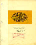
 - Brooklin Women's Institute Tweedsmuir History: Book 1


 The Tweedsmuir History (Book 1) was prepared by the Brooklin Women's Institute in 1950. The volume--a scrapbook--records incidents of note in the history of Brooklin and contains illustrative photographs. This volume is the first of two.

 The Tweedsmuir History (Book 1) was prepared by the Brooklin Women's Institute in 1950. The volume--a scrapbook--records incidents of note in the history of Brooklin and contains illustrative photographs. This …Whitby Public Library
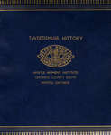
 - Myrtle Women's Institute Tweedsmuir History, 1985


 The Myrtle Women's Institute Tweedsmuir History is a scrapbook providing an account, in narrative form, of the settler history of the Myrtle region of Whitby. This Tweedsmuir History also provides information about the history of the Myrtle Women's Institute chapter, which was operative from 1955-1985.


 The Myrtle Women's Institute Tweedsmuir History is a scrapbook providing an account, in narrative form, of the settler history of the Myrtle region of Whitby. This Tweedsmuir History also provides …Whitby Public Library
 - Brooklin Women's Institute Tweedsmuir History: Book 2

 The Tweedsmuir History (Book 2) was prepared by the Brooklin Women's Institute from 1967 to 1997. The volume--a scrapbook--records incidents of note in the history of Brooklin and contains illustrative photographs. This volume is the second of two.
 The Tweedsmuir History (Book 2) was prepared by the Brooklin Women's Institute from 1967 to 1997. The volume--a scrapbook--records incidents of note in the history of Brooklin and contains illustrative …Whitby Public Library
 - Byron Street, c.1918
 Black and white negative of a photograph of a postcard showing Byron Street looking south from John Street. The Patterson home, on the south-west corner of Byron and John Streets, is visible at right. Byron Street is at left.
  Black and white negative of a photograph of a postcard showing Byron Street looking south from John Street. The Patterson home, on the south-west corner of Byron and John Streets, …Whitby Public Library
 - Centre Street, 1906
 Black and white negative of a photograph of a postcard showing Centre Street looking north from Dunlop Street. In the background is the steeple of All Saints' Anglican Church. The steeple of the Methodist Tabernacle is visible at right. The postcard has been framed with a fancy border.
  Black and white negative of a photograph of a postcard showing Centre Street looking north from Dunlop Street. In the background is the steeple of All Saints' Anglican Church. The …Whitby Public Library
 - Byron Street, c.1918
 Black and white negative of a photograph of a postcard showing Byron Street looking north from Mary Street. The house on the left was owned by Sheriff John F. Paxton.
  Black and white negative of a photograph of a postcard showing Byron Street looking north from Mary Street. The house on the left was owned by Sheriff John F. Paxton.Whitby Public Library
 - Centre Street Looking South, 1907
 Black and white negatives of a photograph showing Centre Street looking south from Dundas Street. The photograph was taken in spring after a late snowfall in 1907. The Methodist Tabernacle (St. Mark's United Church) is visible at left on the corner of Centre and Colborne Streets. The residence of W.J. …
  Black and white negatives of a photograph showing Centre Street looking south from Dundas Street. The photograph was taken in spring after a late snowfall in 1907. The Methodist Tabernacle …Whitby Public Library
 - Colborne Street Looking West, c.1913
 Black and white negative of a photograph of a postcard showing Colborne Street looking west from Byron Street. The Methodist Tabernacle (St. Mark's United Church) is at left and the residence of George Cormack is at right.
  Black and white negative of a photograph of a postcard showing Colborne Street looking west from Byron Street. The Methodist Tabernacle (St. Mark's United Church) is at left and the …Whitby Public Library
 - Byron Street Looking North, 1919
 In the 1980s, Bill Little moved the two houses at right across the street to the south-east corner of Mary and Byron and they became part of the shopping area known as Pearsons Lanes.
  In the 1980s, Bill Little moved the two houses at right across the street to the south-east corner of Mary and Byron and they became part of the shopping area …Whitby Public Library

