Results
We found 78635 matching items.


- Letter, 1 Mar 1847, George Ehninger to John R. Livingston

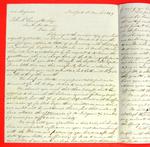
 George Ehninger, American Fur Company, New York to John R. Livingston, Sault Ste. Marie re: St. Mary's accounts, various bills being paid; business of cord wood with the steamers; land claims and Senator Woodbridge
 George Ehninger, American Fur Company, New York to John R. Livingston, Sault Ste. Marie re: St. Mary's accounts, various bills being paid; business of cord wood with the steamers; land …Maritime History of the Great Lakes
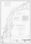
 - South End of Lake Huron and Head of the St. Clair River, 1859
 "Survey of the Northern and North Western Lakes Made in obedience to acts of Congress and under the direction of The Bureau of Topographical Engineers of the War Department South End of Lake Huron and Head of the St. Clair River Projected from a Trigonometrical Survey, executed under the ...
  "Survey of the Northern and North Western Lakes Made in obedience to acts of Congress and under the direction of The Bureau of Topographical Engineers of the War Department South …Maritime History of the Great Lakes
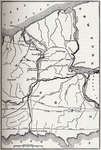
 - Map showing Course of the Ancient St. Lawrence and its Tributaries
 Illustration from J. B. Mansfield, ed., History of the Great Lakes. Volume I, Chicago: J. H. Beers & Co., 1899
  Illustration from J. B. Mansfield, ed., History of the Great Lakes. Volume I, Chicago: J. H. Beers & Co., 1899Maritime History of the Great Lakes
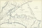
 - Map of Warren Water
 Illustration from J. B. Mansfield, ed., History of the Great Lakes. Volume I, Chicago: J. H. Beers & Co., 1899
  Illustration from J. B. Mansfield, ed., History of the Great Lakes. Volume I, Chicago: J. H. Beers & Co., 1899Maritime History of the Great Lakes
 - Map of the Early Lakes.
 Illustration from J. B. Mansfield, ed., History of the Great Lakes. Volume I, Chicago: J. H. Beers & Co., 1899
  Illustration from J. B. Mansfield, ed., History of the Great Lakes. Volume I, Chicago: J. H. Beers & Co., 1899Maritime History of the Great Lakes
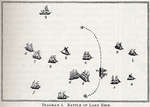
 - Battle of Lake Erie
 Illustration from J. B. Mansfield, ed., History of the Great Lakes. Volume I, Chicago: J. H. Beers & Co., 1899
  Illustration from J. B. Mansfield, ed., History of the Great Lakes. Volume I, Chicago: J. H. Beers & Co., 1899Maritime History of the Great Lakes
 - Battle of Lake Erie
 Illustration from J. B. Mansfield, ed., History of the Great Lakes. Volume I, Chicago: J. H. Beers & Co., 1899
  Illustration from J. B. Mansfield, ed., History of the Great Lakes. Volume I, Chicago: J. H. Beers & Co., 1899Maritime History of the Great Lakes
 - Battle of Lake Erie
 Illustration from J. B. Mansfield, ed., History of the Great Lakes. Volume I, Chicago: J. H. Beers & Co., 1899
  Illustration from J. B. Mansfield, ed., History of the Great Lakes. Volume I, Chicago: J. H. Beers & Co., 1899Maritime History of the Great Lakes
 - The Welland Canal, between Lake Ontario and Lake Erie
 Illustration from J. B. Mansfield, ed., History of the Great Lakes. Volume I, Chicago: J. H. Beers & Co., 1899
  Illustration from J. B. Mansfield, ed., History of the Great Lakes. Volume I, Chicago: J. H. Beers & Co., 1899Maritime History of the Great Lakes
 - Plan of Hamilton docks, 1836
 Map of Burlington Bay to illustrate Ivan S. Brookes, Hamilton Harbor, 1826-1901. Redrawn from an original dating from 1836.
  Map of Burlington Bay to illustrate Ivan S. Brookes, Hamilton Harbor, 1826-1901. Redrawn from an original dating from 1836.Maritime History of the Great Lakes
 - Plan of Hamilton Docks, 1842
 Plan of Hamilton waterfront to illustrate Ivan S. Brookes, Hamilton Harbor, 1826-1901. Redrawn from an original dating from 1842.
  Plan of Hamilton waterfront to illustrate Ivan S. Brookes, Hamilton Harbor, 1826-1901. Redrawn from an original dating from 1842.Maritime History of the Great Lakes
 - Plan of Hamilton Docks, 1874
 Plan of Hamilton waterfront in 1874 to illustrate Ivan S. Brookes, Hamilton Harbor, 1826-1901. Redrawn from an original.
  Plan of Hamilton waterfront in 1874 to illustrate Ivan S. Brookes, Hamilton Harbor, 1826-1901. Redrawn from an original.Maritime History of the Great Lakes
 - Plan of the Hamilton & NorthWestern Railway wharf, 1874
 Used illustrate Ivan S. Brookes, Hamilton Harbor, 1826-1901
  Used illustrate Ivan S. Brookes, Hamilton Harbor, 1826-1901Maritime History of the Great Lakes
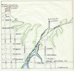
 - Hamilton West End Wharves, 1882
 Plan of Hamilton waterfront in 1882 to illustrate Ivan S. Brookes, Hamilton Harbor, 1826-1901. This section focuses on the Grand Trunk Railway freight yards (formerly the Great Western Railway yards). Redrawn from an original.
  Plan of Hamilton waterfront in 1882 to illustrate Ivan S. Brookes, Hamilton Harbor, 1826-1901. This section focuses on the Grand Trunk Railway freight yards (formerly the Great Western Railway yards). …Maritime History of the Great Lakes
 - Plan of the American Forts and Possessions in the Environs of the Head of Lake Erie [1811]
 Watermark on the paper is 1811. This map was made before 1814 when LeBreton was Deputy Quarter Master General
  Watermark on the paper is 1811. This map was made before 1814 when LeBreton was Deputy Quarter Master GeneralMaritime History of the Great Lakes
 - Map of Detroit River and Adjacent Country [1813]
 From LAC: It appears that the bottom imprint line was cut off. It should read "Enter as the act directs, Philadelphia Published by John Melish, Chestnut street, 26 August 1813."
  From LAC: It appears that the bottom imprint line was cut off. It should read "Enter as the act directs, Philadelphia Published by John Melish, Chestnut street, 26 August 1813."Maritime History of the Great Lakes
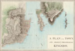
 - A Plan of the Town and Adjacent Fortifications of Kingston
 A Plan of the Town and Adjacent Fortifications of Kingston Surveyed and Drawn in August 1816, by Lieut E. A.Smith, 70th Reg't
  A Plan of the Town and Adjacent Fortifications of Kingston Surveyed and Drawn in August 1816, by Lieut E. A.Smith, 70th Reg'tMaritime History of the Great Lakes
 - Map of Oshawa Harbour [1874]
 Manuscript map of Oshawa harbour.
  Manuscript map of Oshawa harbour.Maritime History of the Great Lakes
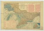
 - Atlas of Canada, Number 22, Canals Lighthouses and Sailing Routes: Saint Lawrence and Great Lakes with Cape Breton Island

 Maritime History of the Great Lakes
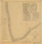
 - Plan Topographique du Détroit et des Eaux qui forment la jonction du Lac Erié avec le lac St. Clair
 The original was in Paris. A copy was made for the Burton Collection in Detroit (now at the Detroit Public Library). This was a further copy made from that copy.
  The original was in Paris. A copy was made for the Burton Collection in Detroit (now at the Detroit Public Library). This was a further copy made from that copy.Maritime History of the Great Lakes






![Plan of the American Forts and Possessions in the Environs of the Head of Lake Erie [1811] Plan of the American Forts and Possessions in the Environs of the Head of Lake Erie [1811]](https://images.MaritimeHistoryoftheGreatLakes.ca/images/MHGL000122573t.jpg)
![Map of Detroit River and Adjacent Country [1813] Map of Detroit River and Adjacent Country [1813]](https://images.MaritimeHistoryoftheGreatLakes.ca/images/MHGL000122574t.jpg)
![Map of Oshawa Harbour [1874] Map of Oshawa Harbour [1874]](https://images.MaritimeHistoryoftheGreatLakes.ca/images/MHGL000122620t.jpg)
