Results
We found 470 matching items.


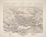
- Bird's Eye View of Smith's Falls, Province of Ontario, Canada, 1874, reproduction map 1973
 Details of this map were illustrated in Glenn J. Lockwood's "Smiths Falls: A Social History of the Men and Women in a Rideau Canal Community 1794-1994", pp.124-125 - plate 60 - the caption reads: "Section of birds eye view map of Smith's Falls showing the detached lock (Jones's lock) on …
  Details of this map were illustrated in Glenn J. Lockwood's "Smiths Falls: A Social History of the Men and Women in a Rideau Canal Community 1794-1994", pp.124-125 - plate 60 …Smiths Falls Public Library
 - Bird's Eye View of Smith's Falls, Province of Ontario, Canada, 1874
 Details of this map were illustrated in Glenn J. Lockwood's "Smiths Falls: A Social History of the Men and Women in a Rideau Canal Community 1794-1994", pp.124-125 - plate 60 - the caption reads: "Section of birds eye view map of Smith's Falls showing the detached lock (Jones's lock) on …
  Details of this map were illustrated in Glenn J. Lockwood's "Smiths Falls: A Social History of the Men and Women in a Rideau Canal Community 1794-1994", pp.124-125 - plate 60 …Smiths Falls Public Library
 - Plan of Smith's Falls, August 1958
 See Glenn J. Lockwood. "Smiths Falls: A Social History of the Men and Women in a Rideau Canal Community 1794-1994." Smiths Falls: Corporation of the Town of Smiths Falls, 1994 for additional plans and maps.
  See Glenn J. Lockwood. "Smiths Falls: A Social History of the Men and Women in a Rideau Canal Community 1794-1994." Smiths Falls: Corporation of the Town of Smiths Falls, 1994 …Smiths Falls Public Library
 - Bird's Eye View of Smith's Falls, Province of Ontario, Canada, 1874
 Details of this map were illustrated in Glenn J. Lockwood's "Smiths Falls: A Social History of the Men and Women in a Rideau Canal Community 1794-1994", pp.124-125 - plate 60 - the caption reads: "Section of birds eye view map of Smith's Falls showing the detached lock (Jones's lock) on …
  Details of this map were illustrated in Glenn J. Lockwood's "Smiths Falls: A Social History of the Men and Women in a Rideau Canal Community 1794-1994", pp.124-125 - plate 60 …Smiths Falls Public Library
 - Plan of the town of Smith's Falls in the County of Lanark; Ontario as Extended, and Ratified by Gov't Proclamation of 29th Sept. AD. 1886
 Illustrated in Glenn J. Lockwood's "Smiths Falls: A Social History of the Men and Women in a Rideau Canal Community 1794-1994", p.519 - plate 203 - the caption reads: "Map of the town of Smiths Falls in the County of Lanark; Ontario. as extended, and ratified by government proclamation of …
  Illustrated in Glenn J. Lockwood's "Smiths Falls: A Social History of the Men and Women in a Rideau Canal Community 1794-1994", p.519 - plate 203 - the caption reads: "Map …Smiths Falls Public Library
 - Electoral district map, Ontario, Lanark South, 1895
 Glenn J. Lockwood. "Smiths Falls: A Social History of the Men and Women in a Rideau Canal Community 1794-1994." Smiths Falls: Corporation of the Town of Smiths Falls, 1994.
  Glenn J. Lockwood. "Smiths Falls: A Social History of the Men and Women in a Rideau Canal Community 1794-1994." Smiths Falls: Corporation of the Town of Smiths Falls, 1994.Smiths Falls Public Library
 - Map of Elmsley North and South by John Stegmann, 1804
 A detail of this map was illustrated in Glenn J. Lockwood's "Smiths Falls: A Social History of the Men and Women in a Rideau Canal Community 1794-1994", p.17 - plate 9 - the caption reads: "Detail from map of Elmsley township showing the eastern section of concessions one to six, …
  A detail of this map was illustrated in Glenn J. Lockwood's "Smiths Falls: A Social History of the Men and Women in a Rideau Canal Community 1794-1994", p.17 - plate …Smiths Falls Public Library
 - Plan of the Town of Smiths Falls shewing the Streets, Railroads, Highways and the Industrial Sites
 Glenn J. Lockwood. "Smiths Falls: A Social History of the Men and Women in a Rideau Canal Community 1794-1994." Smiths Falls: Corporation of the Town of Smiths Falls, 1994.
  Glenn J. Lockwood. "Smiths Falls: A Social History of the Men and Women in a Rideau Canal Community 1794-1994." Smiths Falls: Corporation of the Town of Smiths Falls, 1994.Smiths Falls Public Library
 - Rideau Canal. Plan showing in green coloring land required for service of the canal at Poonamalie Lock Station...(signed) Josias Richey, Provincial Surveyor, Smith's Falls, 30th January, 1850. Royal Engineering Office, Bytown, 24th January, 1851. (signed) Charles E. Ford, Capt. Rl. Engineers. (signed) F. W. Whingates, Lt. Col. Commg. R. Engineers, 17th Sept., 1851. Copied by (sgd.) H. Williams, Lt. Royal Engrs., 17th September, 1853. (Sgd.) Fred. W. King, Lt. Rl. Engineers, 23rd January, 1857. Examined (Sgd.) C.W.
 Glenn J. Lockwood. "Smiths Falls: A Social History of the Men and Women in a Rideau Canal Community 1794-1994." Smiths Falls: Corporation of the Town of Smiths Falls, 1994. Passfield, Robert W. Building the Rideau Canal: A Pictorial History. Don Mills, Ontario: Fitzhenry & Whiteside, 1982, p.103 - First Rapids …
  Glenn J. Lockwood. "Smiths Falls: A Social History of the Men and Women in a Rideau Canal Community 1794-1994." Smiths Falls: Corporation of the Town of Smiths Falls, 1994. Passfield, …Smiths Falls Public Library
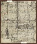
 - Rideau Canal. Plan showing in green coloring land required for the service of the canal at Smith Falls Lock Station...(signed) Josias Rickey, Provl. Surveyor, 25th April 1849. Royal Engineers Office, Bytown, 16th July 1849. (signed) Charles E. Ford, Capt. R. Engineers. True copy (Signed) W.F. Lambert, Lieut. Rl. Engr. 24th March 1851. Compard with the original (signed) H. Savage, Lt. R.E. 5th Aug. 1851. Copied by (signed) George Ranken, Lt. Rl. Engrs. 20th September 1851. Esamd. (sgd.) C.R. 25/9/52. (Signed) F.W. Whinyates [Whingates] Lt. Col. Commandg. R.E. 17th Septr. 1857
 Glenn J. Lockwood. "Smiths Falls: A Social History of the Men and Women in a Rideau Canal Community 1794-1994." Smiths Falls: Corporation of the Town of Smiths Falls, 1994. Passfield, Robert W. Building the Rideau Canal: A Pictorial History. Don Mills, Ontario: Fitzhenry & Whiteside, 1982.
  Glenn J. Lockwood. "Smiths Falls: A Social History of the Men and Women in a Rideau Canal Community 1794-1994." Smiths Falls: Corporation of the Town of Smiths Falls, 1994. Passfield, …Smiths Falls Public Library
 - Map of the counties of Lanark and Renfrew, Canada West, from actual surveys under the direction of H.F. Walling. [Inset engraving of Frost & Wood Co.], 1863
 An image of Frost & Wood Foundry and Machine shop is featured in the upper right hand corner of this map. This record only shows the map that references Smiths Falls and Montague Township. See the external link at the right of this record to access the other maps associated …
  An image of Frost & Wood Foundry and Machine shop is featured in the upper right hand corner of this map. This record only shows the map that references Smiths …Smiths Falls Public Library
 - Locks and Dam at Smith's Falls Rideau River Sect. No. 10, John By Lt. Colonel Roy'l. Engrs., Com'g. Rideau Canal, 25th October 1827
 Illustrated in Glenn J. Lockwood's "Smiths Falls: A Social History of the Men and Women in a Rideau Canal Community 1794-1994", p.93 - plate 44 - the caption reads: "Proposal for locating the Rideau Canal locks and dam at Smith's Falls, in relation to Abel Russell Ward's mill and dam, …
  Illustrated in Glenn J. Lockwood's "Smiths Falls: A Social History of the Men and Women in a Rideau Canal Community 1794-1994", p.93 - plate 44 - the caption reads: "Proposal …Smiths Falls Public Library
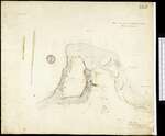
 - Plan of resurvey of the land belonging to the ordnance comprising part of Lot n. 30 Con. E township of Wolford County of Leeds Ontario, 1915 [detail of part of Smiths Falls]
 See Glenn J. Lockwood. "Smiths Falls: A Social History of the Men and Women in a Rideau Canal Community 1794-1994." Smiths Falls: Corporation of the Town of Smiths Falls, 1994 for additional plans and maps.
  See Glenn J. Lockwood. "Smiths Falls: A Social History of the Men and Women in a Rideau Canal Community 1794-1994." Smiths Falls: Corporation of the Town of Smiths Falls, 1994 …Smiths Falls Public Library
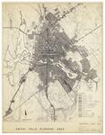
 - Plan of Smith's Falls, 7 May 1962
 Cataloguing from York University: Smiths Falls planning area: existing land use Description A map of the Smiths Falls planning around showing existing land use from 1960. It includes different public, industrial, residential, and other land use areas. Title: Smiths Falls planning area : existing land use Creator(s): A.L.K., Contributor Creator(s): …
  Cataloguing from York University: Smiths Falls planning area: existing land use Description A map of the Smiths Falls planning around showing existing land use from 1960. It includes different public, …Smiths Falls Public Library
 - Ballantyne's School SS#3 South Elmsley about 1895
 Ballantyne's School SS#3 South Elmsley around 1895. The school was built in 1860 by William Ballantyne.
  Ballantyne's School SS#3 South Elmsley around 1895. The school was built in 1860 by William Ballantyne.Rideau Lakes Public Library
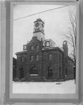
 - Post Office, Smith's Falls
 Catalogued by Library and Archives Canada and downloaded from their site - see link at the right of this record. Hierarchical level: Item (Accession) Date: n.d. Reference: Accession number: 1966-090 NPC, Box number: No.275, T-1829 Type of material: Photographs Found in: Archives / Collections and Fonds Item ID number: 3320306 …
  Catalogued by Library and Archives Canada and downloaded from their site - see link at the right of this record. Hierarchical level: Item (Accession) Date: n.d. Reference: Accession number: 1966-090 …Smiths Falls Public Library
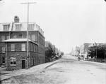
 - Beckwith Street facing north, Smiths Falls by William J. Topley (1845-1930)
 Catalogued by Library and Archives Canada and downloaded from their site - see link at the right of this record. Hierarchical level: Item Date: n.d. Reference: Box number: 00594G Item no. (creator): 597 Type of material: Photographs Found in: Archives / Collections and Fonds Item ID number: 3320302 Context of …
  Catalogued by Library and Archives Canada and downloaded from their site - see link at the right of this record. Hierarchical level: Item Date: n.d. Reference: Box number: 00594G Item …Smiths Falls Public Library
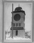
 - Post Office, Smith's Falls
 Catalogued by Library and Archives Canada and downloaded from their site - see link at the right of this record. Hierarchical level: Item (Accession) Reference: Accession number: 1966-090 NPC, Box number: No.274, T-1829 Type of material: Photographs Found in: Archives / Collections and Fonds Item ID number: 3320307 Context of …
  Catalogued by Library and Archives Canada and downloaded from their site - see link at the right of this record. Hierarchical level: Item (Accession) Reference: Accession number: 1966-090 NPC, Box …Smiths Falls Public Library
 - Murray Cookman, Smiths Falls, 1940
 This 1940 National Defence photo also shows Harry Hartsborn of Preston, Ontario. The National Defence catalogue card for this photo is included in the record - see the Pages box at top of this page and click the downward pointing select arrow to access the additional information.
  This 1940 National Defence photo also shows Harry Hartsborn of Preston, Ontario. The National Defence catalogue card for this photo is included in the record - see the Pages box …Smiths Falls Public Library
 - Murray Cookman, Smiths Falls, 1940
 This 1940 National Defence photo also shows Harry Hartsborn of Preston, Ontario. The National Defence catalogue card for this photo is included in the record - see the Pages box at top of this page and click the downward pointing select arrow to access the additional information.
  This 1940 National Defence photo also shows Harry Hartsborn of Preston, Ontario. The National Defence catalogue card for this photo is included in the record - see the Pages box …Smiths Falls Public Library





![Rideau Canal. Plan showing in green coloring land required for the service of the canal at Smith Falls Lock Station...(signed) Josias Rickey, Provl. Surveyor, 25th April 1849. Royal Engineers Office, Bytown, 16th July 1849. (signed) Charles E. Ford, Capt. R. Engineers. True copy (Signed) W.F. Lambert, Lieut. Rl. Engr. 24th March 1851. Compard with the original (signed) H. Savage, Lt. R.E. 5th Aug. 1851. Copied by (signed) George Ranken, Lt. Rl. Engrs. 20th September 1851. Esamd. (sgd.) C.R. 25/9/52. (Signed) F.W. Whinyates [Whingates] Lt. Col. Commandg. R.E. 17th Septr. 1857 Rideau Canal. Plan showing in green coloring land required for the service of the canal at Smith Falls Lock Station...(signed) Josias Rickey, Provl. Surveyor, 25th April 1849. Royal Engineers Office, Bytown, 16th July 1849. (signed) Charles E. Ford, Capt. R. Engineers. True copy (Signed) W.F. Lambert, Lieut. Rl. Engr. 24th March 1851. Compard with the original (signed) H. Savage, Lt. R.E. 5th Aug. 1851. Copied by (signed) George Ranken, Lt. Rl. Engrs. 20th September 1851. Esamd. (sgd.) C.R. 25/9/52. (Signed) F.W. Whinyates [Whingates] Lt. Col. Commandg. R.E. 17th Septr. 1857](https://images.ourontario.ca/Partners/SFPL/SFPL003704915t.jpg)
![Map of the counties of Lanark and Renfrew, Canada West, from actual surveys under the direction of H.F. Walling. [Inset engraving of Frost & Wood Co.], 1863 Map of the counties of Lanark and Renfrew, Canada West, from actual surveys under the direction of H.F. Walling. [Inset engraving of Frost & Wood Co.], 1863](https://images.ourontario.ca/Partners/SFPL/SFPL003704333t.jpg)
![Plan of resurvey of the land belonging to the ordnance comprising part of Lot n. 30 Con. E township of Wolford County of Leeds Ontario, 1915 [detail of part of Smiths Falls] Plan of resurvey of the land belonging to the ordnance comprising part of Lot n. 30 Con. E township of Wolford County of Leeds Ontario, 1915 [detail of part of Smiths Falls]](https://images.ourontario.ca/Partners/SFPL/SFPL003744348t.jpg)
