Results
We found 222478 matching items.


- Map of the Town of Milton, County of Halton, Canada West
 Coloured engraved map of the Town of Milton showing wards, lot lines and numbers, property owners, outlines of buildings and ward boundaries. Details include engravings (clockwise from top left): "ladies Seminary, John Sproat, Esq. Proprietor", "Residence of John Martin Esq.", "Halton Mills, Messrs. White & Martin Proprietors", "Grammar & Common …
  Coloured engraved map of the Town of Milton showing wards, lot lines and numbers, property owners, outlines of buildings and ward boundaries. Details include engravings (clockwise from top left): "ladies …Milton Historical Society
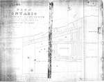
 - Plan of Ontario Methodist Camp Ground, 1875: Auditorium Circle and Victoria Terrace

 This is the plan for the Ontario Methodist Camp Ground in 1875. This was the first year that the Ontario Methodist Camp Ground owned the land sold to them by John B. Bowslaugh, which was approximately 12 1/2 acres. This map lays out the plots of land the company wanted …
 This is the plan for the Ontario Methodist Camp Ground in 1875. This was the first year that the Ontario Methodist Camp Ground owned the land sold to them by …Grimsby Chautauqua
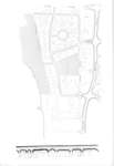
 - Map of Grimsby beach circa 1950s


 This is a map of the Grimsby Beach area in the mid-twentieth century. It shows some of the features of the Grimsby Park times which remained through the changing uses of the area. Auditorium Circle, Bell Park, and Victoria Terrace remain today as identified features in the Grimsby Beach area.

 This is a map of the Grimsby Beach area in the mid-twentieth century. It shows some of the features of the Grimsby Park times which remained through the changing uses …Grimsby Chautauqua
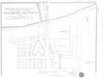
 - Plan of Ontario Methodist Camp Ground, Blocks B and C, 1875

 This map continues the survey of the Ontario Methodist Camp Grounds, plotting the lots for Blocks B. and C., and part of A., D., and F. This map accounts for another approximately 145 lots.
 This map continues the survey of the Ontario Methodist Camp Grounds, plotting the lots for Blocks B. and C., and part of A., D., and F. This map accounts for …Grimsby Chautauqua
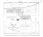
 - Plan of Grimsby Park, 1885

 Title: Grimsby Park. New Survey. 1885. Parts of Lots 3 and 4 in the Broken Front and First Concession of Grimsby. Middle left: Proprietors certificate -- The lots coloured red and the Avenues and Streets coloured brown as shown hereon are laid out according to instructions. (signed) Noah Phelps President …
 Title: Grimsby Park. New Survey. 1885. Parts of Lots 3 and 4 in the Broken Front and First Concession of Grimsby. Middle left: Proprietors certificate -- The lots coloured red …Grimsby Chautauqua
 - McMillan, Doris (Birthday: 90)

 appeared in Cobourg Daily Star, 1 May 2003, p. 12 ...
 appeared in Cobourg Daily Star, 1 May 2003, p. 12 ...Cobourg Public Library
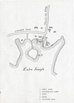
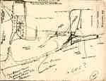
 - Hand drawn Map of the Summit House, Ditchburn Boat Livery, and the "Nipissing" Wreck.

 Conger Road, Tally-ho Road, Lake Joseph, 1. Summit House, 2.Ditchburn Boat Livery, 3. Store, 4. Church, 5. "Nipissing" Wreck
 Conger Road, Tally-ho Road, Lake Joseph, 1. Summit House, 2.Ditchburn Boat Livery, 3. Store, 4. Church, 5. "Nipissing" WreckSeguin Public Library
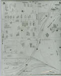
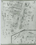
 - Fire Insurance Map, 1908 - 1913, Map 5
 1908 map updated to 1913. Duke Street later became Dupont Street. Bridgeport Road also called Laurel Street. See Detail images for closer view of map.
  1908 map updated to 1913. Duke Street later became Dupont Street. Bridgeport Road also called Laurel Street. See Detail images for closer view of map.Waterloo Public Library
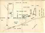
 - Brant Park ca 1915, as recalled by Brant Coleman, pubished version
 ...
...  ...Burlington Historical Society
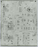
 - Fire Insurance Map, 1908 - 1913, Map 6
 1908 map updated to 1913. Weaver Street later became Dawson Street. See Detail images for closer view of map.
  1908 map updated to 1913. Weaver Street later became Dawson Street. See Detail images for closer view of map.Waterloo Public Library
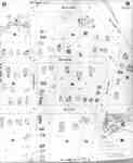
 - Fire Insurance Map 1908 - 1913, Map 7
 1908 map updated to 1913. Morley Street no longer exists.
  1908 map updated to 1913. Morley Street no longer exists.Waterloo Public Library
 - Fire Insurance Map 1908 - 1913, Map 8
 1908 map updated to 1913.
  1908 map updated to 1913.Waterloo Public Library
 - Brant Park ca 1915, as recalled by Brant Coleman, original draft
 ...
...  ...Burlington Historical Society
 - Fire Insurance Map 1908 - 1913, Map 9
 1908 map updated to 1913.
  1908 map updated to 1913.Waterloo Public Library
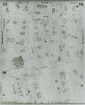
 - Fire Insurance Map 1908 - 1913, Map 10
 1908 map updated to 1913. Ontario Mutual Life Assurance Company was incorporated in 1868, name changed in 1900 to Mutual Life Assurance Company of Canada. They moved to 227 King Street south circa 1913. In 1988 became a part of the Mutual Group; company name changed to Clarica in 1999, …
  1908 map updated to 1913. Ontario Mutual Life Assurance Company was incorporated in 1868, name changed in 1900 to Mutual Life Assurance Company of Canada. They moved to 227 King …Waterloo Public Library
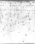
 - Fire Insurance Map 1908 - 1913, Map 11
 1908 map updated to 1913.
  1908 map updated to 1913.Waterloo Public Library
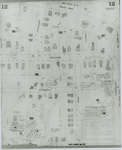
 - Fire Insurance Map 1908 - 1913, Map 12
 1908 map updated to 1913.
  1908 map updated to 1913.Waterloo Public Library
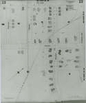
 - Fire Insurance Map 1908 - 1913, Map 13
 1908 map updated to 1913.
  1908 map updated to 1913.Waterloo Public Library
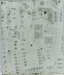
 - Fire Insurance Map 1942, Map 3
 1942 Map. Duke Street became Dupont Street. Queen Street became Regina Street. Cedar Street became Bridgeport Road and was also called Laurel Street east of Peppler Street.
  1942 Map. Duke Street became Dupont Street. Queen Street became Regina Street. Cedar Street became Bridgeport Road and was also called Laurel Street east of Peppler Street.Waterloo Public Library
 - Fire Insurance Map 1942, Map 4
 1942 Map. Duke Street became Dupont Street. Queen Street became Regina Street. Cedar Street became Bridgeport Road and was also called Laurel Street east of Peppler Street.
  1942 Map. Duke Street became Dupont Street. Queen Street became Regina Street. Cedar Street became Bridgeport Road and was also called Laurel Street east of Peppler Street.Waterloo Public Library


