Results
We found 3 matching items.


Page 1 of 1
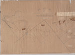
- West Half of the Westport to Farmersville Macadamized Road, from Westport to Phillipsville only
 {Poor - Map is dilapidated.) A map from April 1852 showing the "Macadamized Road" from Westport to Farmersville, Ontario. This map shows the west half of the Westport to Farmersville Macadamized Road, from Westport to Phillipsville only.
  {Poor - Map is dilapidated.) A map from April 1852 showing the "Macadamized Road" from Westport to Farmersville, Ontario. This map shows the west half of the Westport to Farmersville …Leeds & Thousand Islands Public Library
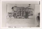
 - Canadian National Bus

 (Condition: Fair.) Photo courtesy of the Allen Townshend private collection
 (Condition: Fair.) Photo courtesy of the Allen Townshend private collectionLeeds & Thousand Islands Public Library
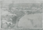
 - Westport Ontario taken from Spy Rock c.1900

 (Condition: Fair. faded copy)
 (Condition: Fair. faded copy)Rideau Lakes Public Library
Page 1 of 1


