Results
We found 3 matching items.


Page 1 of 1
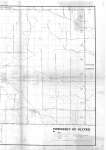
- Township of Oliver (Right side of map)
 Map housed at the Brodie Resource Library See left side of map on separate record
  Map housed at the Brodie Resource Library See left side of map on separate recordThunder Bay Public Library
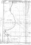
 - Township of Oliver (Left side of map)
 Map housed at the Brodie Resource Library See right side of map on separate record
  Map housed at the Brodie Resource Library See right side of map on separate recordThunder Bay Public Library
 - Thunder Bay Area Rural Roads
 Map housed at the Brodie Resource Library
  Map housed at the Brodie Resource LibraryThunder Bay Public Library
Page 1 of 1


