Results
We found 493 matching items.


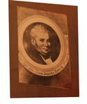
- Portrait of Bro. John Graves Simcoe, Lieutenant-Governor of Upper Canada, 1791-1796
 Framed portrait of Bro. Lieutenant-Colonel John Graves Simcoe, Lieutenant-Governor of Upper Canada, 1791-1796.
  Framed portrait of Bro. Lieutenant-Colonel John Graves Simcoe, Lieutenant-Governor of Upper Canada, 1791-1796.Niagara-on-the-Lake Public Library
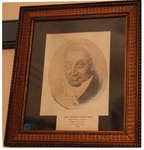
 - Portrait of Robert Hamilton, Provincial Deputy Grand Master of Upper Canada, 1796
 Oval-shaped portrait of Robert Hamilton, Deputy Provincial Grand Master of Upper Canada, 1796; in decorative frame. Inscription at the bottom reads: "Hon. Robert Hamilton. Queenston, Canada. First D. G. M. A. F. and A. M. 1794"
  Oval-shaped portrait of Robert Hamilton, Deputy Provincial Grand Master of Upper Canada, 1796; in decorative frame. Inscription at the bottom reads: "Hon. Robert Hamilton. Queenston, Canada. First D. G. M. …Niagara-on-the-Lake Public Library
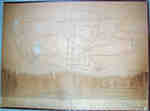
 - Plan of Fort's George, Mississauga, and Niagara, The Military Reserves and the Town of Newark- 1908 Copy of an 1817 Original
 A plan by H.H. Willson[s] of Fort's George, Mississauga and Niagara, the Military Reserves and the Town of Newark. It is dated 2 May 1817 and has "Royal Regiment Office, Quebec". A memo above the title states the plan "shows a new proposed military reserve in red lines." This is …
  A plan by H.H. Willson[s] of Fort's George, Mississauga and Niagara, the Military Reserves and the Town of Newark. It is dated 2 May 1817 and has "Royal Regiment Office, …
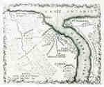
 - Map of the Town of Newark in 1813
 A print of a plan of Niagara in 1813 which provides a basic outline of the town of Newark, the North end of the Niagara River, Fort George, Fort Niagara and other points of interest.
  A print of a plan of Niagara in 1813 which provides a basic outline of the town of Newark, the North end of the Niagara River, Fort George, Fort Niagara …
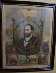
 - Lithograph of H.R.H. Albert, Prince of Wales, M.W. Grand Master of the United Grand Lodge of England, 1875
 Prince Consort, Albert Edward was eldest son of Queen Victoria and king of the United Kingdom of Great Britain and Ireland and of the British dominions and emperor of India from 1901 (Edward VII). Prince Albert Edward was initiated by the King of Sweden in 1868, installed as Most Worshipful …
  Prince Consort, Albert Edward was eldest son of Queen Victoria and king of the United Kingdom of Great Britain and Ireland and of the British dominions and emperor of India …Niagara-on-the-Lake Public Library
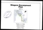
 - Niagara Escarpment Plan: County of Grey, 1994 (Map 6)
 Map of a section of the Niagara Escarpment, encompassing the County of Grey. This includes the Townships of Artemeisa, Collingwood, Euphrasia, Osprey, and St. Vincent. Compiled as a part of a full proposed revision to the Niagara Escarpment Plan in 1994. Map information was supplied by the Department of Energy, …
  Map of a section of the Niagara Escarpment, encompassing the County of Grey. This includes the Townships of Artemeisa, Collingwood, Euphrasia, Osprey, and St. Vincent. Compiled as a part of …Niagara-on-the-Lake Public Library
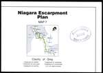
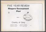
 - Niagara Escarpment Plan: County of Grey, 1994 (Map 7)
 Map of a section of the Niagara Escarpment, encompassing the County of Grey. This includes the Townships of Derby, Holland, Keppel, Sarawak, Sydenham, and the city of Owen Sound. Compiled as a part of a full proposed revision to the Niagara Escarpment Plan in 1994. Map information was supplied by …
  Map of a section of the Niagara Escarpment, encompassing the County of Grey. This includes the Townships of Derby, Holland, Keppel, Sarawak, Sydenham, and the city of Owen Sound. Compiled …Niagara-on-the-Lake Public Library
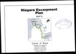
 - Niagara Escarpment Plan: County of Bruce, 1994 (Map 8)
 Map of a section of the Niagara Escarpment, encompassing the County of Bruce. This includes the Townships Albermarle, Amabel, and Eastnor, the town of Wiarton, and the Village of Lion's Head. Compiled as a part of a full proposed revision to the Niagara Escarpment Plan in 1994. Map information was …
  Map of a section of the Niagara Escarpment, encompassing the County of Bruce. This includes the Townships Albermarle, Amabel, and Eastnor, the town of Wiarton, and the Village of Lion's …Niagara-on-the-Lake Public Library
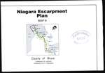
 - Niagara Escarpment Plan: County of Bruce, 1994 (Map 9)
 Map of a section of the Niagara Escarpment, encompassing the Bruce. This includes the Townships of Lindsay and St. Edmunds. Compiled as a part of a full proposed revision to the Niagara Escarpment Plan in 1994. Map information was supplied by the Department of Energy, Mines, and Resources c. 1989-1992. …
  Map of a section of the Niagara Escarpment, encompassing the Bruce. This includes the Townships of Lindsay and St. Edmunds. Compiled as a part of a full proposed revision to …Niagara-on-the-Lake Public Library
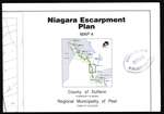
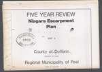
 - Niagara Escarpment Plan: County of Dufferin and Municipality of Peel, 1994 (Map 4)
 Map of a section of the Niagara Escarpment, encompassing the Regional Municipality of Peel and the County of Dufferin. This includes the town of Caledon and Township of Mono. Compiled as a part of a full proposed revision to the Niagara Escarpment Plan in 1994. Map information was supplied by …
  Map of a section of the Niagara Escarpment, encompassing the Regional Municipality of Peel and the County of Dufferin. This includes the town of Caledon and Township of Mono. Compiled …Niagara-on-the-Lake Public Library
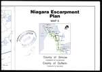
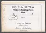
 - Niagara Escarpment Plan: County of Simcoe and County of Dufferin, 1994 (Map 5)
 Map of a section of the Niagara Escarpment, encompassing the Counties of Simcoe and Dufferin. This includes the Townships of Clearview and Mulmur. Compiled as a part of a full proposed revision to the Niagara Escarpment Plan in 1994. Map information was supplied by the Department of Energy, Mines, and …
  Map of a section of the Niagara Escarpment, encompassing the Counties of Simcoe and Dufferin. This includes the Townships of Clearview and Mulmur. Compiled as a part of a full …Niagara-on-the-Lake Public Library
 - Niagara Escarpment Plan: Regional Municipality of Halton, 1991 (Map 3)
 Map of a section of the Niagara Escarpment, encompassing the Municipality of Halton. This includes Halton Hills, Milton, and Burlington. Compiled as a part of a full proposed revision to the Niagara Escarpment Plan in 1991. Map information was supplied by the Department of Energy, Mines, and Resources c. 1980. …
  Map of a section of the Niagara Escarpment, encompassing the Municipality of Halton. This includes Halton Hills, Milton, and Burlington. Compiled as a part of a full proposed revision to …Niagara-on-the-Lake Public Library
 - Niagara Escarpment Plan: County of Dufferin and Regional Municipality of Peel, 1991 (Map 4)
 Map of a section of the Niagara Escarpment, encompassing the County of Dufferin and Municipality of Peel. This includes the township of Mono and town of Caledon. Compiled as a part of a full proposed revision to the Niagara Escarpment Plan in 1991. Map information was supplied by the Department …
  Map of a section of the Niagara Escarpment, encompassing the County of Dufferin and Municipality of Peel. This includes the township of Mono and town of Caledon. Compiled as a …Niagara-on-the-Lake Public Library
 - Niagara Escarpment Plan: County of Dufferin and County of Simcoe, 1991 (Map 5)
 Map of a section of the Niagara Escarpment, encompassing the County of Dufferin and County of Simcoe. This includes Nottawasaga, Mulmur, and Melancthon. Compiled as a part of a full proposed revision to the Niagara Escarpment Plan in 1991. Map information was supplied by the Department of Energy, Mines, and …
  Map of a section of the Niagara Escarpment, encompassing the County of Dufferin and County of Simcoe. This includes Nottawasaga, Mulmur, and Melancthon. Compiled as a part of a full …Niagara-on-the-Lake Public Library
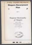
 - Niagara Escarpment Plan: Regional Municipality of Niagara, 1991 (Map 1)
 Map of a section of the Niagara Escarpment, encompassing the Municipality of Niagara. This includes Grimsby, Lincoln, Niagara-on-the-Lake, Pelham, Thorold, Niagara Falls, and St. Catharines. Compiled as a part of a full proposed revision to the Niagara Escarpment Plan in 1991. Map information was supplied by the Department of Energy, …
  Map of a section of the Niagara Escarpment, encompassing the Municipality of Niagara. This includes Grimsby, Lincoln, Niagara-on-the-Lake, Pelham, Thorold, Niagara Falls, and St. Catharines. Compiled as a part of …Niagara-on-the-Lake Public Library
 - Niagara Escarpment Plan: County of Grey, 1991 (Map 7)
 Map of a section of the Niagara Escarpment, encompassing part of the County of Grey. This includes Derby, Holland, Keppel, Sarawak, Sydenham, and Owen Sound. Compiled as a part of a full proposed revision to the Niagara Escarpment Plan in 1991. Map information was supplied by the Department of Energy, …
  Map of a section of the Niagara Escarpment, encompassing part of the County of Grey. This includes Derby, Holland, Keppel, Sarawak, Sydenham, and Owen Sound. Compiled as a part of …Niagara-on-the-Lake Public Library
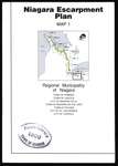
 - Niagara Escarpment Plan: Regional Municipality of Niagara, 1994 (Map 1)
 Map of a section of the Niagara Escarpment, encompassing the Regional Municipality of Niagara. This includes Grimsby, Lincoln, Niagara Falls, Niagara-on-the-Lake, Pelham, St. Catharines, and Thorold. Compiled as a part of a full proposed revision to the Niagara Escarpment Plan in 1994. Map information was supplied by the Department of …
  Map of a section of the Niagara Escarpment, encompassing the Regional Municipality of Niagara. This includes Grimsby, Lincoln, Niagara Falls, Niagara-on-the-Lake, Pelham, St. Catharines, and Thorold. Compiled as a part …Niagara-on-the-Lake Public Library
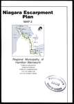
 - Niagara Escarpment Plan: Regional Municipality of Hamilton-Wentworth, 1994 (Map 2)
 Map of a section of the Niagara Escarpment, encompassing the Regional Municipality of Hamilton-Wentworth. This includes Ancaster, Dundas, Flamborough, Hamilton, and Stoney Creek. Compiled as a part of a full proposed revision to the Niagara Escarpment Plan in 1994. Map information was supplied by the Department of Energy, Mines, and …
  Map of a section of the Niagara Escarpment, encompassing the Regional Municipality of Hamilton-Wentworth. This includes Ancaster, Dundas, Flamborough, Hamilton, and Stoney Creek. Compiled as a part of a full …Niagara-on-the-Lake Public Library
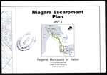
 - Niagara Escarpment Plan: Regional Municipality of Halton, 1994 (Map 3)
 Map of a section of the Niagara Escarpment, encompassing the Regional Municipality of Halton. This includes Burlington, Halton Hills, and Milton. Compiled as a part of a full proposed revision to the Niagara Escarpment Plan in 1994. Map information was supplied by the Department of Energy, Mines, and Resources c. …
  Map of a section of the Niagara Escarpment, encompassing the Regional Municipality of Halton. This includes Burlington, Halton Hills, and Milton. Compiled as a part of a full proposed revision …Niagara-on-the-Lake Public Library
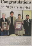
 - Linda Potter and Gerda Molson - 30 years of service as employees of the Niagara-on-the-Lake Public Library

 Niagara Advance (Niagara-on-the-Lake, Ontario, Canada), July, 1999 Articles about celebrating 30 years of work of the Niagara-on-the-Lake librarians, Linda Potter and Gerda Molson, who were presented with plaques by Lord Mayor Art Viola and Alderman Jamie Slingerland. Also, colour photographs of Linda Potter, Gerda Molson, David Eke and Mellie Enns, taken during their anniversary celebration at the …
 Niagara Advance (Niagara-on-the-Lake, Ontario, Canada), July, 1999 Articles about celebrating 30 years of work of the Niagara-on-the-Lake librarians, Linda Potter and Gerda Molson, who were presented with plaques by Lord Mayor Art Viola and Alderman Jamie Slingerland. …Niagara-on-the-Lake Public Library

