Results
We found 662 matching items.


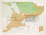
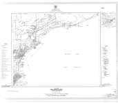
- LHM085 Land Use of Southern Ontario (map)
 "This map shows the uses of land in Southern Ontario."
  "This map shows the uses of land in Southern Ontario."Oshawa Public Libraries
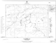
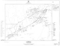
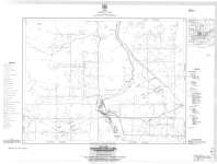
 - Hymers-Stanley Area : Gunflint Iron Range
 Map housed at the Brodie Resource Library
  Map housed at the Brodie Resource LibraryThunder Bay Public Library
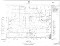
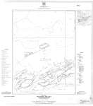
 - McIntyre Area : Gunflint Iron Range
 Map housed at the Brodie Resource Library
  Map housed at the Brodie Resource LibraryThunder Bay Public Library
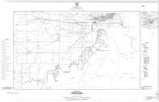
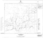
 - Neebing Area : Gunflint Iron Range
 Map housed at the Brodie Resource Library
  Map housed at the Brodie Resource LibraryThunder Bay Public Library
 - Port Arthur Area : Gunflint Iron Range
 Map housed at the Brodie Resource Library
  Map housed at the Brodie Resource LibraryThunder Bay Public Library
 - Loon Lake Area : Gunflint Iron Range
 Map housed at the Brodie Resource Library
  Map housed at the Brodie Resource LibraryThunder Bay Public Library
 - Whitefish Lake Area : Gunflint Iron Range
 Map housed at the Brodie Resource Library
  Map housed at the Brodie Resource LibraryThunder Bay Public Library
 - Silver Mountain Area : Gunflint Iron Range
 Map housed at the Brodie Resource Library
  Map housed at the Brodie Resource LibraryThunder Bay Public Library
 - Kakabeka Falls Area : Gunflint Iron Range
 Map housed at the Brodie Resource Library
  Map housed at the Brodie Resource LibraryThunder Bay Public Library
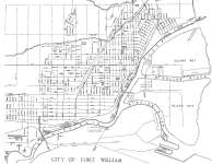
 - City of Fort William
 Map housed at the Brodie Resource Library
  Map housed at the Brodie Resource LibraryThunder Bay Public Library
 - Aerial View of Iron Bridge, Circa 1960
 This color postcard is an aerial view of the town of Iron Bridge. This photo was taken prior to the original bridge being dismantled and after the new bridge had been put in place. The photo shows most of the town east of the river.
  This color postcard is an aerial view of the town of Iron Bridge. This photo was taken prior to the original bridge being dismantled and after the new bridge had …Huron Shores Museum
 - Red Rock Falls Hydro Dam, North of Iron Bridge, 1960
 The construction for the Red Rock Hydro Dam began in 1959 in response to the need for more power after the discovery of Uranium in Elliott Lake. Red Rock was built in response to the demand from the mines, cost approximately $17 million and employed 550 people at some points …
  The construction for the Red Rock Hydro Dam began in 1959 in response to the need for more power after the discovery of Uranium in Elliott Lake. Red Rock was …Huron Shores Museum
 - "Old Faithful" 1907 Pumper Wagon Postcard, Blind River, Circa 1960
 This color postcard shows a 1907 Pumper Wagon that was situated in front of the Blind River Fire Department. These older vehicles were coal fired and a fireman would feed coal to the engine. This would be done on the way to the fire site in order to build up …
  This color postcard shows a 1907 Pumper Wagon that was situated in front of the Blind River Fire Department. These older vehicles were coal fired and a fireman would feed …Huron Shores Museum
 - General Foods Limited
 Cobourg's largest industry, General Foods purchased the Douglas Pectin Ltd. plant in 1929. Located between William and Ontario Street.
  Cobourg's largest industry, General Foods purchased the Douglas Pectin Ltd. plant in 1929. Located between William and Ontario Street.Cobourg Public Library
 - Ballinderry Lodge
 This farmhouse on the east end of King Street was locally known as the 'Checkerboard House' and was built in 1878 by Leopold Kobald. Leopold was a butcher who came first to Montreal in 1844 and then to Cobourg in 1847. His first home was built on Cottesmore Avenue but …
  This farmhouse on the east end of King Street was locally known as the 'Checkerboard House' and was built in 1878 by Leopold Kobald. Leopold was a butcher who came …Cobourg Public Library
 - Ballinderry Lodge

 This farmhouse on the east end of King Street was locally known as the 'Checkerboard House' and was built in 1878 by Leopold Kobald. Leopold was a butcher who came first to Montreal in 1844 and then to Cobourg in 1847. His first home was built on Cottesmore Avenue but …
 This farmhouse on the east end of King Street was locally known as the 'Checkerboard House' and was built in 1878 by Leopold Kobald. Leopold was a butcher who came …Cobourg Public Library
 - Northumberland and Durham Municipal building
 In the mid-1950s Counties Administration moved to this new building on William Street. In 2007 construction had begun on Elgin to move the Administrative offices leaving this building strictly for the various levels of court.
  In the mid-1950s Counties Administration moved to this new building on William Street. In 2007 construction had begun on Elgin to move the Administrative offices leaving this building strictly for …Cobourg Public Library
 - Victoria Park Beach
 As far back as the early 1800s Cobourg's main beach was used as a stopover location for travellers along the Lake Ontario's north shore. The beach was a place of stopover and encampment, especially at the west end of the beach where the large stream entered the lake. This area …
  As far back as the early 1800s Cobourg's main beach was used as a stopover location for travellers along the Lake Ontario's north shore. The beach was a place of …Cobourg Public Library
 - Marie Dressler House
 Marie Dressler was born in 1873. Her father Charles von Koerber was organist at St. Peter's Church and introduced Leila to the town's dramatic, musical and theatrical activites. During her professional career she starred in many movies throught the USA and Canada.
  Marie Dressler was born in 1873. Her father Charles von Koerber was organist at St. Peter's Church and introduced Leila to the town's dramatic, musical and theatrical activites. During her …Cobourg Public Library
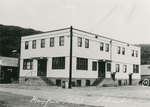
 - Mayfair Hotel, Schreiber, Ontario
 Old Mayfair Hotel in Schreiber Ontario. This building burned down.
  Old Mayfair Hotel in Schreiber Ontario. This building burned down.Schreiber Public Library

