Results
We found 69 matching items.


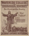
- Waterloo College and theological seminary : for Christ and our country
 Waterloo College brochure aimed at raising funds to pay for repairs and upgrades to Willison Hall. Contains information about the repairs and costs, enrolment levels, and the need for Lutheran pastors.
  Waterloo College brochure aimed at raising funds to pay for repairs and upgrades to Willison Hall. Contains information about the repairs and costs, enrolment levels, and the need for Lutheran …Wilfrid Laurier University Library
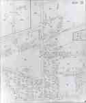
 - Fire Insurance Map 1942, Map 16
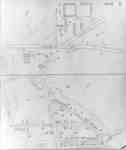
 Fire Insurance map from 1942 of north central Waterloo in two sections, along Albert Street from Dearborn (later University Avenue) to North (later Columbia) Street, considered the city limits; and along King Street from Schneider's Road (later University Avenue) to North (later Columbia Street). Also shown is Hill Street at …
  Fire Insurance map from 1942 of north central Waterloo in two sections, along Albert Street from Dearborn (later University Avenue) to North (later Columbia) Street, considered the city limits; and …Waterloo Public Library
 - Fire Insurance Map 1942, Map 5
 Fire Insurance map from 1942 of the southeast business district of Waterloo, Erb Street to the north, George Street to the south, King Street to the west and Willow Street (not visible) to the east. Some of the businesses visible on the map include: L.J. Klopp, Dry Goods; Rennel Drugs; …
  Fire Insurance map from 1942 of the southeast business district of Waterloo, Erb Street to the north, George Street to the south, King Street to the west and Willow Street …Waterloo Public Library
 - Fire Insurance Map 1942, Map 6
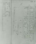
 Earl Street became Severn Avenue. Fischer Street became Belmont Avenue. Victoria Street became Avondale Avenue.
  Earl Street became Severn Avenue. Fischer Street became Belmont Avenue. Victoria Street became Avondale Avenue.Waterloo Public Library
 - Fire Insurance Map 1942, Map 13
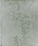
 1946, 1951 and 1956 show a service station and White Rose Inn and restaurant at 188 King north. Unclear if the service station and inn were jointly owned or two separate businesses. Main Street became Lodge Street. Schneider's Road became University Avenue at King Street. Snider Street became Fountain Street. …
  1946, 1951 and 1956 show a service station and White Rose Inn and restaurant at 188 King north. Unclear if the service station and inn were jointly owned or two …Waterloo Public Library
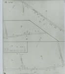
 - Fire Insurance Map 1942, Map 14
 Fire Insurance map from 1942 of a northwest section of of Waterloo, Erb Street between McDougall Avenue and Amos Avenue. A separate section showing Bridgeport Road and Margaret Avenue is included.
  Fire Insurance map from 1942 of a northwest section of of Waterloo, Erb Street between McDougall Avenue and Amos Avenue. A separate section showing Bridgeport Road and Margaret Avenue is …Waterloo Public Library
 - Fire Insurance Map 1942, Map 15
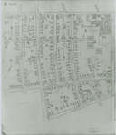
 Victoria Street became Avondale Avenue. Shantz Street became Canbar Avenue and no longer exists. Knox Avenue no longer exists. Elizabeth Street became Beverley Street. Rudy Street became Roslin Avenue. Charles Street became Dunbar Avenue.
  Victoria Street became Avondale Avenue. Shantz Street became Canbar Avenue and no longer exists. Knox Avenue no longer exists. Elizabeth Street became Beverley Street. Rudy Street became Roslin Avenue. Charles …Waterloo Public Library
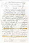
 - Map of Strong Township, 1942

 A map of Strong Township, produced in 1942. It shows the division of property in Strong Township and names of the land owners. Lake Bernard is near the center of the township. There is a legend at the bottom of the map. Machar Township borders on the north, Chapman on …
 A map of Strong Township, produced in 1942. It shows the division of property in Strong Township and names of the land owners. Lake Bernard is near the center of …Sundridge - Strong Union PL
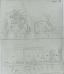
 - Fire Insurance Map 1942, Map 2
 Fire Insurance map of southwest business district of Waterloo, Young Street to the north, Duke (later Dupont) Street to the south, Albert Street to the west and King Street to the east. Town Hall, Library, Fire Hall and Market building as well as many businesses identified on the map.
  Fire Insurance map of southwest business district of Waterloo, Young Street to the north, Duke (later Dupont) Street to the south, Albert Street to the west and King Street to …Waterloo Public Library
 - Fire Insurance Map 1942, Map 3
 1942 Map. Duke Street became Dupont Street. Queen Street became Regina Street. Cedar Street became Bridgeport Road and was also called Laurel Street east of Peppler Street.
  1942 Map. Duke Street became Dupont Street. Queen Street became Regina Street. Cedar Street became Bridgeport Road and was also called Laurel Street east of Peppler Street.Waterloo Public Library
 - Fire Insurance Map 1942, Map 4
 1942 Map. Duke Street became Dupont Street. Queen Street became Regina Street. Cedar Street became Bridgeport Road and was also called Laurel Street east of Peppler Street.
  1942 Map. Duke Street became Dupont Street. Queen Street became Regina Street. Cedar Street became Bridgeport Road and was also called Laurel Street east of Peppler Street.Waterloo Public Library
 - Fire Insurance Map 1942
 See detail photographs for enhanced view of the map.
  See detail photographs for enhanced view of the map.Waterloo Public Library
 - Hearst-Longlac Portion of the Trans-Canada Highway : Districts of Cochrane and Thunder Bay, Ontario
 Map housed at the Brodie Resource Library
  Map housed at the Brodie Resource LibraryThunder Bay Public Library
 - Fire Insurance Map, 1942


 Waterloo Public Library
 - Fire Insurance Map 1942, Map 10
 Bellevue Avenue later became Tweed Street. Cedar Street later became Bridgeport Road and was also called Laurel Street east of Peppler Street ca. 1950s.
  Bellevue Avenue later became Tweed Street. Cedar Street later became Bridgeport Road and was also called Laurel Street east of Peppler Street ca. 1950s.Waterloo Public Library
 - Fire Insurance Map 1942, Map 11
 Lexington Road at Bridgeport Street later became Lincoln Road and was altered slightly at Weber Street. Elmer Street later became Graham Street. David Street later became Roger Street.
  Lexington Road at Bridgeport Street later became Lincoln Road and was altered slightly at Weber Street. Elmer Street later became Graham Street. David Street later became Roger Street.Waterloo Public Library
 - Fire Insurance Map 1942, Map 12
 Dearborn Street became University Avenue at Albert Street, also Schneider's Road became University Avenue at King Street. Ervin Street later became Lester Street. Unger Street later became Sunview Street. Church Street later became Central Street. Jefferson Street later became Seagram Drive. Clifton Street ran east and west between Jefferson and …
  Dearborn Street became University Avenue at Albert Street, also Schneider's Road became University Avenue at King Street. Ervin Street later became Lester Street. Unger Street later became Sunview Street. Church …Waterloo Public Library
 - Fire Insurance Map 1942, Map 8
 Rudy Avenue became Roslin (sometimes Roslyn in directories) Avenue. Victoria Street later became Avondale Avenue. Charles Street became Dunbar Street. Weaver Street (sometimes Weber Street in directories) follows the current Dawson Street and ended at the Seagram's Distillery complex.
  Rudy Avenue became Roslin (sometimes Roslyn in directories) Avenue. Victoria Street later became Avondale Avenue. Charles Street became Dunbar Street. Weaver Street (sometimes Weber Street in directories) follows the current …Waterloo Public Library
 - Fire Insurance Map 1942, Map 9
 Rudy Avenue became Roslin (sometimes Roslyn in directories) Avenue. Victoria Street later became Avondale Avenue. Charles Street became Dunbar Street. Elizabeth Street became Beverley Street. Weaver Street (sometimes Weber Street in directories) follows the current Dawson Street and ended at the Seagram's Distillery complex.
  Rudy Avenue became Roslin (sometimes Roslyn in directories) Avenue. Victoria Street later became Avondale Avenue. Charles Street became Dunbar Street. Elizabeth Street became Beverley Street. Weaver Street (sometimes Weber Street …Waterloo Public Library
 - Fire Insurance Map 1942, Map 7
 Fire Insurance map from 1942 of the southeast business and residential district of Waterloo, William Street to the north, Union Street to the south, King Street to the west and the CNR tracks to the east. Places of interest include: the Badminton Club on Bowman Street; Boyer Lumber Company on …
  Fire Insurance map from 1942 of the southeast business and residential district of Waterloo, William Street to the north, Union Street to the south, King Street to the west and …Waterloo Public Library

