Results
We found 508 matching items.


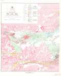
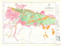
- Red Lake Area (West Sheet) : District of Kenora (Patricia Portion), Ontario
 Map housed at the Brodie Resource Library
  Map housed at the Brodie Resource LibraryThunder Bay Public Library
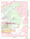
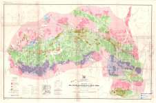
 - Red Lake Area (East Sheet) : District of Kenora (Patricia Portion), Ontario
 Map housed at the Brodie Resource Library
  Map housed at the Brodie Resource LibraryThunder Bay Public Library
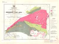
 - Mishibishu Lake Area : District of Thunder Bay, Ontario
 Map housed at the Brodie Resource Library
  Map housed at the Brodie Resource LibraryThunder Bay Public Library
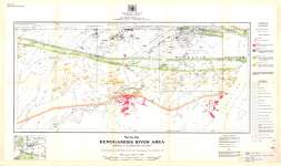
 - Kenogamisis River Area : district of Thunder Bay, Ontario
 Map housed at the Brodie Resource Library
  Map housed at the Brodie Resource LibraryThunder Bay Public Library
 - Caribou-Pikitigushi Area : District of Thunder Bay, Ontario
 Map housed at the Brodie Resource Library
  Map housed at the Brodie Resource LibraryThunder Bay Public Library
 - Big Duck - Aguasabon Lakes Area : District of Thunder Bay, Ontario
 Map housed at the Brodie Resource Library
  Map housed at the Brodie Resource LibraryThunder Bay Public Library
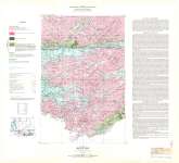
 - Quetico (West Half)
 Map housed at the Brodie Resource Library
  Map housed at the Brodie Resource LibraryThunder Bay Public Library
 - Brock Street looking south from Dundas Street
 The street light at right was installed in 1939.
  The street light at right was installed in 1939.Whitby Public Library
 - Brock Street looking south from Elm Street
 A black and white photographic postcard of Brock Street looking south from Elm Street. Cars can be seen parked near the Dominion Bank building at the far left of the image. A sign in the foreground advertises cigarettes, cakes and pastry. A clock tower says 3:00. Many stores and shops …
  A black and white photographic postcard of Brock Street looking south from Elm Street. Cars can be seen parked near the Dominion Bank building at the far left of the …Whitby Public Library
 - Subway Trailer Camp, c.1940
 The subway trailer camp is located on the north side of Dundas Street at 1010 Dundas Street East. It is immediately east of the "subway" where the CPR crosses Dundas Street, near Anderson Street. It was established as a camping and tourist ground in the 1920s or 1930s and became …
  The subway trailer camp is located on the north side of Dundas Street at 1010 Dundas Street East. It is immediately east of the "subway" where the CPR crosses Dundas …Whitby Public Library
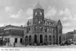
 - Post Office, c.1940
 The stone post office was built at the south west corner of Brock Street and Dundas Street between 1908 and 1910. It opened in 1910. The clock was installed in 1911 after being shipped from England. It was closed in 1956 and demolished in 1959.
  The stone post office was built at the south west corner of Brock Street and Dundas Street between 1908 and 1910. It opened in 1910. The clock was installed in …Whitby Public Library
 - View of The Bay at Tulloch's Camp, Iron Bridge, Circa 1940
 This is a black and white photographic postcard, showing a part of the shore at Tulloch's Camp on Chiblow Lake. The photo includes several canoes and row boats on the shore line. There are also cabins and a vehicle parked near the shore line. Two men stand near the car …
  This is a black and white photographic postcard, showing a part of the shore at Tulloch's Camp on Chiblow Lake. The photo includes several canoes and row boats on the …Huron Shores Museum
 - Postcard of a Scene Near Iverson's, South River, circa 1940

 Black and white postcard of a body of water in the forest. There's a line of logs in the water. It's hard to tell if this line is man made or naturally occurring. There is a bridge off in the distance.
 Black and white postcard of a body of water in the forest. There's a line of logs in the water. It's hard to tell if this line is man made …South River - Machar Union PL
 - Another Scene Near Iverson's, South River, circa 1940

 Black and white postcard of a man made waterfall with a bridge over it. There's a water flume going to the power house. There's a forest on the either side of the river. In the foreground there is a dam to change the flow of water.
 Black and white postcard of a man made waterfall with a bridge over it. There's a water flume going to the power house. There's a forest on the either side …South River - Machar Union PL
 - Iverson's, South River, circa 1940

 Black and white postcard of Iverson's. It's unclear what Iverson's was. It's possibly a restaurant or a general store. There's a house to the right of Ivereson's with a truck in the driveway. There's a paved road running in front of Iverson's. There's a forest all around the store.
 Black and white postcard of Iverson's. It's unclear what Iverson's was. It's possibly a restaurant or a general store. There's a house to the right of Ivereson's with a truck …South River - Machar Union PL
 - Remembrance Day Window Display, c.1940
 A black and white portrait photograph of a window display for Remembrance Day. Flags can be seen as well as a banner that says 1939 - ? 1914 - 1918.
  A black and white portrait photograph of a window display for Remembrance Day. Flags can be seen as well as a banner that says 1939 - ? 1914 - 1918.Whitby Public Library
 - Algoma Tourist Camp, c.1940
 This view shows the tourist cabins on the site where Lupin Drive later met Highway 2, east of Garden Street (732 Dundas Street East). In the 1960s the cabins were replaced by the Canadiana Motel.Whitby’s house numbering system was provided by Rev. Dr. James Roy Van Wyck (1877-1941), a retired …
  This view shows the tourist cabins on the site where Lupin Drive later met Highway 2, east of Garden Street (732 Dundas Street East). In the 1960s the cabins were …Whitby Public Library
 - Waterloo Public Library Overdue Notice, 1940
 The Carnegie Library was built 1903-1905 with funds from the Carnegie Foundation. A new library building was constructed in 1966 and this building became police headquarters and is now the Habitat for Humanity headquarters. See reverse for postmark.
  The Carnegie Library was built 1903-1905 with funds from the Carnegie Foundation. A new library building was constructed in 1966 and this building became police headquarters and is now the …Waterloo Public Library
 - Postcard of the Main Lodge at Knoepfli Inn, circa 1940


 Black and white postcard of the main lodge at the Knoepfli Inn. The two story building is sitting in the middle of the image. There is a porch running around the house with a roof covering it. The three buildings in the background of the image are probably rooms for …

 Black and white postcard of the main lodge at the Knoepfli Inn. The two story building is sitting in the middle of the image. There is a porch running around …Magnetawan Public Library
 - Grand Trunk Railway Depot, South River, Postcard, circa 1940

 Black and white postcard of the Grand Trunk Railway Depot in South River. In the foreground is a number of railway lines, and in the background's the Depot. It's a fairly large building, with dark painted concrete on the bottom end of the structure, with wood siding on the upper …
 Black and white postcard of the Grand Trunk Railway Depot in South River. In the foreground is a number of railway lines, and in the background's the Depot. It's a …South River - Machar Union PL

