Results


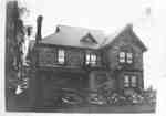
- St. Andrew's Presbyterian Manse, c.1930.
 This house at the north-east corner of Centre and Gilbert Streets was built in 1902 as the manse for St. Andrew's Presbyterian Church (at 210 Gilbert Street West). It served as a manse until 1957, and was demolished in 1977.Whitby’s house numbering system was provided by Rev. Dr. James Roy …
  This house at the north-east corner of Centre and Gilbert Streets was built in 1902 as the manse for St. Andrew's Presbyterian Church (at 210 Gilbert Street West). It served …Whitby Public Library
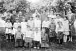
 - Spencer School Class, 1930

 Spencer School was built in 1877 on lot 30, Concession 7 in Whitby Township. It was known as S.S. No.6. The school closed in 1965 but the building was used as Spencer Community Centre from 1967.
 Spencer School was built in 1877 on lot 30, Concession 7 in Whitby Township. It was known as S.S. No.6. The school closed in 1965 but the building was used …Whitby Public Library
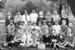
 - St. Bernard's Separate School Students, c.1930
 St. Bernard's Separate School was opened in 1926 at the north-east corner of Centre and Dundas Streets. An addition was constructed in 1950. The school closed in 1975 and demolished in 1987.
  St. Bernard's Separate School was opened in 1926 at the north-east corner of Centre and Dundas Streets. An addition was constructed in 1950. The school closed in 1975 and demolished …Whitby Public Library
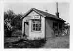
 - Scott's Dairy

 Scott's Dairy was operated by Herman Scott from the late 1920s to the late 1930s. It was located on the north side of Kingston Road/Highway 2, east of the brick house at the north-west corner of Kingston Road/Highway 2 and Scott Street. It was converted into a house in the …
 Scott's Dairy was operated by Herman Scott from the late 1920s to the late 1930s. It was located on the north side of Kingston Road/Highway 2, east of the brick …Whitby Public Library
 - Residence of Mark Crawforth

 This house was built about 1878 by Whitby Township farmer Mark Crawforth (1857-1934) about the time of his marriage. It was located on the north side of the Base Line at the Whitby - East Whitby Township border. The house was demolished about 1998.
 This house was built about 1878 by Whitby Township farmer Mark Crawforth (1857-1934) about the time of his marriage. It was located on the north side of the Base Line …Whitby Public Library
 - Lynde Creek c.1930

 This scene was taken from the top of the large clay cliff known as Whiteface. This portion of the creek is north of the end of Wellington Street.
 This scene was taken from the top of the large clay cliff known as Whiteface. This portion of the creek is north of the end of Wellington Street.Whitby Public Library
 - Scott's Dairy

 Scott's Dairy was operated by Herman Scott from the late 1920s to the late 1930s. It was located on the north side of Kingston Road/Highway 2, east of the brick house at the north-west corner of Kingston Road/Highway 2 and Scott Street. It was converted into a house in the …
 Scott's Dairy was operated by Herman Scott from the late 1920s to the late 1930s. It was located on the north side of Kingston Road/Highway 2, east of the brick …Whitby Public Library
 - Glen Dhu Farmhouse

 Glen Dhu was settled in 1833 by William Dow who was from Marnoch Parish, Banffshire, Scotland. The farm was located on lot 23 of Concession 3/Rossland Road in Whitby Township and it remained in the Dow family until 1915. The main part of the house was built in 1849 and …
 Glen Dhu was settled in 1833 by William Dow who was from Marnoch Parish, Banffshire, Scotland. The farm was located on lot 23 of Concession 3/Rossland Road in Whitby Township …Whitby Public Library
 - The Stone Lodge/Residence of Jeremiah Lick

 This granite fieldstone house was built in 1884 by William Pearson of Ashburn for Jeremiah Lick. At the time this photograph was taken, the Stone Lodge was a tourist home. It is located on lot 20 on the south side of Concession 1 (Highway 2) between Kendalwood Road and Thickson …
 This granite fieldstone house was built in 1884 by William Pearson of Ashburn for Jeremiah Lick. At the time this photograph was taken, the Stone Lodge was a tourist home. …Whitby Public Library
 - Canadian Pacific Railway Switching Tower
 The tower was built about 1914 when the Canadian Pacific Railway was built through Whitby and was demolished after the Whitby and Port Perry line was torn up in 1941.
  The tower was built about 1914 when the Canadian Pacific Railway was built through Whitby and was demolished after the Whitby and Port Perry line was torn up in 1941.Whitby Public Library
 - Train between Whitby and Brooklin
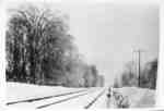
 The tracks for the Port Whitby, Port Perry, and Lindsay Railway were opened in December 1871 and removed in July 1941.
  The tracks for the Port Whitby, Port Perry, and Lindsay Railway were opened in December 1871 and removed in July 1941.Whitby Public Library
 - Railroad Tracks through Arksey's Woods
 The Whitby, Port Perry, and Lindsay Railway was built in 1871 and the tracks were removed in 1941. Arksey's Woods was south of Brooklin.
  The Whitby, Port Perry, and Lindsay Railway was built in 1871 and the tracks were removed in 1941. Arksey's Woods was south of Brooklin.Whitby Public Library
 - Brock Street, South, Whitby, Ontario
 The post office was demolished in 1959.
  The post office was demolished in 1959.Whitby Public Library
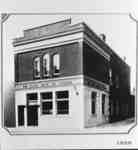
 - Royal Bank of Canada after its completed renovations
 This building was located at 102 Brock Street South. The Royal Bank moved into this store in July 1929 and completed its renovations in May, 1930. This picture shows the bank after the completed renovoations. The bank closed in 1935 and vacated the building, a victim of the Depression. This …
  This building was located at 102 Brock Street South. The Royal Bank moved into this store in July 1929 and completed its renovations in May, 1930. This picture shows the …Whitby Public Library
 - Dundas Street looking east from Byron Street
 A black and white photographic post card of Dundas Street looking east from Byron Street. Stores and shops can be seen as well as vehicles on the road and parked along the side of the road. There is an advertisemement for KENDALL MOTOR OIL at the right of the image …
  A black and white photographic post card of Dundas Street looking east from Byron Street. Stores and shops can be seen as well as vehicles on the road and parked …Whitby Public Library
 - View of Ontario Ladies' College, c.1930
 This is a black and white photograph of the front view of the Ontario Ladies' College building. There are several cars outside the building.
  This is a black and white photograph of the front view of the Ontario Ladies' College building. There are several cars outside the building.Whitby Public Library
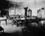
 - Study Hall at Ontario Ladies' College, c.1930
 This is a black and white photograph of the study hall at Ontario Ladies' College.
  This is a black and white photograph of the study hall at Ontario Ladies' College.Whitby Public Library
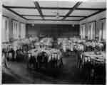
 - Dining Room at Ontario Ladies' College, c.1930
 This is a black and white photograph of the dining room at Ontario Ladies' College.
  This is a black and white photograph of the dining room at Ontario Ladies' College.Whitby Public Library
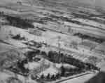
 - Aerial View of Ontario Ladies' College, c.1930
 This is a black and white aerial photograph of the Ontario Ladies' College buildings and property.
  This is a black and white aerial photograph of the Ontario Ladies' College buildings and property.Whitby Public Library
 - Ontario Ladies' College Memorial Gates, c.1930
 The college gates were built in 1924 as a memorial to Dr. John J. Hare, the College's first principal, and his wife. They were demolished in 1959 after one of the posts was hit by a dump truck. Ontario Ladies' College is now known as Trafalgar Castle School, and is …
  The college gates were built in 1924 as a memorial to Dr. John J. Hare, the College's first principal, and his wife. They were demolished in 1959 after one of …Whitby Public Library


