Results
We found 12 matching items.


Page 1 of 1
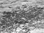
- Looking North-west from Brock and Trent Streets, 1929
 Black and white negative of an aerial photograph showing the Town of Whitby looking north-west from Brock and Trent Streets.
  Black and white negative of an aerial photograph showing the Town of Whitby looking north-west from Brock and Trent Streets.Whitby Public Library
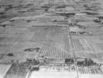
 - Red Wing Orchards, 1929
 Black and white negative of a photograph of Red Wing Orchards. View looking north from Highway 2 shows the intersection of the highway and the Whitby-Pickering town line (Lake Ridge Road). Almonds School is visible on the north-west corner of this intersection.
  Black and white negative of a photograph of Red Wing Orchards. View looking north from Highway 2 shows the intersection of the highway and the Whitby-Pickering town line (Lake Ridge …Whitby Public Library
 - Collapse of Canadian Pacific Railway Bridge over Lynde Creek
 The bridge and supports collapsed during the storm of 5/6 April 1929. Only the tracks hanging above the valley remained.
  The bridge and supports collapsed during the storm of 5/6 April 1929. Only the tracks hanging above the valley remained.Whitby Public Library
 - Collapse of Canadian Pacific Railway Bridge over Lynde Creek
 The bridge was destroyed in the storm of 5/6 April 1929.
  The bridge was destroyed in the storm of 5/6 April 1929.Whitby Public Library
 - Collapsed Canadian Pacific Railway Bridge over Lynde Creek
 The bridge collapsed during a storm on 5/6 April 1929.
  The bridge collapsed during a storm on 5/6 April 1929.Whitby Public Library
 - Remains of Canadian Pacific Railway Bridge over Lynde Creek
 The bridge was washed out in a severe storm which took place on 5/6 April 1929.
  The bridge was washed out in a severe storm which took place on 5/6 April 1929.Whitby Public Library
 - Staff at the Construction of Ontario County Land Registry Office Addition
 The Ontario Country Registry Office was built in 1873 at the south-west corner of Centre and Gilbert Streets. Additions were made in 1929 and 1954. It stood on the same block as the Ontario County Courthouse. The office closed in 1987.
  The Ontario Country Registry Office was built in 1873 at the south-west corner of Centre and Gilbert Streets. Additions were made in 1929 and 1954. It stood on the same …Whitby Public Library
 - Ontario County Land Registry Office
 The Ontario Country Registry Office was built in 1873 at the south-west corner of Centre and Gilbert Streets. Additions were made in 1929 and 1954. It stood on the same block as the Ontario County Courthouse.
  The Ontario Country Registry Office was built in 1873 at the south-west corner of Centre and Gilbert Streets. Additions were made in 1929 and 1954. It stood on the same …Whitby Public Library
 - Ontario County Land Registry Office
 The Ontario Country Registry Office was built in 1873 at the south-west corner of Centre and Gilbert Streets. Additions were made in 1929 and 1954. It stood on the same block as the Ontario County Courthouse.
  The Ontario Country Registry Office was built in 1873 at the south-west corner of Centre and Gilbert Streets. Additions were made in 1929 and 1954. It stood on the same …Whitby Public Library
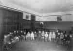
 - Kindergarten Class at King Street School, c.1929
 King Street School was built in 1921 on the block bounded by King, Dunlop, Henry, and Gilbert Streets. It was built to replace Henry Street School which burned down in 1920. In 1979 it was renamed R.A. Sennett Public School in honour of its first principal who served from 1921-1952.
  King Street School was built in 1921 on the block bounded by King, Dunlop, Henry, and Gilbert Streets. It was built to replace Henry Street School which burned down in …Whitby Public Library
 - Dundas Street School Grade Two Class, c.1929-1930
 Dundas Street School, also known as the model school, was built in 1875 on the north side of Dundas Street west of Garden Street. It was demolished in the early 1960s but additions from the 1950s remained and were renamed Florence Heard Public School in 1974.
  Dundas Street School, also known as the model school, was built in 1875 on the north side of Dundas Street west of Garden Street. It was demolished in the early …Whitby Public Library
 - Residence of Frank Puckrin

 This house was built around 1912-1914 on lot 29 of Concession 4 (Taunton Road) in Whitby Township. It was located on the north side of Taunton Road at Cochrane Street.
 This house was built around 1912-1914 on lot 29 of Concession 4 (Taunton Road) in Whitby Township. It was located on the north side of Taunton Road at Cochrane Street.Whitby Public Library
Page 1 of 1


