Results
We found 22 matching items.


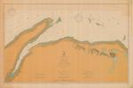
- Lake Superior, 1906
 Eastern Lake Superior; Shelter Bay to St. Marys River to Slate Islands
  Eastern Lake Superior; Shelter Bay to St. Marys River to Slate IslandsMaritime History of the Great Lakes
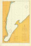
 - Lake Superior: Huron Bay and Huron Islands, 1906

 Maritime History of the Great Lakes
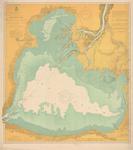
 - Lake Superior: Keweenaw Bay, 1906
 including L'Anse and Portage Entry
  including L'Anse and Portage EntryMaritime History of the Great Lakes
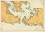
 - Lake St. Clair, 1906

 Maritime History of the Great Lakes
 - St. Marys River from Lake Huron to Twin Islands, 1906

 Maritime History of the Great Lakes
 - Lake Ontario Coast Chart No. 3. Little Sodus Bay to Charlotte. 1906
 Survey of the southern shore of Lake Ontario from Charlotte, Pultneyville, Sodus Point to Little Sodus Bay and Fair Haven.
  Survey of the southern shore of Lake Ontario from Charlotte, Pultneyville, Sodus Point to Little Sodus Bay and Fair Haven.Maritime History of the Great Lakes
 - Lake Erie Coast Chart No. 2. Dunkirk to Erie and Long Point, 1906
 Survey of the southern shore of Lake Erie from Dunkirk, NY to Eire, PA including Westfield, NY (Barcelona). The tip of Long Point, ON appears in the North west corner of the chart.
  Survey of the southern shore of Lake Erie from Dunkirk, NY to Eire, PA including Westfield, NY (Barcelona). The tip of Long Point, ON appears in the North west corner …Maritime History of the Great Lakes
 - St. Marys River Head of Hay Lake to Whitefish Bay. 1906
 Survey of the St. Marys River from the head of Hay Lake to Whitefish Bay, including the canals at Sault Ste. Marie (the Soo)
  Survey of the St. Marys River from the head of Hay Lake to Whitefish Bay, including the canals at Sault Ste. Marie (the Soo)Maritime History of the Great Lakes
 - Lake Superior, 1906
 Western end of Lake Superior
  Western end of Lake SuperiorMaritime History of the Great Lakes
 - Lake Michigan: South Haven to New Buffalo, 1906

 Maritime History of the Great Lakes
 - Lake Michigan: Muskegon to Ludington, 1906

 Maritime History of the Great Lakes
 - North End of Lake Michigan including Green Bay and the Straits of Macinac, 1906

 Maritime History of the Great Lakes
 - Ashtabula harbor, OH, 1906

 Maritime History of the Great Lakes
 - Lake Michigan, Ulao to Calvin Creek, 1906
 includes Sheboygan and Port Washington
  includes Sheboygan and Port WashingtonMaritime History of the Great Lakes
 - General Chart of Lake Michigan. 1906
 Survey of Lake Michigan
  Survey of Lake MichiganMaritime History of the Great Lakes
 - Emmanuel United Church, Waterloo, Ontario
 The Evangelical Association's first building was a constructed by Samuel Burkholder in 1849 at 7 Central Street. In 1871 a new church was built on Cedar Street (later Bridgeport Road). In 1906 a new structure was completed on the same site. In 1946 they joined with the United Brethren in …
  The Evangelical Association's first building was a constructed by Samuel Burkholder in 1849 at 7 Central Street. In 1871 a new church was built on Cedar Street (later Bridgeport Road). …Waterloo Public Library
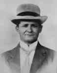
 - Arthur Thomas Lawler, c.1906
 Arthur Thomas Lawler was born at Whitby on June 13, 1866. He was a grocer in Whitby. In 1906, he became Mayor of Whitby and from 1908 to 1928 he was a member of the Whitby Board of Education. He died at Whitby on November 24, 1928 and is buried …
  Arthur Thomas Lawler was born at Whitby on June 13, 1866. He was a grocer in Whitby. In 1906, he became Mayor of Whitby and from 1908 to 1928 he …Whitby Public Library
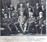
 - Waterloo County Council 1906
 Scanned from original publication in "100 Years of Progress in Waterloo County: semi-centennial souvenir, 1856-1906". page 12.
  Scanned from original publication in "100 Years of Progress in Waterloo County: semi-centennial souvenir, 1856-1906". page 12.Waterloo Public Library
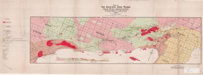
 - Map of The Animikie Iron Range Near Port Arthur, Ont.
 Map housed at the Brodie Resource Library
  Map housed at the Brodie Resource LibraryThunder Bay Public Library
 - Funeral Card of Elisabeth Creswell

 This is an image of the funeral card for Elizabeth Bridget Creswell, who died in the Township of Onondaga on Tuesday, April 17, 1906 at the age of 82 years. She was a relict of the late Henry Creswell. The original card was provided by Elaine Waterman.
 This is an image of the funeral card for Elizabeth Bridget Creswell, who died in the Township of Onondaga on Tuesday, April 17, 1906 at the age of 82 years. …County of Brant Public Library


