Results


Page 1 of 1
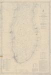
- Lake Michigan: New Buffalo to Chicago, 1876
 Aids to Navigation corrected to 4 April 1892
  Aids to Navigation corrected to 4 April 1892Maritime History of the Great Lakes
 - South End of Lake Michigan, 1876

 Maritime History of the Great Lakes
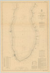
 - Lake Michigan: Vicinity of Milwaukee, 1876
 Aids to Navigation corrected to 18 June 1896
  Aids to Navigation corrected to 18 June 1896Maritime History of the Great Lakes
 - South End of Lake Michigan, 1876
 SURVEY OF THE NORTHERN AND NORTH WESTERN LAKES Made in obedience to acts of Congress and orders FROM THE HEADQUARTERS OF THE CORPS OF ENGINEERS, WAR DEPARTMENT SOUTH END OF LAKE MICHIGAN Projected from a Trigonometrical Survey executed under the orders of Lieut. Col. W.F. RAYNOLDS, Corps ...
  SURVEY OF THE NORTHERN AND NORTH WESTERN LAKES Made in obedience to acts of Congress and orders FROM THE HEADQUARTERS OF THE CORPS OF ENGINEERS, WAR DEPARTMENT SOUTH END OF …Maritime History of the Great Lakes
 - Lake Michigan: Coast Chart No. 3: Vicinity of Milwaukee, 1876
 SURVEY OF THE NORTHERN AND NORTH WESTERN LAKES Made in obedience to acts of Congress and orders from THE HEADQUARTERS OF THE CORPS OF ENGINEERS, WAR DEPARTMENT LAKE MICHIGAN COAST CHART No 3 VICINITY OF MILWAUKEE. Projected from trigonometrical Surveys executed under the orders Maj. C.B. ...
  SURVEY OF THE NORTHERN AND NORTH WESTERN LAKES Made in obedience to acts of Congress and orders from THE HEADQUARTERS OF THE CORPS OF ENGINEERS, WAR DEPARTMENT LAKE MICHIGAN COAST …Maritime History of the Great Lakes
 - Lake Michigan Coast Chart No. 5: New Buffalo to Chicago, 1876
 SURVEY OF THE NORTHERN AND NORTH WESTERN LAKES Made in obedience to acts of Congress and orders FROM THE HEADQUARTERS OF THE CORPS OF ENGINEERS, WAR DEPARTMENT LAKE MICHIGAN COAST CHART No 5 NEW BUFFALO to CHICAGO Projected from trigonometrical Surveys executed under the orders Maj. C.B. ...
  SURVEY OF THE NORTHERN AND NORTH WESTERN LAKES Made in obedience to acts of Congress and orders FROM THE HEADQUARTERS OF THE CORPS OF ENGINEERS, WAR DEPARTMENT LAKE MICHIGAN COAST …Maritime History of the Great Lakes
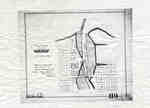
 - Plan of Oakville 1876
 This map shows the division of land in Oakville surrounding the Sixteen Mile Creek. It was verified by the Department of Crown Lands the same year it was created.
  This map shows the division of land in Oakville surrounding the Sixteen Mile Creek. It was verified by the Department of Crown Lands the same year it was created.Oakville Public Library
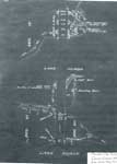
 - Survey of Thessalon Township - Dyment Mill Location, 1876
 The is a black and white photo of a survey of the Thessalon Township - Dyment Mill site dated 1876. Lake Huron, The Thessalon River along with survey measurements, post locations and local landmarks are noted. The wharf, light house, boarding house and Dyment saw mill locations are all shown …
  The is a black and white photo of a survey of the Thessalon Township - Dyment Mill site dated 1876. Lake Huron, The Thessalon River along with survey measurements, post …Heritage Park Museum
 - 1876 Plan of the Town of Paris

 This 1876 town map shows Paris as it was at the time. The lots are numbered individually. A number of notable town landmarks are indicated, with the key in the lower centre of the map.
 This 1876 town map shows Paris as it was at the time. The lots are numbered individually. A number of notable town landmarks are indicated, with the key in the …County of Brant Public Library
Page 1 of 1


