Results
We found 7 matching items.


Page 1 of 1
- Lake Superior, 1870
 Central Lake Superior; Munising to Ontonagon; Slate Islands to Pgeon Bay; includes Marquette, L'Anse; Keeweenaw, Nipigon Bay, Thunder Bay and Isle Royale
  Central Lake Superior; Munising to Ontonagon; Slate Islands to Pgeon Bay; includes Marquette, L'Anse; Keeweenaw, Nipigon Bay, Thunder Bay and Isle RoyaleMaritime History of the Great Lakes
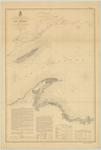
 - Preliminary Chart of Part of Lake Superior, 1868 [Superior to Ontonagon]
 SURVEY OF THE NORTHERN AND NORTH WESTERN LAKES. Made in obedience to acts of Congress and orders from THE HEADQUARTERS OF THE CORPS OF ENGINEERS, WAR DEPT. PRELIMINARY CHART OF PART OF LAKE SUPERIOR Comprising the data obtained up to the close of field operations in 1869 Surveyed and drawn …
  SURVEY OF THE NORTHERN AND NORTH WESTERN LAKES. Made in obedience to acts of Congress and orders from THE HEADQUARTERS OF THE CORPS OF ENGINEERS, WAR DEPT. PRELIMINARY CHART OF …Maritime History of the Great Lakes
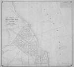
 - Map of the Village of Port Hope or Stafford, Huron Co. Mich.
 Plan of the village of Port Hope, MI showing the surveyed lots, streets, reserved properties, wharf, with proposed lights and breakwaters. Soundings are provided along with sailing directions from Gratiot Light House (Port Huron) and Au Sauble and Alpena.
  Plan of the village of Port Hope, MI showing the surveyed lots, streets, reserved properties, wharf, with proposed lights and breakwaters. Soundings are provided along with sailing directions from Gratiot …Maritime History of the Great Lakes
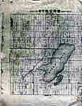
 - Map of Strong Township, Machar


 Photocopy of an early concession map for Strong Township. The township is divided into 14 x 30 plots. Lake Bernard is still Stony Lake at this time. Pool Lake and Lake Wallace are also shown. The main road Distress Road is in the middle of the map. The townships on …

 Photocopy of an early concession map for Strong Township. The township is divided into 14 x 30 plots. Lake Bernard is still Stony Lake at this time. Pool Lake and …Sundridge - Strong Union PL
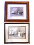
 - The Harbour Mouth, William Henry Bartlett, circa 1870
 The "Harbour Mouth, Cobourg" by W.H. Bartlett. Circa 1870. Here we have two prints (different sizes) of the same artwork. For additional information on the artist please click on link beneath the picture under "Other Websites".
  The "Harbour Mouth, Cobourg" by W.H. Bartlett. Circa 1870. Here we have two prints (different sizes) of the same artwork. For additional information on the artist please click on link …Cobourg Museum Foundation
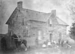
 - Residence of William Heron, c.1870
 The stone farmhouse was built by William Pearson of Ashburn between 1855-1860. It remained in the Heron family for many years. The house is located at 9210 Heron Rd, lot 29, concession 9.
  The stone farmhouse was built by William Pearson of Ashburn between 1855-1860. It remained in the Heron family for many years. The house is located at 9210 Heron Rd, lot …Whitby Public Library
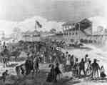
 - The Queen's Plate
 Unknown, Canadian Illustrated News, 18 June 1870 The Queen's Plate, Canada's most noted horse race, was run at Whitby in May 1870. The track was located on the west side of McQuay Street north of Dundas Street. The race was attended by John Sandfield Macdonald, Attorney General of Ontario, and records state that there were more than …
  Unknown, Canadian Illustrated News, 18 June 1870 The Queen's Plate, Canada's most noted horse race, was run at Whitby in May 1870. The track was located on the west side of McQuay Street north of Dundas Street. …Whitby Public Library
Page 1 of 1

![Preliminary Chart of Part of Lake Superior, 1868 [Superior to Ontonagon] Preliminary Chart of Part of Lake Superior, 1868 [Superior to Ontonagon]](https://images.MaritimeHistoryoftheGreatLakes.ca/images/MHGL000066603t.jpg)
