Results


Page 1 of 1
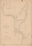
- A Survey of St. Joseph's North Channel, Lake Huron [1822, 1865]
 Chart extends from Lake George and Sugar Island in the northwest, Neebish Island and Mud Lake in the south west, St. Joseph Island on the south and east to the bay that would eventually front Bruce Mines.
  Chart extends from Lake George and Sugar Island in the northwest, Neebish Island and Mud Lake in the south west, St. Joseph Island on the south and east to the …Maritime History of the Great Lakes
 - Upper Canada: Plans of Ports in Lake Huron:
Penetanguishene, Collingwood, Goderich [1865]
 Georgian Bay Penetanguishene Harbour Surveyed by Lieut. Henry W. Bayfield, R. N. 1822 Magnetic Variation in 1863, increasing 4' annually. -- Georgian Bay Collingwood harbour Surveyed by Mr. Wm. Gibbard, C.E. April 1858 -- Goderich Harbour Surveyed by Mr. F. A. Wise July ...
  Georgian Bay Penetanguishene Harbour Surveyed by Lieut. Henry W. Bayfield, R. N. 1822 Magnetic Variation in 1863, increasing 4' annually. -- Georgian Bay Collingwood harbour Surveyed by Mr. Wm. Gibbard, …Maritime History of the Great Lakes
 - Portage Lake and River with Part of Keweenaw Bay, 1865
 Aids to navigation corrected to 4 Jan. 1898
  Aids to navigation corrected to 4 Jan. 1898Maritime History of the Great Lakes
 - Cataraugus Harbor, 1865

 Maritime History of the Great Lakes
Page 1 of 1

![A Survey of St. Joseph's North Channel, Lake Huron [1822, 1865] A Survey of St. Joseph's North Channel, Lake Huron [1822, 1865]](https://images.MaritimeHistoryoftheGreatLakes.ca/images/MHGL000122614t.jpg)
![Upper Canada: Plans of Ports in Lake Huron:
Penetanguishene, Collingwood, Goderich [1865] Upper Canada: Plans of Ports in Lake Huron:
Penetanguishene, Collingwood, Goderich [1865]](https://images.MaritimeHistoryoftheGreatLakes.ca/images/MHGL000122616t.jpg)


