Results
We found 2 matching items.


Page 1 of 1
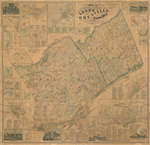
- Map of the United Counties of Leeds and Grenville

 This item is a map of the United Counties of Leeds and Grenville, Canada West, as of 1861. It was based on surveys under the direction of H.F. Walling, and includes the townships of Leeds, Lansdowne, and Escott. This map includes some pictures, individual lot and concession numbers for each …
 This item is a map of the United Counties of Leeds and Grenville, Canada West, as of 1861. It was based on surveys under the direction of H.F. Walling, and …Leeds & Thousand Islands Public Library
 - Indenture Between The Great Western Railway Company and Hiram Capron

 This land indenture documents an agreement between Capron and the Great Western Railway Company. This is not the first agreement between Capron and the Great Western Railway company; an earlier document was signed in 1848. Capron built a highway and sold several lots near the strip of land he had …
 This land indenture documents an agreement between Capron and the Great Western Railway Company. This is not the first agreement between Capron and the Great Western Railway company; an earlier …
Page 1 of 1


