Results
We found 2 matching items.


Page 1 of 1
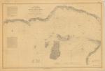
- North End of Lake Michigan Including the Beaver Island Group , 1855
 Manistique River to St. Helena Shoal
  Manistique River to St. Helena ShoalMaritime History of the Great Lakes
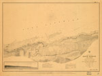
 - Preliminary Chart of Eagle Harbor Lake Superior, 1855
 PRELIMINARY CHART OF EAGLE HARBOR LAKE SUPERIOR From surveys under the direction of the TOPOGRAPHICAL BUREAU OF THE WAR DEPARTMENT in obedience to Acts of Congress requiring the SURVEY OF THE NORTH AND NORTH WESTERN LAKES Surveyed and drawn under the direction of Captain J. N. MACOMB Topl ...
  PRELIMINARY CHART OF EAGLE HARBOR LAKE SUPERIOR From surveys under the direction of the TOPOGRAPHICAL BUREAU OF THE WAR DEPARTMENT in obedience to Acts of Congress requiring the SURVEY OF …Maritime History of the Great Lakes
Page 1 of 1


