Results


Page 1 of 1
- St. Marys Falls Ship Canal, 1854
 combined from two scans at NOAA
  combined from two scans at NOAAMaritime History of the Great Lakes
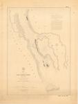
 - East Neebish Rapids, 1854

 Maritime History of the Great Lakes
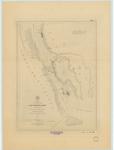
 - East Neebish Rapids, 1854
 Aids to Navigation corrected to 20 March 1893
  Aids to Navigation corrected to 20 March 1893Maritime History of the Great Lakes
 - Division 3. From Lake St. Francis to Point au Diable comprising the Coteau Rapids
 Map 3 from "Maps, Reports, Estimates, &c., Relative to Improvements of the Navigation of the River St. Lawrence; and a Proposed Canal Connecting the River St. Lawrence and Lake Champlain"
  Map 3 from "Maps, Reports, Estimates, &c., Relative to Improvements of the Navigation of the River St. Lawrence; and a Proposed Canal Connecting the River St. Lawrence and Lake Champlain"Maritime History of the Great Lakes
 - Division 4. Survey of a portion of the River St. Lawrence between Pointe au Diable and Pointe au Moulin, including the Cedar Rapids.
 Map 4 from "Maps, Reports, Estimates, &c., Relative to Improvements of the Navigation of the River St. Lawrence; and a Proposed Canal Connecting the River St. Lawrence and Lake Champlain"
  Map 4 from "Maps, Reports, Estimates, &c., Relative to Improvements of the Navigation of the River St. Lawrence; and a Proposed Canal Connecting the River St. Lawrence and Lake Champlain"Maritime History of the Great Lakes
 - Straits of Mackinac, 1854
 STRAITS OF MACKINAC WITH THE APPROACHES THERETO FROM LAKES HURON AND MICHIGAN AND THE ENTRANCE BY THE DETOUR PASSAGE TO THE ST. MARY'S RIVER From trigonometrical Surveys under the direction of the TOPOGRAPHICAL BUREAU OF THE WAR DEPARTMENT in obedience to Acts of Congress requiring ...
  STRAITS OF MACKINAC WITH THE APPROACHES THERETO FROM LAKES HURON AND MICHIGAN AND THE ENTRANCE BY THE DETOUR PASSAGE TO THE ST. MARY'S RIVER From trigonometrical Surveys under the direction …Maritime History of the Great Lakes
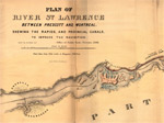
 - Plan of River St. Lawrence Between Prescott and Montreal Shewing the Rapids, and Provincial Canals, to Improve the Navigation.
 George Mathews, Montreal is credited as the lithographer
  George Mathews, Montreal is credited as the lithographerMaritime History of the Great Lakes
Page 1 of 1


