Results
We found 2 matching items.


Page 1 of 1
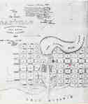
- Map of Oakville 1837
 The Drawing has been prepared from information gathered from a copy of the first registered plan of Oakville, by Deputy Provincial Surveyor, Robert W. Kerr in 1836, under the direction of Col. William Chisholm, the founder of Oakville. The Plan was registered January 12th 1850. James Madill, Oakville, 1973
  The Drawing has been prepared from information gathered from a copy of the first registered plan of Oakville, by Deputy Provincial Surveyor, Robert W. Kerr in 1836, under the direction …Oakville Public Library
 - A Map of Port Colborne: the termination of the Welland Canal on Lake Erie, 1837
 Original in collection of LAC H1/440/Port Colborne/[1837]
  Original in collection of LAC H1/440/Port Colborne/[1837]Port Colborne Historical and Marine Museum
Page 1 of 1


