Results


- Welland Canal Survey of Lands Company Land in Dunnville, 1834
 See also Pp. 148-151
  See also Pp. 148-151Brock University Archives
 - Welland Canal Survey of Lands Welland Canal Company Land in Thorold, 1834
 Survey map of the lands of the Welland Canal Company in Thorold. Created by The Welland Canal Company. Noteable features include; Company's land, reservoir, channel of canal, bridge, Pine street, Mullen street, lot divisions. The plan is titled "Plan of Lands belonging to the Welland Canal Company being the West …
  Survey map of the lands of the Welland Canal Company in Thorold. Created by The Welland Canal Company. Noteable features include; Company's land, reservoir, channel of canal, bridge, Pine street, …Brock University Archives
 - Welland Canal Survey of Lands Widow Elizabeth Ball, 1834
 Survey map and description of Widow Elizabeth Ball's land created by The Welland Canal Company. Included is a written description of the land along with a drawing of the land. Noteable features include; locks no. 28, 29, 30, 31, line between Widow Ball and Thomas Ker's land, township line between …
  Survey map and description of Widow Elizabeth Ball's land created by The Welland Canal Company. Included is a written description of the land along with a drawing of the land. …Brock University Archives
 - Welland Canal Survey of Lands Frederick Bouke 1834
 Survey map and description of Frederick Bouke's land created by The Welland Canal Company. Included is a written description of the land along with a drawing of the land. The land is on lot no.29 in the township of Thorold. Noteable features include; line between Bouke and Peter Vanevery's land, …
  Survey map and description of Frederick Bouke's land created by The Welland Canal Company. Included is a written description of the land along with a drawing of the land. The …Brock University Archives
 - Welland Canal Survey of Lands Daniel Shriner 1834
 Survey map and description of Daniel Shriner's land created by The Welland Canal Company. Included is a written description of the land along with a drawing of the land. Noteable features include; north and south branch of reservoir, line between Bouke and Shriner's land. Surveyor notes are seen in pencil …
  Survey map and description of Daniel Shriner's land created by The Welland Canal Company. Included is a written description of the land along with a drawing of the land. Noteable …Brock University Archives
 - Welland Canal Survey of Lands Estate of Hall Davis and Jeremiah Adley 1834
 Survey map and description of the Estate of Hall Davis and Jeremiah Adley's land created by The Welland Canal Company. Included is a written description of the land along with a drawing of the land. Noteable features include; Holland road, Adley's house, waste weir. The total land for the Estate …
  Survey map and description of the Estate of Hall Davis and Jeremiah Adley's land created by The Welland Canal Company. Included is a written description of the land along with …Brock University Archives
 - Welland Canal Survey of Lands Alem Marr, 1834
 Survey map and description of Alem Marr's land created by The Welland Canal Company. Included is a written description of the land along with a drawing of the land. Noteable features include; line between Marr and Shotwell's land, road allowance. The land totals 10 acres, 1 road and 28 perches. …
  Survey map and description of Alem Marr's land created by The Welland Canal Company. Included is a written description of the land along with a drawing of the land. Noteable …Brock University Archives
 - Welland Canal Survey of Lands Elijah Shotwell, 1834
 See also page 138.
  See also page 138.Brock University Archives
 - Welland Canal Survey of Lands Jonathan Silverthorn, 1834
 See also page 138.
  See also page 138.Brock University Archives
 - Welland Canal Survey of Lands Smith Shotwell, 1834
 Survey map and description of Smith Shotwell's land created by The Welland Canal Company. Included is a written description of the land along with a drawing of the land. Noteable features include; the Welland River, road. The deed for the land is dated October 14, 1834. The land totals 10 …
  Survey map and description of Smith Shotwell's land created by The Welland Canal Company. Included is a written description of the land along with a drawing of the land. Noteable …Brock University Archives
 - Welland Canal Survey of Lands Jesse Wilson, 1834
 Survey map and description of Jesse Willson's land created by The Welland Canal Company. Included is a written description of the land along with a drawing of the land. Noteable features include; Welland river, aquaduct, canal and 'place of beginning'. The deed for the land is dated July 12, 1834. …
  Survey map and description of Jesse Willson's land created by The Welland Canal Company. Included is a written description of the land along with a drawing of the land. Noteable …Brock University Archives
 - Welland Canal Survey of Lands David Price, 1834
 Survey map and description of David Price's land created by The Welland Canal Company. Included is a written description of the land along with a drawing of the land. Noteable features include; Hellem's Creek, road, bridge, Chippewa, Griffith's land, canal. The deed for the land is dated October 14, 1834. …
  Survey map and description of David Price's land created by The Welland Canal Company. Included is a written description of the land along with a drawing of the land. Noteable …Brock University Archives
 - Welland Canal Survey of Lands Michael and Jacob Silverthorn, 1834
 Survey map and description of Michael and Jacob Silverthorn's land created by The Welland Canal Company. Included is a written description of the land along with a drawing of the land. Noteable features include; line between Burger and Silverthorn's land, reservoir, wood land, road leading to Quaker settlement, line between …
  Survey map and description of Michael and Jacob Silverthorn's land created by The Welland Canal Company. Included is a written description of the land along with a drawing of the …Brock University Archives
 - James Sydney Westbrook

 The Lang Cemetery is behind the barn on the east corner of Hwy No.2 and the Madden Road. It is no more than half an acre in size. There are a number of graves without stones. Most of the stones had foot stones that have been removed. This is a …
 The Lang Cemetery is behind the barn on the east corner of Hwy No.2 and the Madden Road. It is no more than half an acre in size. There are …County of Brant Public Library
 - Water wagon
 In 1834, the fire department purchased a new ten-man hand-operated pumper known as the "Man Killer," as well as a horse drawn wagon to carry axes, a horse-drawn ladder wagon, a hand-operated pump with leather hose, and a water wagon.
  In 1834, the fire department purchased a new ten-man hand-operated pumper known as the "Man Killer," as well as a horse drawn wagon to carry axes, a horse-drawn ladder wagon, …Niagara-on-the-Lake Public Library
 - 1834 Pumper
 The Niagara Fire Department purchased this early apparatus in 1834. This hand pump engine was probably one of the first hand pumpers built by James Smith of New York City. Between 1810 and the 1860s, Smith manufactured close to 500 hand pumpers.
  The Niagara Fire Department purchased this early apparatus in 1834. This hand pump engine was probably one of the first hand pumpers built by James Smith of New York City. …Niagara-on-the-Lake Public Library
 - The London Sun newspaper
 The London Sun newspaper Mackenzie's Colonial Advocate, July 14, 183l,p.3, col. 2: "First issue was Thursday, July 7, 1831." It was the most westerly paper at this time. Its publication was irregular at times and finally ceased printing. Death of paper: Dec. 1833 (Source: Montreal ...
  The London Sun newspaper Mackenzie's Colonial Advocate, July 14, 183l,p.3, col. 2: "First issue was Thursday, July 7, 1831." It was the most westerly paper at this time. Its publication …London Public Library
 - "The Solid Rock"
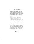
 Original version and Mohawk translation of the song "The Solid Rock."
  Original version and Mohawk translation of the song "The Solid Rock."Six Nations Public Library
 - Howell Block


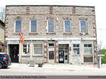
 Summary Howell Block has served a wide variety of functions within the St. George community, including a tinsmith, drug store, hardware store, library, museum, community hall, newspaper office, lawyers office, central telephone office, and post office. The original store and distillery was owned and operated by Nicholas Barmore in 1834 …

 Summary Howell Block has served a wide variety of functions within the St. George community, including a tinsmith, drug store, hardware store, library, museum, community hall, newspaper office, lawyers office, …
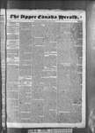
 - Upper Canada Herald (Kingston1819), 11 Jun 1834
 ...
...  ...Kingston Frontenac Public Library


