Results
We found 16 matching items.


Page 1 of 1
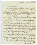
- Welland Canal Survey of Lands Widow Elizabeth Ball, 1834
 Survey map and description of Widow Elizabeth Ball's land created by The Welland Canal Company. Included is a written description of the land along with a drawing of the land. Noteable features include; locks no. 28, 29, 30, 31, line between Widow Ball and Thomas Ker's land, township line between …
  Survey map and description of Widow Elizabeth Ball's land created by The Welland Canal Company. Included is a written description of the land along with a drawing of the land. …Brock University Archives
 - Welland Canal Survey of Lands Frederick Bouke 1834
 Survey map and description of Frederick Bouke's land created by The Welland Canal Company. Included is a written description of the land along with a drawing of the land. The land is on lot no.29 in the township of Thorold. Noteable features include; line between Bouke and Peter Vanevery's land, …
  Survey map and description of Frederick Bouke's land created by The Welland Canal Company. Included is a written description of the land along with a drawing of the land. The …Brock University Archives
 - Welland Canal Survey of Lands Daniel Shriner 1834
 Survey map and description of Daniel Shriner's land created by The Welland Canal Company. Included is a written description of the land along with a drawing of the land. Noteable features include; north and south branch of reservoir, line between Bouke and Shriner's land. Surveyor notes are seen in pencil …
  Survey map and description of Daniel Shriner's land created by The Welland Canal Company. Included is a written description of the land along with a drawing of the land. Noteable …Brock University Archives
 - Welland Canal Survey of Lands Estate of Hall Davis and Jeremiah Adley 1834
 Survey map and description of the Estate of Hall Davis and Jeremiah Adley's land created by The Welland Canal Company. Included is a written description of the land along with a drawing of the land. Noteable features include; Holland road, Adley's house, waste weir. The total land for the Estate …
  Survey map and description of the Estate of Hall Davis and Jeremiah Adley's land created by The Welland Canal Company. Included is a written description of the land along with …Brock University Archives
 - "The Solid Rock"
 Original version and Mohawk translation of the song "The Solid Rock."
  Original version and Mohawk translation of the song "The Solid Rock."Six Nations Public Library
 - Indenture of Mortgage between Peregrine Warren and Archibald Fraser
 Indenture of Mortgage between Peregrine Warren and Archibald Fraser Source: Unknown Acquired: February 2008
  Indenture of Mortgage between Peregrine Warren and Archibald Fraser Source: Unknown Acquired: February 2008Cobourg Public Library
 - St. Paul's Basilica, Toronto

 In the Archdiocese of Toronto, original parish registers are not available to the public. Please DO NOT contact parishes for access to these registers.
 In the Archdiocese of Toronto, original parish registers are not available to the public. Please DO NOT contact parishes for access to these registers.Archives of the Roman Catholic Archdiocese of Toronto
 - 1834-1850 Combination Register, St. Paul's Basilica

 In the Archdiocese of Toronto, original parish registers are not available to the public. Please DO NOT contact parishes for access to these registers.
 In the Archdiocese of Toronto, original parish registers are not available to the public. Please DO NOT contact parishes for access to these registers.Archives of the Roman Catholic Archdiocese of Toronto
 - Letter from the Most Rev. Ignace Bourget

 Letter to Michael Power at Ste. Martine, concerning a school teacher for the parish.
 Letter to Michael Power at Ste. Martine, concerning a school teacher for the parish.Archives of the Roman Catholic Archdiocese of Toronto
 - Howell Block


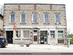
 Summary Howell Block has served a wide variety of functions within the St. George community, including a tinsmith, drug store, hardware store, library, museum, community hall, newspaper office, lawyers office, central telephone office, and post office. The original store and distillery was owned and operated by Nicholas Barmore in 1834 …

 Summary Howell Block has served a wide variety of functions within the St. George community, including a tinsmith, drug store, hardware store, library, museum, community hall, newspaper office, lawyers office, …
 - Almena Landon

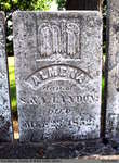
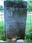
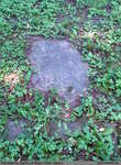
 St. Abner's Cemetery is an inactive cemetery in Brant County, under the jurisdiction of the Corporation of the County of Brant. It is located at 77 Henderson Rd., North-East of Burford. The stones have been moved from their original spot, and are now lined up in a row. All but …
 St. Abner's Cemetery is an inactive cemetery in Brant County, under the jurisdiction of the Corporation of the County of Brant. It is located at 77 Henderson Rd., North-East of …County of Brant Public Library
 - Mary Anna Macartney and Infant Son

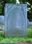
 Old Paris Cemetery is an inactive cemetery in Brant County, under the jurisdiction of the Corporation of the County of Brant. It is located on the south side of Church Street in Paris soon after turning off Dundas Street West (Highway #2). Range 2-11
 Old Paris Cemetery is an inactive cemetery in Brant County, under the jurisdiction of the Corporation of the County of Brant. It is located on the south side of Church …County of Brant Public Library
 - Mary Ann Sanber


 Old Paris Cemetery is an inactive cemetery in Brant County, under the jurisdiction of the Corporation of the County of Brant. It is located on the south side of Church Street in Paris soon after turning off Dundas Street West (Highway #2). Range 3-1

 Old Paris Cemetery is an inactive cemetery in Brant County, under the jurisdiction of the Corporation of the County of Brant. It is located on the south side of Church …County of Brant Public Library
 - William Conworth


 Range 2-1

 Range 2-1County of Brant Public Library
 - Minerva A, Elizabeth E, and David McKay


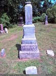
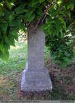
 Papple Cemetery is an inactive cemetery in Brant County, under the jurisdiction of the Corporation of the County of Brant. It is located on Brant County Highway # 99, 2.5 kms east of the St George Road (Brant County Road # 13). Range 9-9

 Papple Cemetery is an inactive cemetery in Brant County, under the jurisdiction of the Corporation of the County of Brant. It is located on Brant County Highway # 99, 2.5 …County of Brant Public Library
 - David Currey


 Harley Cemetery is an active cemetery in Brant County (Burford Township), under the jurisdiction of the Corporation of the County of Brant. It is located at 125 Harley Rd (Brant Road #202). Range 7-3

 Harley Cemetery is an active cemetery in Brant County (Burford Township), under the jurisdiction of the Corporation of the County of Brant. It is located at 125 Harley Rd (Brant …County of Brant Public Library
Page 1 of 1


