Results
We found 15 matching items.


Page 1 of 1
- Welland Canal Survey of Lands Zachariah Rykert, 1827
 urvey map and description of Zachariah Rykert's land created by The Welland Canal Company. Included is a written description of the land along with a drawing of the land. Noteable features include; line between Rykert and Parnell's land, lot divisions. The land totals 5.5 acres. Surveyor notes are seen in …
  urvey map and description of Zachariah Rykert's land created by The Welland Canal Company. Included is a written description of the land along with a drawing of the land. Noteable …Brock University Archives
 - Welland Canal Survey of Lands Peter Vanevery, 1827
 Survey map and description of Peter Vanevery's land created by The Welland Canal Company. Included is a written description of the land along with a drawing of the land. Noteable features include; lines between lots, L. Carrol's and E. Bouke's land. The land totals 100 acres. Deed from Jacob Stule …
  Survey map and description of Peter Vanevery's land created by The Welland Canal Company. Included is a written description of the land along with a drawing of the land. Noteable …Brock University Archives
 - Welland Canal Survey of Lands Samuel Swayze, 1827
 Survey map and description of Samuel Swayze's land created by The Welland Canal Company. Included is a written description of the land along with a drawing of the land. Noteable features include; lot division. The land totals 65 acres and 12 perches. The deed from Hall Davis to the Welland …
  Survey map and description of Samuel Swayze's land created by The Welland Canal Company. Included is a written description of the land along with a drawing of the land. Noteable …Brock University Archives
 - Welland Canal Survey of Lands John Brown, 1827
 Survey map and description of John Brown's land created by The Welland Canal Company. Included is a written description of the land along with a drawing of the land. Noteable features include; Welland river, towpath, canal, lock, side line between Broan and Carl. The land totals 6 acres, 3 roads …
  Survey map and description of John Brown's land created by The Welland Canal Company. Included is a written description of the land along with a drawing of the land. Noteable …Brock University Archives
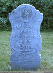
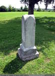
 - John Dougherty
 This headstone is located in the Second Onondaga Baptist Church Cemetery which was established after the church was built in 1854. The Church and Cemetery are located on 330 Baptist Church Road, 0.3 km south of Mulligan Road. Location: 18-3
  This headstone is located in the Second Onondaga Baptist Church Cemetery which was established after the church was built in 1854. The Church and Cemetery are located on 330 Baptist …County of Brant Public Library
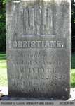
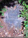
 - Christiane McIntyre

 Range 2-15
 Range 2-15County of Brant Public Library
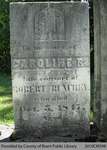
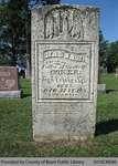
 - Caroline R. Runchey

 Range 2-16
 Range 2-16County of Brant Public Library
 - Sherman Robinson

 Range 12-4
 Range 12-4County of Brant Public Library
 - Margaret Ann Herrett

 St. Abner's Cemetery is an inactive cemetery in Brant County, under the jurisdiction of the Corporation of the County of Brant. It is located at 77 Henderson Rd., North-East of Burford. The stones have been moved from their original spot, and are now lined up in a row. All but …
 St. Abner's Cemetery is an inactive cemetery in Brant County, under the jurisdiction of the Corporation of the County of Brant. It is located at 77 Henderson Rd., North-East of …County of Brant Public Library
 - Margaret McKenzie

 Old Paris Cemetery is an inactive cemetery in Brant County, under the jurisdiction of the Corporation of the County of Brant. It is located on the south side of Church Street in Paris soon after turning off Dundas Street West (Highway #2). Range 3-6
 Old Paris Cemetery is an inactive cemetery in Brant County, under the jurisdiction of the Corporation of the County of Brant. It is located on the south side of Church …County of Brant Public Library
 - John and Ann M. (Bass) Tew

 Range 3-5
 Range 3-5County of Brant Public Library
 - Robert L. Lucas


 Papple Cemetery is an inactive cemetery in Brant County, under the jurisdiction of the Corporation of the County of Brant. It is located on Brant County Highway # 99, 2.5 kms east of the St George Road (Brant County Road # 13). Range 4-6

 Papple Cemetery is an inactive cemetery in Brant County, under the jurisdiction of the Corporation of the County of Brant. It is located on Brant County Highway # 99, 2.5 …County of Brant Public Library
 - Roland, Smith, Clarenda, Charity Cronkwright, Nellie (Cronkwright) Lawrence


 Harley Cemetery is an active cemetery in Brant County (Burford Township), under the jurisdiction of the Corporation of the County of Brant. It is located at 125 Harley Rd (Brant Road #202). Range 2-16

 Harley Cemetery is an active cemetery in Brant County (Burford Township), under the jurisdiction of the Corporation of the County of Brant. It is located at 125 Harley Rd (Brant …County of Brant Public Library
 - Elizabeth (Houghton) Oliver


 Old Paris Cemetery is an inactive cemetery in Brant County, under the jurisdiction of the Corporation of the County of Brant. It is located on the south side of Church Street in Paris soon after turning off Dundas Street West (Highway #2). Range 7-8

 Old Paris Cemetery is an inactive cemetery in Brant County, under the jurisdiction of the Corporation of the County of Brant. It is located on the south side of Church …County of Brant Public Library
 - Hannah Coker

 Range 4-4
 Range 4-4County of Brant Public Library
Page 1 of 1


