Results
We found 18 matching items.


Page 1 of 1
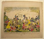
- Col. Johnson's Mounted Men Charging a Party of British Artillerists. By Dr. Gabriel F. S. Miesse
 A coloured ink print believed to have been created in the United States of America. Below the image it reads: "Col. Johnsons mounted men charging a party of British Artillerists and Indians at the Battle fought near Moravian Town October 2nd 1813 when the whole of the British force commanded …
  A coloured ink print believed to have been created in the United States of America. Below the image it reads: "Col. Johnsons mounted men charging a party of British Artillerists …
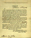
 - William Hamilton Merritt Welland Canal circular, July 12, 1823
 This circular, dated at St. Catharines, July 12, 1823, and addressed to Alexander Hamilton, Esq., from W. Hamilton Merritt, is one of the earliest printed references to the construction of the Welland Canal. That same year, Merritt had organized local meetings to gain support of his plan to build a …
  This circular, dated at St. Catharines, July 12, 1823, and addressed to Alexander Hamilton, Esq., from W. Hamilton Merritt, is one of the earliest printed references to the construction of …Brock University Archives
 - Fort Erie: Defense of the Block House
 An ink print created in the United States of America depicting the Siege of Fort Erie, one of the last and most protracted engagements between British and American forces during the Niagara campaign of the American War of 1812. The Americans successfully defended Fort Erie against the British Army but …
  An ink print created in the United States of America depicting the Siege of Fort Erie, one of the last and most protracted engagements between British and American forces during …
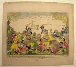
 - Col. Johnsons mounted men charging a party of British Artillerists
 Coloured ink print believed to have been created in the United States of America. Below the image it reads: "Col. Johnsons mounted men charging a party of British Artillerists and Indians at the Battle fought near Moravian Town October 2nd 1813 when the whole of the British force commanded by …
  Coloured ink print believed to have been created in the United States of America. Below the image it reads: "Col. Johnsons mounted men charging a party of British Artillerists and …
 - Elizabeth, Robert, and Martha S. Mulligan and Robert, Isabella A. and Anna Poag
 This headstone is located in the Second Onondaga Baptist Church Cemetery which was established after the church was built in 1854. The Church and Cemetery are located on 330 Baptist Church Road, 0.3 km south of Mulligan Road. Location: 4-2
  This headstone is located in the Second Onondaga Baptist Church Cemetery which was established after the church was built in 1854. The Church and Cemetery are located on 330 Baptist …County of Brant Public Library
 - Chart of that Part of the North Coast of Lake Superior that includes Neepigon & Black Bays [1823]
 Chart of that Part of the North Coast of Lake Superior that includes Neepigon [Nipigon] & Black Bays Surveyed by Lieu't Henry W'y Bayfield, R. N. and his assistant Mr. Philip E. Collins, Mid., R. N. 1823 NB the Soundings are in Feet London Published according to Act of Parliament …
  Chart of that Part of the North Coast of Lake Superior that includes Neepigon [Nipigon] & Black Bays Surveyed by Lieu't Henry W'y Bayfield, R. N. and his assistant Mr. …Maritime History of the Great Lakes
 - Lake Superior. Sheet III [1823-24]
 Chart of eastern Lake Superior from Sand River in the southwest to the Falls of St. Mary's (Sault Ste Marie) to the Slate Islands in the north west. An inset shows the Hudson Bay Company post and the lower reaches of the Pic River. The wreck of the schooner Invincible …
  Chart of eastern Lake Superior from Sand River in the southwest to the Falls of St. Mary's (Sault Ste Marie) to the Slate Islands in the north west. An inset …Maritime History of the Great Lakes
 - Lake Superior. Sheet 2 [1823-24]
 Lake Superior. Sheet 2 The Soundings are in Feet London Published according to Act of Parliament at the Hydrographical Office of the Admiralty, 1st Sept. 1828. J. & C. Walker Sculpt
  Lake Superior. Sheet 2 The Soundings are in Feet London Published according to Act of Parliament at the Hydrographical Office of the Admiralty, 1st Sept. 1828. J. & C. Walker …Maritime History of the Great Lakes
 - Chart of Part of the North Coast of Lake Superior, from Small Lake Harbour to Peninsula Harbour [1823]
 Chart of Part of the North Coast of Lake Superior from Small Lake Harbour to Peninsula Harbour Surveyed by Lieu't Henry W'y Bayfield, R. N. assisted by Mr. Philip E. Collins, Mid'n 1823 NB The Soundings are in feet London Published according to Act of Parliament at the ...
  Chart of Part of the North Coast of Lake Superior from Small Lake Harbour to Peninsula Harbour Surveyed by Lieu't Henry W'y Bayfield, R. N. assisted by Mr. Philip E. …Maritime History of the Great Lakes
 - Survey of Lake Superior. Sheet 1 [1823-25]
 Survey of Lake Superior by Lieut Henry W'y Bayfield, R. N. assisted by Mr. Philip Ed. Collins, Mid. between the Years 1823 & 1825 NB The soundings are in Feet Sheet 1 --inset-- Track Survey of the River St. Louis by Mr. Philip Ed. Collins, Mid. under the direction of …
  Survey of Lake Superior by Lieut Henry W'y Bayfield, R. N. assisted by Mr. Philip Ed. Collins, Mid. between the Years 1823 & 1825 NB The soundings are in Feet …Maritime History of the Great Lakes
 - Survey of Lake Superior. Sheet 1 [1823-25, 1863]
 Survey of Lake Superior by Lieut Henry W'y Bayfield, R. N. assisted by Mr. Philip Ed. Collins, Mid. between the Years 1823 & 1825 NB The soundings are in Feet Sheet 1 Variation in 1860, decreasing about 4' annually --inset-- Track Survey of the River St. Louis by Mr. Philip …
  Survey of Lake Superior by Lieut Henry W'y Bayfield, R. N. assisted by Mr. Philip Ed. Collins, Mid. between the Years 1823 & 1825 NB The soundings are in Feet …Maritime History of the Great Lakes
 - Queenston Heights
 Painting:Watercolour
  Painting:WatercolourAssociation for Great Lakes Maritime History
 - Chart of part of the North Coast of Lake Superior from Grand Portage Bay to Hawk Islet, including Isle Royale [1823-25]
 Chart of part of the North Coast of Lake Superior, from Grand Portage Bay to Hawk Islet, including Isle Royale Surveyed by Lieu't Henry W'y Bayfield R. N. and his Assistant Mr. Philip E. Collins Mid'n R. N. N.B. The Soundings are in Feet --inset-- Track Survey of the River …
  Chart of part of the North Coast of Lake Superior, from Grand Portage Bay to Hawk Islet, including Isle Royale Surveyed by Lieu't Henry W'y Bayfield R. N. and his …Maritime History of the Great Lakes
 - Letter from Hiram Capron to his Parents

 While the letter itself is not dated, D.A. Smith dates it to April 3rd, 1823, in At the Forks of the Grand, Volume I. He quotes it on pages 28-29.
 While the letter itself is not dated, D.A. Smith dates it to April 3rd, 1823, in At the Forks of the Grand, Volume I. He quotes it on pages 28-29.
 - Tamar S. and William S. Coon


 Harley Cemetery is an active cemetery in Brant County (Burford Township), under the jurisdiction of the Corporation of the County of Brant. It is located at 125 Harley Rd (Brant Road #202). Range 4-5

 Harley Cemetery is an active cemetery in Brant County (Burford Township), under the jurisdiction of the Corporation of the County of Brant. It is located at 125 Harley Rd (Brant …County of Brant Public Library
 - George Denholm

 Old Paris Cemetery is an inactive cemetery in Brant County, under the jurisdiction of the Corporation of the County of Brant. It is located on the south side of Church Street in Paris soon after turning off Dundas Street West (Highway #2). Range 2-2
 Old Paris Cemetery is an inactive cemetery in Brant County, under the jurisdiction of the Corporation of the County of Brant. It is located on the south side of Church …County of Brant Public Library
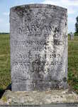
 - Mary Ann Winegardner


 Hill Cemetery is an inactive cemetery in Brant County (Burford Township), under the jurisdiction of the Corporation of the County of Brant. It is located on Middle Townline Road (Brant County Road # 25), about 0.7 kms north of Burford/Delhi Town Road in Burford Township. Range 3-4

 Hill Cemetery is an inactive cemetery in Brant County (Burford Township), under the jurisdiction of the Corporation of the County of Brant. It is located on Middle Townline Road (Brant …County of Brant Public Library
 - Maria Walker


 Old Paris Cemetery is an inactive cemetery in Brant County, under the jurisdiction of the Corporation of the County of Brant. It is located on the south side of Church Street in Paris soon after turning off Dundas Street West (Highway #2). Range 5-11

 Old Paris Cemetery is an inactive cemetery in Brant County, under the jurisdiction of the Corporation of the County of Brant. It is located on the south side of Church …County of Brant Public Library
Page 1 of 1

![Chart of that Part of the North Coast of Lake Superior that includes Neepigon & Black Bays [1823] Chart of that Part of the North Coast of Lake Superior that includes Neepigon & Black Bays [1823]](https://images.MaritimeHistoryoftheGreatLakes.ca/images/MHGL000122585t.jpg)
![Lake Superior. Sheet III [1823-24] Lake Superior. Sheet III [1823-24]](https://images.MaritimeHistoryoftheGreatLakes.ca/images/MHGL000122593t.jpg)
![Lake Superior. Sheet 2 [1823-24] Lake Superior. Sheet 2 [1823-24]](https://images.MaritimeHistoryoftheGreatLakes.ca/images/MHGL000122594t.jpg)
![Chart of Part of the North Coast of Lake Superior, from Small Lake Harbour to Peninsula Harbour [1823] Chart of Part of the North Coast of Lake Superior, from Small Lake Harbour to Peninsula Harbour [1823]](https://images.MaritimeHistoryoftheGreatLakes.ca/images/MHGL000122595t.jpg)
![Survey of Lake Superior. Sheet 1 [1823-25] Survey of Lake Superior. Sheet 1 [1823-25]](https://images.MaritimeHistoryoftheGreatLakes.ca/images/MHGL000122596t.jpg)
![Survey of Lake Superior. Sheet 1 [1823-25, 1863] Survey of Lake Superior. Sheet 1 [1823-25, 1863]](https://images.MaritimeHistoryoftheGreatLakes.ca/images/MHGL000122612t.jpg)
![Chart of part of the North Coast of Lake Superior from Grand Portage Bay to Hawk Islet, including Isle Royale [1823-25] Chart of part of the North Coast of Lake Superior from Grand Portage Bay to Hawk Islet, including Isle Royale [1823-25]](https://images.MaritimeHistoryoftheGreatLakes.ca/images/MHGL000122617t.jpg)

