Results


Page 1 of 1
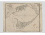
- Plan of Toronto Harbour, Lake Ontario
 Plan of Toronto Harbour, Lake Ontario. Surveyed under the Direction of Capt'n W. F. W. Owen, R. N. By Lieu't now Commander H.W.Bayfield, R. N. Drawn by Geo. D. Cranfield, Lieu't 90th L't. Inf'y The Town is copied from a Plan in the Surveyor General's Office. --- London Published ...
  Plan of Toronto Harbour, Lake Ontario. Surveyed under the Direction of Capt'n W. F. W. Owen, R. N. By Lieu't now Commander H.W.Bayfield, R. N. Drawn by Geo. D. Cranfield, …Maritime History of the Great Lakes
 - Survey of the River Niagara [1817]
 Survey of the River Niagara. Made under the direction of Capt'n W'm Fiz W'm. Owen, in the Year 1817 The Soundings are laid down in Feet -- Inset -- Survey of the entrance of the River Niagara from Lake Erie by Lieu't H. W. Bayfield, R. N. -- London Published …
  Survey of the River Niagara. Made under the direction of Capt'n W'm Fiz W'm. Owen, in the Year 1817 The Soundings are laid down in Feet -- Inset -- Survey …Maritime History of the Great Lakes
 - Survey of Lake Erie [1817-18][manuscript]
 Copy of the original manuscript chart of Lake Erie surveyed by Henry W. Bayfield in 1817-18. There are different insets than in the published chart.
  Copy of the original manuscript chart of Lake Erie surveyed by Henry W. Bayfield in 1817-18. There are different insets than in the published chart.Maritime History of the Great Lakes
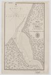
 - Sketch of a Small river Ten miles to the Westward of Buffalo, Lake Erie
 Bayfield would appear to have gotten his distances wrong, as this appears to be the mouth of Eighteen Mile Creek.
  Bayfield would appear to have gotten his distances wrong, as this appears to be the mouth of Eighteen Mile Creek.Maritime History of the Great Lakes
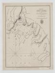
 - Lake Huron. Port Collier
 Lake Huron. Port Collier by Lieut H. W. Bayfield R. N. 1817 NB The Sounding are in feet London Published according to Act of Parliament at the Hydrographical Office of the Admiralty, 31th May 1828. J. & C. Walker Sculpt
  Lake Huron. Port Collier by Lieut H. W. Bayfield R. N. 1817 NB The Sounding are in feet London Published according to Act of Parliament at the Hydrographical Office of …Maritime History of the Great Lakes
 - Track Survey of the Lake & River St. Clair [1817]
 Added by 1861: Lighthouses at Windmill Point, mouth of the River Thames and Fort Gratiot
  Added by 1861: Lighthouses at Windmill Point, mouth of the River Thames and Fort GratiotMaritime History of the Great Lakes
 - A Survey of Lake Erie [1817-18]
 A Survey of Lake Erie; in the Years 1817 & 1818 By Lieu't Henry W. Bayfield, R. N. All Soundings are in feet N.B. The depth of water varies, according as the seasons are wet or dry; the maximum being from two to three feet. ---insets--- Survey of Put In …
  A Survey of Lake Erie; in the Years 1817 & 1818 By Lieu't Henry W. Bayfield, R. N. All Soundings are in feet N.B. The depth of water varies, according …Maritime History of the Great Lakes
Page 1 of 1


![Survey of the River Niagara [1817] Survey of the River Niagara [1817]](https://images.MaritimeHistoryoftheGreatLakes.ca/images/MHGL000122579t.jpg)
![Survey of Lake Erie [1817-18][manuscript] Survey of Lake Erie [1817-18][manuscript]](https://images.MaritimeHistoryoftheGreatLakes.ca/images/MHGL000122605t.jpg)


![Track Survey of the Lake & River St. Clair [1817] Track Survey of the Lake & River St. Clair [1817]](https://images.MaritimeHistoryoftheGreatLakes.ca/images/MHGL000122598t.jpg)
![A Survey of Lake Erie [1817-18] A Survey of Lake Erie [1817-18]](https://images.MaritimeHistoryoftheGreatLakes.ca/images/MHGL000122588t.jpg)
